


Location:
Southwestern Europe, Pyrenees mountains, on the border between France and Spain
Geographic coordinates:
42 30 N, 1 30 E
Map references:
Europe
Area:
total: 468 sq km
[see also: Area - total country ranks ]
land: 468 sq km
[see also: Area - land country ranks ]
water: 0 sq km
[see also: Area - water country ranks ]
country comparison to the world (CIA rank, may be based on non-current data):
196
Area - comparative:
2.5 times the size of Washington, DC
Area comparison map:
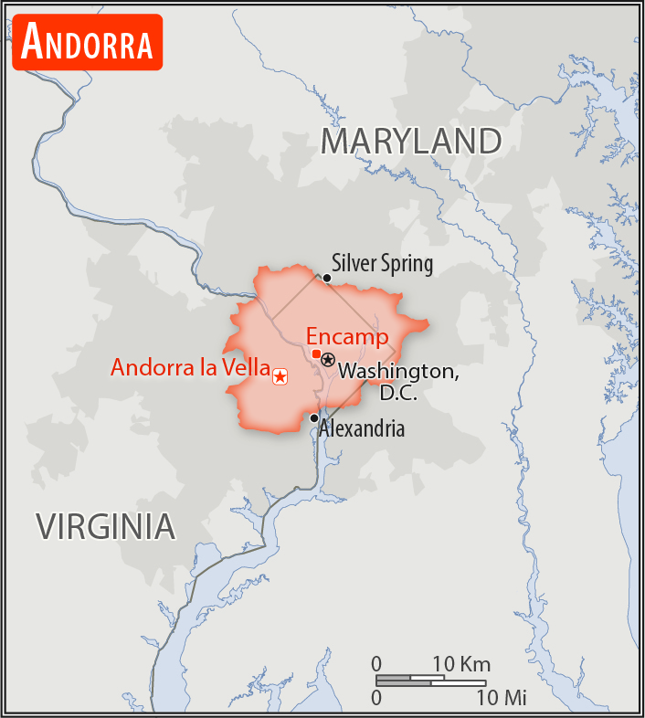
2.5 times the size of Washington, DC
Land boundaries:
total: 118 km
[see also: Land boundaries - total country ranks ]
border countries (2):
France 55 km, Spain 63 km
Coastline:
0 km
(landlocked)
[see also: Coastline country ranks ]
Maritime claims:
none (landlocked)
Climate:
temperate; snowy, cold winters and warm, dry summers
Terrain:
rugged mountains dissected by narrow valleys
Elevation:
mean elevation: 1,996 m
[see also: Elevation - mean elevation country ranks ]
lowest point:
Riu Runer 840 m
highest point:
Pic de Coma Pedrosa 2,946 m
Natural resources:
hydropower, mineral water, timber, iron ore, lead
Land use:
agricultural land: 40%
(2016 est.)
[see also: Land use - agricultural land country ranks ]
arable land: 1.7%
(2016 est.)
[see also: Land use - arable land country ranks ]
permanent crops: 0%
(2016 est.)
[see also: Land use - permanent crops country ranks ]
permanent pasture: 38.3%
(2016 est.)
[see also: Land use - permanent pasture country ranks ]
forest: 34%
(2016 est.)
[see also: Land use - forest country ranks ]
other: 26%
(2016 est.)
[see also: Land use country ranks ]
Irrigated land:
0 sq km
(2012)
[see also: Irrigated land country ranks ]
Population distribution:
population is unevenly distributed and is concentrated in the seven urbanized valleys that make up the country's parishes (political administrative divisions)
Natural hazards:
avalanches
Environment - current issues:
deforestation; overgrazing of mountain meadows contributes to soil erosion; air pollution; wastewater treatment and solid waste disposal
Environment - international agreements:
party to:
Biodiversity, Desertification, Hazardous Wastes, Ozone Layer Protection
signed, but not ratified:
none of the selected agreements
Geography - note:
landlocked; straddles a number of important crossroads in the Pyrenees
NOTE: 1) The information regarding Andorra on this page is re-published from the 2020 World Fact Book of the United States Central Intelligence Agency and other sources. No claims are made regarding the accuracy of Andorra Geography 2020 information contained here. All suggestions for corrections of any errors about Andorra Geography 2020 should be addressed to the CIA or the source cited on each page.
2) The rank that you see is the CIA reported rank, which may have the following issues:
a) They assign increasing rank number, alphabetically for countries with the same value of the ranked item, whereas we assign them the same rank.
b) The CIA sometimes assigns counterintuitive ranks. For example, it assigns unemployment rates in increasing order, whereas we rank them in decreasing order.
- Main Index
- 2020 Index
- Country Ranks
- Definitions
- Andorra Index 2020
- Andorra Main Index
- Introduction
- History
- Geography
- Maps
- People
- Religion
- Government
- Gov. Leaders
- Flags
- Economy
- Energy
- Communications
- Transportation
- Airport Codes
- Military
- Transnational Issues
- Photos
- Advertise Here
- Feedback

This page was last modified 27-Jan-20