


Location:
Southeastern Asia, along the northern coast of the island of Borneo, bordering the South China Sea and Malaysia
Geographic coordinates:
4 30 N, 114 40 E
Map references:
Southeast Asia
Area:
total: 5,765 sq km
[see also: Area - total country ranks ]
land: 5,265 sq km
[see also: Area - land country ranks ]
water: 500 sq km
[see also: Area - water country ranks ]
country comparison to the world (CIA rank, may be based on non-current data):
173
Area - comparative:
slightly smaller than Delaware
Area comparison map:
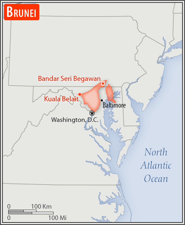
slightly smaller than Delaware
Land boundaries:
total: 266 km
[see also: Land boundaries - total country ranks ]
border countries (1):
Malaysia 266 km
Coastline:
161 km
[see also: Coastline country ranks ]
Maritime claims:
territorial sea: 12
nm
[see also: Maritime claims - territorial sea country ranks ]
exclusive economic zone: 200
nm or to median line
[see also: Maritime claims - exclusive economic zone country ranks ]
Climate:
tropical; hot, humid, rainy
Terrain:
flat coastal plain rises to mountains in east; hilly lowland in west
Elevation:
mean elevation: 478 m
[see also: Elevation - mean elevation country ranks ]
lowest point:
South China Sea 0 m
highest point:
Bukit Pagon 1,850 m
Natural resources:
petroleum, natural gas, timber
Land use:
agricultural land: 2.5%
(2011 est.)
[see also: Land use - agricultural land country ranks ]
arable land: 0.8%
(2011 est.)
[see also: Land use - arable land country ranks ]
permanent crops: 1.1%
(2011 est.)
[see also: Land use - permanent crops country ranks ]
permanent pasture: 0.6%
(2011 est.)
[see also: Land use - permanent pasture country ranks ]
forest: 71.8%
(2011 est.)
[see also: Land use - forest country ranks ]
other: 25.7%
(2011 est.)
[see also: Land use country ranks ]
Irrigated land:
10 sq km
(2012)
[see also: Irrigated land country ranks ]
Natural hazards:
typhoons, earthquakes, and severe flooding are rare
Environment - current issues:
no major environmental problems, but air pollution control is becoming a concern; seasonal trans-boundary haze from forest fires in Indonesia
Environment - international agreements:
party to:
Biodiversity, Climate Change, Desertification, Endangered Species, Hazardous Wastes, Law of the Sea, Ozone Layer Protection, Ship Pollution
signed, but not ratified:
none of the selected agreements
Geography - note:
close to vital sea lanes through South China Sea linking Indian and Pacific Oceans; two parts physically separated by Malaysia; the eastern part, the Temburong district, is an exclave and is almost an enclave within Malaysia
NOTE: 1) The information regarding Brunei on this page is re-published from the 2020 World Fact Book of the United States Central Intelligence Agency and other sources. No claims are made regarding the accuracy of Brunei Geography 2020 information contained here. All suggestions for corrections of any errors about Brunei Geography 2020 should be addressed to the CIA or the source cited on each page.
2) The rank that you see is the CIA reported rank, which may have the following issues:
a) They assign increasing rank number, alphabetically for countries with the same value of the ranked item, whereas we assign them the same rank.
b) The CIA sometimes assigns counterintuitive ranks. For example, it assigns unemployment rates in increasing order, whereas we rank them in decreasing order.
- Main Index
- 2020 Index
- Country Ranks
- Definitions
- Brunei Index 2020
- Brunei Main Index
- Introduction
- History
- Geography
- Maps
- People
- Religion
- Government
- Gov. Leaders
- Flags
- Economy
- Energy
- Communications
- Transportation
- Airport Codes
- Military
- Transnational Issues
- Photos
- Advertise Here
- Feedback

This page was last modified 27-Jan-20