


Location:
Caribbean, eastern two-thirds of the island of Hispaniola, between the Caribbean Sea and the North Atlantic Ocean, east of Haiti
Geographic coordinates:
19 00 N, 70 40 W
Map references:
Central America and the Caribbean
Area:
total: 48,670 sq km
[see also: Area - total country ranks ]
land: 48,320 sq km
[see also: Area - land country ranks ]
water: 350 sq km
[see also: Area - water country ranks ]
country comparison to the world (CIA rank, may be based on non-current data):
132
Area - comparative:
slightly more than twice the size of New Jersey
Area comparison map:
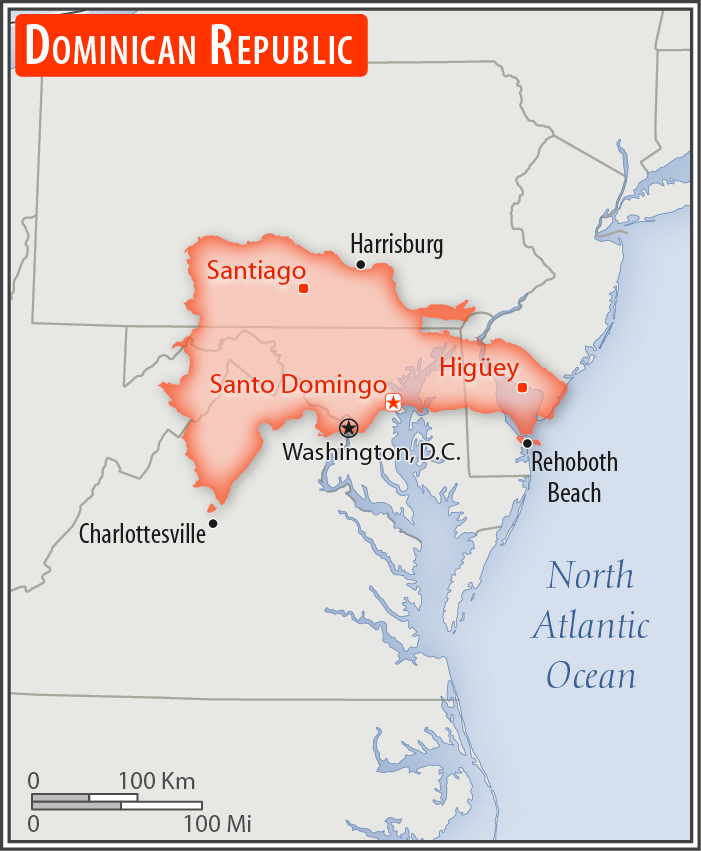
slightly more than twice the size of New Jersey
Land boundaries:
total: 376 km
[see also: Land boundaries - total country ranks ]
border countries (1):
Haiti 376 km
Coastline:
1,288 km
[see also: Coastline country ranks ]
Maritime claims:
territorial sea: 12
nm
[see also: Maritime claims - territorial sea country ranks ]
exclusive economic zone: 200
nm
[see also: Maritime claims - exclusive economic zone country ranks ]
contiguous zone: 24
nm
[see also: Maritime claims - contiguous zone country ranks ]
continental shelf: 200
nm or to the edge of the continental margin
measured from claimed archipelagic straight baselines
Climate:
tropical maritime; little seasonal temperature variation; seasonal variation in rainfall
More Climate Details
Terrain:
rugged highlands and mountains interspersed with fertile valleys
Elevation:
mean elevation: 424 m
[see also: Elevation - mean elevation country ranks ]
lowest point:
Lago Enriquillo -46 m
highest point:
Pico Duarte 3,098 m
Natural resources:
nickel, bauxite, gold, silver, arable land
Land use:
agricultural land: 51.5%
(2011 est.)
[see also: Land use - agricultural land country ranks ]
arable land: 16.6%
(2011 est.)
[see also: Land use - arable land country ranks ]
permanent crops: 10.1%
(2011 est.)
[see also: Land use - permanent crops country ranks ]
permanent pasture: 24.8%
(2011 est.)
[see also: Land use - permanent pasture country ranks ]
forest: 40.8%
(2011 est.)
[see also: Land use - forest country ranks ]
other: 7.7%
(2011 est.)
[see also: Land use country ranks ]
Irrigated land:
3,070 sq km
(2012)
[see also: Irrigated land country ranks ]
Population distribution:
coastal development is significant, especially in the southern coastal plains and the Cibao Valley, where population density is highest; smaller population clusters exist in the interior mountains (Cordillera Central)
Natural hazards:
lies in the middle of the hurricane belt and subject to severe storms from June to October; occasional flooding; periodic droughts
Environment - current issues:
water shortages; soil eroding into the sea damages coral reefs; deforestation
Environment - international agreements:
party to:
Biodiversity, Climate Change, Climate Change-Kyoto Protocol, Desertification, Endangered Species, Hazardous Wastes, Marine Dumping, Marine Life Conservation, Ozone Layer Protection, Ship Pollution, Wetlands
signed, but not ratified:
Law of the Sea
Geography - note:
shares island of Hispaniola with Haiti (eastern two-thirds makes up the Dominican Republic, western one-third is Haiti); the second largest country in the Antilles (after Cuba); geographically diverse with the Caribbean's tallest mountain, Pico Duarte, and lowest elevation and largest lake, Lago Enriquillo
NOTE: 1) The information regarding Dominican Republic on this page is re-published from the 2020 World Fact Book of the United States Central Intelligence Agency and other sources. No claims are made regarding the accuracy of Dominican Republic Geography 2020 information contained here. All suggestions for corrections of any errors about Dominican Republic Geography 2020 should be addressed to the CIA or the source cited on each page.
2) The rank that you see is the CIA reported rank, which may have the following issues:
a) They assign increasing rank number, alphabetically for countries with the same value of the ranked item, whereas we assign them the same rank.
b) The CIA sometimes assigns counterintuitive ranks. For example, it assigns unemployment rates in increasing order, whereas we rank them in decreasing order.
- Main Index
- 2020 Index
- Country Ranks
- Definitions
- Dominican Republic Index 2020
- Dominican Republic Main Index
- Introduction
- History
- Geography
- Climate
- Maps
- People
- Religion
- Government
- Gov. Leaders
- Flags
- Economy
- Energy
- Communications
- Transportation
- Airport Codes
- Military
- Transnational Issues
- Photos
- Advertise Here
- Feedback

This page was last modified 27-Jan-20