


Location:
Northern South America, bordering the North Atlantic Ocean, between Suriname and Venezuela
Geographic coordinates:
5 00 N, 59 00 W
Map references:
South America
Area:
total: 214,969 sq km
[see also: Area - total country ranks ]
land: 196,849 sq km
[see also: Area - land country ranks ]
water: 18,120 sq km
[see also: Area - water country ranks ]
country comparison to the world (CIA rank, may be based on non-current data):
86
Area - comparative:
slightly smaller than Idaho; almost twice the size of Tennessee
Area comparison map:
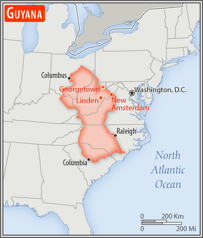
slightly smaller than Idaho; almost twice the size of Tennessee
Land boundaries:
total: 2,933 km
[see also: Land boundaries - total country ranks ]
border countries (3):
Brazil 1308 km, Suriname 836 km, Venezuela 789 km
Coastline:
459 km
[see also: Coastline country ranks ]
Maritime claims:
territorial sea: 12
nm
[see also: Maritime claims - territorial sea country ranks ]
exclusive economic zone: 200
nm
[see also: Maritime claims - exclusive economic zone country ranks ]
continental shelf: 200
nm or to the outer edge of the continental margin
[see also: Maritime claims - continental shelf country ranks ]
Climate:
tropical; hot, humid, moderated by northeast trade winds; two rainy seasons (May to August, November to January)
More Climate Details
Terrain:
mostly rolling highlands; low coastal plain; savanna in south
Elevation:
mean elevation: 207 m
[see also: Elevation - mean elevation country ranks ]
lowest point:
Atlantic Ocean 0 m
highest point:
Laberintos del Norte on Mount Roraima 2,775 m
Natural resources:
bauxite, gold, diamonds, hardwood timber, shrimp, fish
Land use:
agricultural land: 8.4%
(2011 est.)
[see also: Land use - agricultural land country ranks ]
arable land: 2.1%
(2011 est.)
[see also: Land use - arable land country ranks ]
permanent crops: 0.1%
(2011 est.)
[see also: Land use - permanent crops country ranks ]
permanent pasture: 6.2%
(2011 est.)
[see also: Land use - permanent pasture country ranks ]
forest: 77.4%
(2011 est.)
[see also: Land use - forest country ranks ]
other: 14.2%
(2011 est.)
[see also: Land use country ranks ]
Irrigated land:
1,430 sq km
(2012)
[see also: Irrigated land country ranks ]
Population distribution:
population is heavily concentrated in the northeast in and around Georgetown, with noteable concentrations along the Berbice River to the east; the remainder of the country is sparsely populated
Natural hazards:
flash flood threat during rainy seasons
Environment - current issues:
water pollution from sewage and agricultural and industrial chemicals; deforestation
Environment - international agreements:
party to:
Biodiversity, Climate Change, Climate Change-Kyoto Protocol, Desertification, Endangered Species, Hazardous Wastes, Law of the Sea, Ozone Layer Protection, Ship Pollution, Tropical Timber 83, Tropical Timber 94
signed, but not ratified:
none of the selected agreements
Geography - note:
the third-smallest country in South America after Suriname and Uruguay; substantial portions of its western and eastern territories are claimed by Venezuela and Suriname respectively; contains some of the largest unspoiled rainforests on the continent
NOTE: 1) The information regarding Guyana on this page is re-published from the 2020 World Fact Book of the United States Central Intelligence Agency and other sources. No claims are made regarding the accuracy of Guyana Geography 2020 information contained here. All suggestions for corrections of any errors about Guyana Geography 2020 should be addressed to the CIA or the source cited on each page.
2) The rank that you see is the CIA reported rank, which may have the following issues:
a) They assign increasing rank number, alphabetically for countries with the same value of the ranked item, whereas we assign them the same rank.
b) The CIA sometimes assigns counterintuitive ranks. For example, it assigns unemployment rates in increasing order, whereas we rank them in decreasing order.
- Main Index
- 2020 Index
- Country Ranks
- Definitions
- Guyana Index 2020
- Guyana Main Index
- Introduction
- History
- Geography
- Climate
- Maps
- People
- Religion
- Government
- Gov. Leaders
- Flags
- Economy
- Energy
- Communications
- Transportation
- Airport Codes
- Military
- Transnational Issues
- Photos
- Advertise Here
- Feedback

This page was last modified 27-Jan-20