


Location:
Southeastern Asia, archipelago between the Indian Ocean and the Pacific Ocean
Geographic coordinates:
5 00 S, 120 00 E
Map references:
Southeast Asia
Area:
total: 1,904,569 sq km
[see also: Area - total country ranks ]
land: 1,811,569 sq km
[see also: Area - land country ranks ]
water: 93,000 sq km
[see also: Area - water country ranks ]
country comparison to the world (CIA rank, may be based on non-current data):
16
Area - comparative:
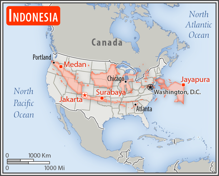
slightly less than three times the size of Texas
Area comparison map:
slightly less than three times the size of Texas
Land boundaries:
total: 2,958 km
[see also: Land boundaries - total country ranks ]
border countries (3):
Malaysia 1881 km, Papua New Guinea 824 km, Timor-Leste 253 km
Coastline:
54,716 km
[see also: Coastline country ranks ]
Maritime claims:
territorial sea: 12
nm
[see also: Maritime claims - territorial sea country ranks ]
exclusive economic zone: 200
nm
measured from claimed archipelagic straight baselines
Climate:
tropical; hot, humid; more moderate in highlands
More Climate Details
Terrain:
mostly coastal lowlands; larger islands have interior mountains
Elevation:
mean elevation: 367 m
[see also: Elevation - mean elevation country ranks ]
lowest point:
Indian Ocean 0 m
highest point:
Puncak Jaya 4,884 m
Natural resources:
petroleum, tin, natural gas, nickel, timber, bauxite, copper, fertile soils, coal, gold, silver
Land use:
agricultural land: 31.2%
(2011 est.)
[see also: Land use - agricultural land country ranks ]
arable land: 13%
(2011 est.)
[see also: Land use - arable land country ranks ]
permanent crops: 12.1%
(2011 est.)
[see also: Land use - permanent crops country ranks ]
permanent pasture: 6.1%
(2011 est.)
[see also: Land use - permanent pasture country ranks ]
forest: 51.7%
(2011 est.)
[see also: Land use - forest country ranks ]
other: 17.1%
(2011 est.)
[see also: Land use country ranks ]
Irrigated land:
67,220 sq km
(2012)
[see also: Irrigated land country ranks ]
Population distribution:
major concentration on the island of Java, which is considered one of the most densely populated places on earth; of the outer islands (those surrounding Java and Bali), Sumatra contains some of the most significant clusters, particularly in the south near the Selat Sunda, and along the northeastern coast near Medan; the cities of Makasar (Sulawesi), Banjarmasin (Kalimantan) are also heavily populated
Natural hazards:
occasional floods; severe droughts; tsunamis; earthquakes; volcanoes; forest fires
volcanism: Indonesia contains the most volcanoes of any country in the world - some 76 are historically active; significant volcanic activity occurs on Java, Sumatra, the Sunda Islands, Halmahera Island, Sulawesi Island, Sangihe Island, and in the Banda Sea; Merapi (2,968 m), Indonesia's most active volcano and in eruption since 2010, has been deemed a Decade Volcano by the International Association of Volcanology and Chemistry of the Earth's Interior, worthy of study due to its explosive history and close proximity to human populations; other notable historically active volcanoes include Agung, Awu, Karangetang, Krakatau (Krakatoa), Makian, Raung, and Tambora; see note 2 under "Geography - note"
Environment - current issues:
large-scale deforestation (much of it illegal) and related wildfires cause heavy smog; over-exploitation of marine resources; environmental problems associated with rapid urbanization and economic development, including air pollution, traffic congestion, garbage management, and reliable water and waste water services; water pollution from industrial wastes, sewage
Environment - international agreements:
party to:
Biodiversity, Climate Change, Climate Change-Kyoto Protocol, Desertification, Endangered Species, Hazardous Wastes, Law of the Sea, Ozone Layer Protection, Ship Pollution, Tropical Timber 83, Tropical Timber 94, Wetlands
signed, but not ratified:
Marine Life Conservation
note 1: according to Indonesia's National Coordinating Agency for Survey and Mapping, the total number of islands in the archipelago is 13,466, of which 922 are permanently inhabited (Indonesia is the world's largest country comprised solely of islands); the country straddles the equator and occupies a strategic location astride or along major sea lanes from the Indian Ocean to the Pacific Ocean
note 2: Indonesia is one of the countries along the Ring of Fire, a belt of active volcanoes and earthquake epicenters bordering the Pacific Ocean; up to 90% of the world's earthquakes and some 75% of the world's volcanoes occur within the Ring of Fire
note 3: despite having the fourth largest population in the world, Indonesia is the most heavily forested region on earth after the Amazon
NOTE: 1) The information regarding Indonesia on this page is re-published from the 2020 World Fact Book of the United States Central Intelligence Agency and other sources. No claims are made regarding the accuracy of Indonesia Geography 2020 information contained here. All suggestions for corrections of any errors about Indonesia Geography 2020 should be addressed to the CIA or the source cited on each page.
2) The rank that you see is the CIA reported rank, which may have the following issues:
a) They assign increasing rank number, alphabetically for countries with the same value of the ranked item, whereas we assign them the same rank.
b) The CIA sometimes assigns counterintuitive ranks. For example, it assigns unemployment rates in increasing order, whereas we rank them in decreasing order.
- Main Index
- 2020 Index
- Country Ranks
- Definitions
- Indonesia Index 2020
- Indonesia Main Index
- Introduction
- History
- Geography
- Climate
- Maps
- People
- Religion
- Government
- Gov. Leaders
- Flags
- Economy
- Energy
- Communications
- Transportation
- Airport Codes
- Military
- Terrorism
- Transnational Issues
- Photos
- Advertise Here
- Feedback

This page was last modified 27-Jan-20