


Location:
Eastern Asia, northern half of the Korean Peninsula bordering the Korea Bay and the Sea of Japan, between China and South Korea
Geographic coordinates:
40 00 N, 127 00 E
Map references:
Asia
Area:
total: 120,538 sq km
[see also: Area - total country ranks ]
land: 120,408 sq km
[see also: Area - land country ranks ]
water: 130 sq km
[see also: Area - water country ranks ]
country comparison to the world (CIA rank, may be based on non-current data):
100
Area - comparative:
slightly larger than Virginia; slightly smaller than Mississippi
Area comparison map:
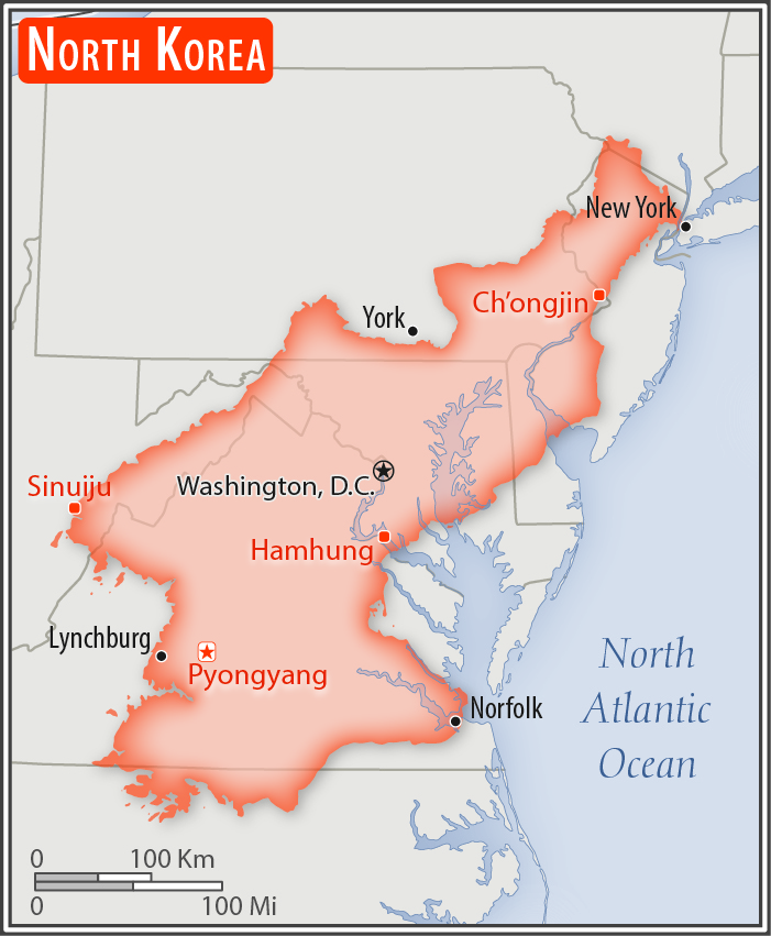
slightly larger than Virginia; slightly smaller than Mississippi
Land boundaries:
total: 1,607 km
[see also: Land boundaries - total country ranks ]
border countries (3):
China 1352 km, South Korea 237 km, Russia 18 km
Coastline:
2,495 km
[see also: Coastline country ranks ]
Maritime claims:
territorial sea: 12
nm
[see also: Maritime claims - territorial sea country ranks ]
exclusive economic zone: 200
nm
note: military boundary line 50 nm in the Sea of Japan and the exclusive economic zone limit in the Yellow Sea where all foreign vessels and aircraft without permission are banned
Climate:
temperate, with rainfall concentrated in summer; long, bitter winters
More Climate Details
Terrain:
mostly hills and mountains separated by deep, narrow valleys; wide coastal plains in west, discontinuous in east
Elevation:
mean elevation: 600 m
[see also: Elevation - mean elevation country ranks ]
lowest point:
Sea of Japan 0 m
highest point:
Paektu-san 2,744 m
Natural resources:
coal, iron ore, limestone, magnesite, graphite, copper, zinc, lead, precious metals, hydropower
Land use:
agricultural land: 21.8%
(2011 est.)
[see also: Land use - agricultural land country ranks ]
arable land: 19.5%
(2011 est.)
[see also: Land use - arable land country ranks ]
permanent crops: 1.9%
(2011 est.)
[see also: Land use - permanent crops country ranks ]
permanent pasture: 0.4%
(2011 est.)
[see also: Land use - permanent pasture country ranks ]
forest: 46%
(2011 est.)
[see also: Land use - forest country ranks ]
other: 32.2%
(2011 est.)
[see also: Land use country ranks ]
Irrigated land:
14,600 sq km
(2012)
[see also: Irrigated land country ranks ]
Population distribution:
population concentrated in the plains and lowlands; least populated regions are the mountainous provinces adjacent to the Chinese border; largest concentrations are in the western provinces, particularly the municipal district of Pyongyang, and around Hungnam and Wonsan in the east
Natural hazards:
late spring droughts often followed by severe flooding; occasional typhoons during the early fall
volcanism: Changbaishan (2,744 m) (also known as Baitoushan, Baegdu or P'aektu-san), on the Chinese border, is considered historically active
Environment - current issues:
water pollution; inadequate supplies of potable water; waterborne disease; deforestation; soil erosion and degradation
Environment - international agreements:
party to:
Antarctic Treaty, Biodiversity, Climate Change, Climate Change-Kyoto Protocol, Desertification, Environmental Modification, Hazardous Wastes, Ozone Layer Protection, Ship Pollution
signed, but not ratified:
Law of the Sea
Geography - note:
strategic location bordering China, South Korea, and Russia; mountainous interior is isolated and sparsely populated
NOTE: 1) The information regarding Korea, North on this page is re-published from the 2020 World Fact Book of the United States Central Intelligence Agency and other sources. No claims are made regarding the accuracy of Korea, North Geography 2020 information contained here. All suggestions for corrections of any errors about Korea, North Geography 2020 should be addressed to the CIA or the source cited on each page.
2) The rank that you see is the CIA reported rank, which may have the following issues:
a) They assign increasing rank number, alphabetically for countries with the same value of the ranked item, whereas we assign them the same rank.
b) The CIA sometimes assigns counterintuitive ranks. For example, it assigns unemployment rates in increasing order, whereas we rank them in decreasing order.
- Main Index
- 2020 Index
- Country Ranks
- Definitions
- Korea, North Index 2020
- Korea, North Main Index
- Introduction
- History
- Geography
- Climate
- Maps
- People
- Religion
- Government
- Gov. Leaders
- Flags
- Economy
- Energy
- Communications
- Transportation
- Airport Codes
- Military
- Transnational Issues
- Photos
- Advertise Here
- Feedback

This page was last modified 27-Jan-20