


Location:
Southeastern Asia, northeast of Thailand, west of Vietnam
Geographic coordinates:
18 00 N, 105 00 E
Map references:
Southeast Asia
Area:
total: 236,800 sq km
[see also: Area - total country ranks ]
land: 230,800 sq km
[see also: Area - land country ranks ]
water: 6,000 sq km
[see also: Area - water country ranks ]
country comparison to the world (CIA rank, may be based on non-current data):
85
Area - comparative:
about twice the size of Pennsylvania; slightly larger than Utah
Area comparison map:
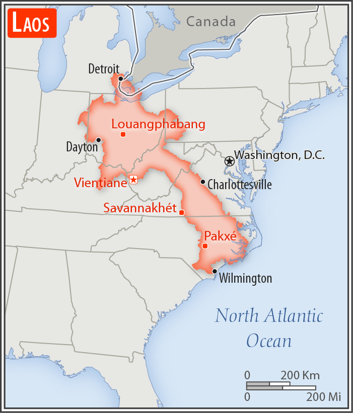
about twice the size of Pennsylvania; slightly larger than Utah
Land boundaries:
total: 5,274 km
[see also: Land boundaries - total country ranks ]
border countries (5):
Burma 238 km, Cambodia 555 km, China 475 km, Thailand 1845 km, Vietnam 2161 km
Coastline:
0 km
(landlocked)
[see also: Coastline country ranks ]
Maritime claims:
none (landlocked)
Climate:
tropical monsoon; rainy season (May to November); dry season (December to April)
More Climate Details
Terrain:
mostly rugged mountains; some plains and plateaus
Elevation:
mean elevation: 710 m
[see also: Elevation - mean elevation country ranks ]
lowest point:
Mekong River 70 m
highest point:
Phu Bia 2,817 m
Natural resources:
timber, hydropower, gypsum, tin, gold, gemstones
Land use:
agricultural land: 10.6%
(2011 est.)
[see also: Land use - agricultural land country ranks ]
arable land: 6.2%
(2011 est.)
[see also: Land use - arable land country ranks ]
permanent crops: 0.7%
(2011 est.)
[see also: Land use - permanent crops country ranks ]
permanent pasture: 3.7%
(2011 est.)
[see also: Land use - permanent pasture country ranks ]
forest: 67.9%
(2011 est.)
[see also: Land use - forest country ranks ]
other: 21.5%
(2011 est.)
[see also: Land use country ranks ]
Irrigated land:
3,100 sq km
(2012)
[see also: Irrigated land country ranks ]
Population distribution:
most densely populated area is in and around the capital city of Vientiane; large communities are primarily found along the Mekong River along the southwestern border; overall density is considered one of the lowest in Southeast Asia
Natural hazards:
floods, droughts
Environment - current issues:
unexploded ordnance; deforestation; soil erosion; loss of biodiversity; water pollution, most of the population does not have access to potable water
Environment - international agreements:
party to:
Biodiversity, Climate Change, Climate Change-Kyoto Protocol, Desertification, Endangered Species, Environmental Modification, Hazardous Wastes, Law of the Sea, Ozone Layer Protection
signed, but not ratified:
none of the selected agreements
Geography - note:
landlocked; most of the country is mountainous and thickly forested; the Mekong River forms a large part of the western boundary with Thailand
NOTE: 1) The information regarding Laos on this page is re-published from the 2020 World Fact Book of the United States Central Intelligence Agency and other sources. No claims are made regarding the accuracy of Laos Geography 2020 information contained here. All suggestions for corrections of any errors about Laos Geography 2020 should be addressed to the CIA or the source cited on each page.
2) The rank that you see is the CIA reported rank, which may have the following issues:
a) They assign increasing rank number, alphabetically for countries with the same value of the ranked item, whereas we assign them the same rank.
b) The CIA sometimes assigns counterintuitive ranks. For example, it assigns unemployment rates in increasing order, whereas we rank them in decreasing order.
- Main Index
- 2020 Index
- Country Ranks
- Definitions
- Laos Index 2020
- Laos Main Index
- Introduction
- History
- Geography
- Climate
- Maps
- People
- Religion
- Government
- Gov. Leaders
- Flags
- Economy
- Energy
- Communications
- Transportation
- Airport Codes
- Military
- Transnational Issues
- Photos
- Advertise Here
- Feedback

This page was last modified 27-Jan-20