


Location:
Western Europe, between France and Germany
Geographic coordinates:
49 45 N, 6 10 E
Map references:
Europe
Area:
total: 2,586 sq km
[see also: Area - total country ranks ]
land: 2,586 sq km
[see also: Area - land country ranks ]
water: 0 sq km
[see also: Area - water country ranks ]
country comparison to the world (CIA rank, may be based on non-current data):
179
Area - comparative:
slightly smaller than Rhode Island; about half the size of Delaware
Area comparison map:
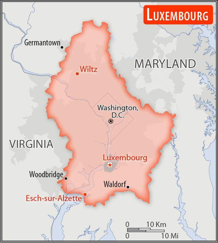
slightly smaller than Rhode Island; about half the size of Delaware
Land boundaries:
total: 327 km
[see also: Land boundaries - total country ranks ]
border countries (3):
Belgium 130 km, France 69 km, Germany 128 km
Coastline:
0 km
(landlocked)
[see also: Coastline country ranks ]
Maritime claims:
none (landlocked)
Climate:
modified continental with mild winters, cool summers
More Climate Details
Terrain:
mostly gently rolling uplands with broad, shallow valleys; uplands to slightly mountainous in the north; steep slope down to Moselle flood plain in the southeast
Elevation:
mean elevation: 325 m
[see also: Elevation - mean elevation country ranks ]
lowest point:
Moselle River 133 m
highest point:
Buurgplaatz 559 m
Natural resources:
iron ore (no longer exploited), arable land
Land use:
agricultural land: 50.7%
(2011 est.)
[see also: Land use - agricultural land country ranks ]
arable land: 24%
(2011 est.)
[see also: Land use - arable land country ranks ]
permanent crops: 0.6%
(2011 est.)
[see also: Land use - permanent crops country ranks ]
permanent pasture: 26.1%
(2011 est.)
[see also: Land use - permanent pasture country ranks ]
forest: 33.5%
(2011 est.)
[see also: Land use - forest country ranks ]
other: 15.8%
(2011 est.)
[see also: Land use country ranks ]
Irrigated land:
0 sq km
(2012)
[see also: Irrigated land country ranks ]
Population distribution:
most people live in the south, on or near the border with France
Natural hazards:
occasional flooding
Environment - current issues:
air and water pollution in urban areas, soil pollution of farmland; unsustainable patterns of consumption (transport, energy, recreation, space) threaten biodiversity and landscapes
Environment - international agreements:
party to:
Air Pollution, Air Pollution-Nitrogen Oxides, Air Pollution-Persistent Organic Pollutants, Air Pollution-Sulfur 85, Air Pollution-Sulfur 94, Air Pollution-Volatile Organic Compounds, Biodiversity, Climate Change, Climate Change-Kyoto Protocol, Desertification, Endangered Species, Hazardous Wastes, Law of the Sea, Marine Dumping, Ozone Layer Protection, Ship Pollution, Tropical Timber 83, Tropical Timber 94, Wetlands
signed, but not ratified:
Environmental Modification
Geography - note:
landlocked; the only grand duchy in the world
NOTE: 1) The information regarding Luxembourg on this page is re-published from the 2020 World Fact Book of the United States Central Intelligence Agency and other sources. No claims are made regarding the accuracy of Luxembourg Geography 2020 information contained here. All suggestions for corrections of any errors about Luxembourg Geography 2020 should be addressed to the CIA or the source cited on each page.
2) The rank that you see is the CIA reported rank, which may have the following issues:
a) They assign increasing rank number, alphabetically for countries with the same value of the ranked item, whereas we assign them the same rank.
b) The CIA sometimes assigns counterintuitive ranks. For example, it assigns unemployment rates in increasing order, whereas we rank them in decreasing order.
- Main Index
- 2020 Index
- Country Ranks
- Definitions
- Luxembourg Index 2020
- Luxembourg Main Index
- Introduction
- History
- Geography
- Climate
- Maps
- People
- Religion
- Government
- Gov. Leaders
- Flags
- Economy
- Energy
- Communications
- Transportation
- Airport Codes
- Military
- Transnational Issues
- Photos
- Advertise Here
- Feedback

This page was last modified 27-Jan-20