


Location:
Oceania, island group in the North Pacific Ocean, about three-quarters of the way from Hawaii to Indonesia
Geographic coordinates:
6 55 N, 158 15 E
Map references:
Oceania
Area:
total: 702 sq km
[see also: Area - total country ranks ]
land: 702 sq km
[see also: Area - land country ranks ]
water: 0 sq km
(fresh water only)
note: includes Pohnpei (Ponape), Chuuk (Truk) Islands, Yap Islands, and Kosrae (Kosaie)
country comparison to the world (CIA rank, may be based on non-current data):
192
Area - comparative:
four times the size of Washington, DC (land area only)
Area comparison map:
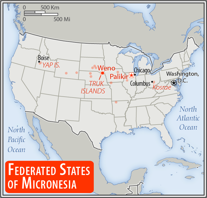
four times the size of Washington, DC (land area only)
Land boundaries:
0 km
Coastline:
6,112 km
[see also: Coastline country ranks ]
Maritime claims:
territorial sea: 12
nm
[see also: Maritime claims - territorial sea country ranks ]
exclusive economic zone: 200
nm
[see also: Maritime claims - exclusive economic zone country ranks ]
Climate:
tropical; heavy year-round rainfall, especially in the eastern islands; located on southern edge of the typhoon belt with occasionally severe damage
Terrain:
islands vary geologically from high mountainous islands to low, coral atolls; volcanic outcroppings on Pohnpei, Kosrae, and Chuuk
Elevation:
lowest point:
Pacific Ocean 0 m
highest point:
Nanlaud on Pohnpei 782 m
Natural resources:
timber, marine products, deep-seabed minerals, phosphate
Land use:
agricultural land: 25.5%
(2011 est.)
[see also: Land use - agricultural land country ranks ]
arable land: 2.3%
(2011 est.)
[see also: Land use - arable land country ranks ]
permanent crops: 19.7%
(2011 est.)
[see also: Land use - permanent crops country ranks ]
permanent pasture: 3.5%
(2011 est.)
[see also: Land use - permanent pasture country ranks ]
forest: 74.5%
(2011 est.)
[see also: Land use - forest country ranks ]
other: 0%
(2011 est.)
[see also: Land use country ranks ]
Irrigated land:
0 sq km
NA
(2012)
[see also: Irrigated land country ranks ]
Population distribution:
the majority of the populaton lives in the coastal areas of the high islands; the mountainous interior is largely uninhabited; less than half of the population lives in urban areas
Natural hazards:
typhoons (June to December)
Environment - current issues:
overfishing; climate change; water pollution, toxic pollution from mining; solid waste disposal
Environment - international agreements:
party to:
Biodiversity, Climate Change, Climate Change-Kyoto Protocol, Desertification, Hazardous Wastes, Law of the Sea, Ozone Layer Protection
signed, but not ratified:
none of the selected agreements
Geography - note:
composed of four major island groups totaling 607 islands
NOTE: 1) The information regarding Micronesia, Federated States Of on this page is re-published from the 2020 World Fact Book of the United States Central Intelligence Agency and other sources. No claims are made regarding the accuracy of Micronesia, Federated States Of Geography 2020 information contained here. All suggestions for corrections of any errors about Micronesia, Federated States Of Geography 2020 should be addressed to the CIA or the source cited on each page.
2) The rank that you see is the CIA reported rank, which may have the following issues:
a) They assign increasing rank number, alphabetically for countries with the same value of the ranked item, whereas we assign them the same rank.
b) The CIA sometimes assigns counterintuitive ranks. For example, it assigns unemployment rates in increasing order, whereas we rank them in decreasing order.
- Main Index
- 2020 Index
- Country Ranks
- Definitions
- Micronesia, Federated States Of Index 2020
- Micronesia, Federated States Of Main Index
- Introduction
- Geography
- Maps
- People
- Religion
- Government
- Gov. Leaders
- Flags
- Economy
- Energy
- Communications
- Transportation
- Airport Codes
- Military
- Transnational Issues
- Photos
- Advertise Here
- Feedback

This page was last modified 27-Jan-20