


Location:
Southeastern Europe, between the Adriatic Sea and Serbia
Geographic coordinates:
42 30 N, 19 18 E
Map references:
Europe
Area:
total: 13,812 sq km
[see also: Area - total country ranks ]
land: 13,452 sq km
[see also: Area - land country ranks ]
water: 360 sq km
[see also: Area - water country ranks ]
country comparison to the world (CIA rank, may be based on non-current data):
162
Area - comparative:
slightly smaller than Connecticut; slightly larger than twice the size of Delaware
Area comparison map:
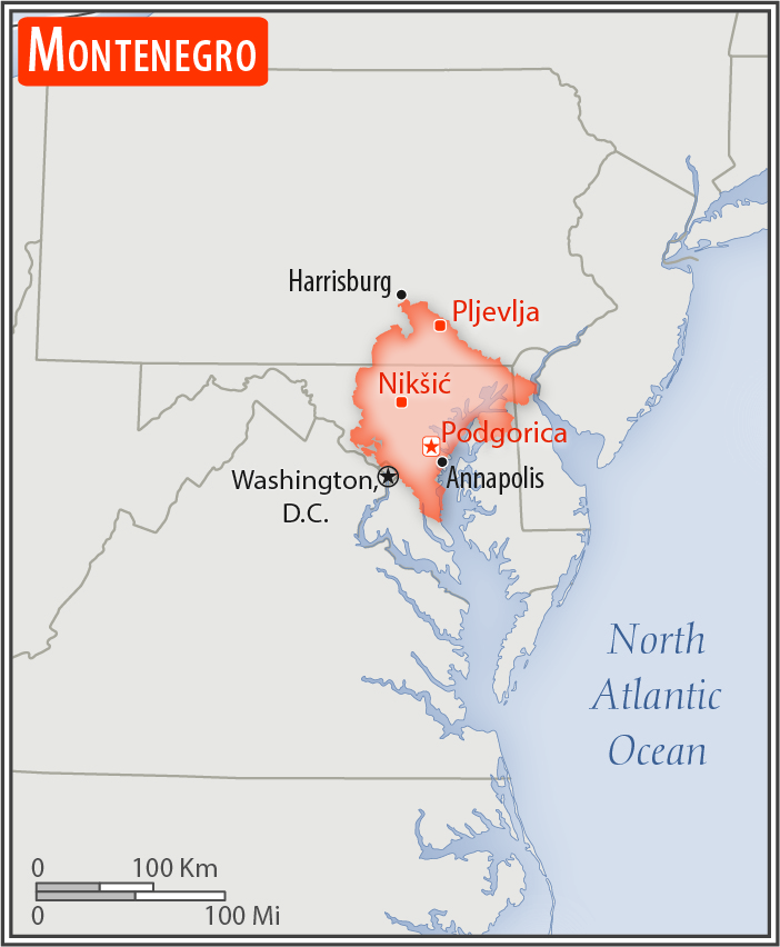
slightly smaller than Connecticut; slightly larger than twice the size of Delaware
Land boundaries:
total: 680 km
[see also: Land boundaries - total country ranks ]
border countries (5):
Albania 186 km, Bosnia and Herzegovina 242 km, Croatia 19 km, Kosovo 76 km, Serbia 157 km
Coastline:
293.5 km
[see also: Coastline country ranks ]
Maritime claims:
territorial sea: 12
nm
[see also: Maritime claims - territorial sea country ranks ]
continental shelf:
defined by treaty
[see also: Maritime claims - continental shelf country ranks ]
Climate:
Mediterranean climate, hot dry summers and autumns and relatively cold winters with heavy snowfalls inland
More Climate Details
Terrain:
highly indented coastline with narrow coastal plain backed by rugged high limestone mountains and plateaus
Elevation:
mean elevation: 1,086 m
[see also: Elevation - mean elevation country ranks ]
lowest point:
Adriatic Sea 0 m
highest point:
Bobotov Kuk 2,522 m
Natural resources:
bauxite, hydroelectricity
Land use:
agricultural land: 38.2%
(2011 est.)
[see also: Land use - agricultural land country ranks ]
arable land: 12.9%
(2011 est.)
[see also: Land use - arable land country ranks ]
permanent crops: 1.2%
(2011 est.)
[see also: Land use - permanent crops country ranks ]
permanent pasture: 24.1%
(2011 est.)
[see also: Land use - permanent pasture country ranks ]
forest: 40.4%
(2011 est.)
[see also: Land use - forest country ranks ]
other: 21.4%
(2011 est.)
[see also: Land use country ranks ]
Irrigated land:
24 sq km
(2012)
[see also: Irrigated land country ranks ]
Population distribution:
highest population density is concentrated in the south, southwest; the extreme eastern border is the least populated area
Natural hazards:
destructive earthquakes
Environment - current issues:
pollution of coastal waters from sewage outlets, especially in tourist-related areas such as Kotor; serious air pollution in Podgorica, Pljevlja and Niksie; air pollution in Pljevlja is caused by the nearby lignite power plant and the domestic use of coal and wood for household heating
Environment - international agreements:
party to:
Air Pollution, Biodiversity, Climate Change, Climate Change-Kyoto Protocol, Desertification, Hazardous Wastes, Law of the Sea, Marine Dumping, Marine Life Conservation, Ozone Layer Protection, Ship Pollution
signed, but not ratified:
none of the selected agreements
Geography - note:
strategic location along the Adriatic coast
NOTE: 1) The information regarding Montenegro on this page is re-published from the 2020 World Fact Book of the United States Central Intelligence Agency and other sources. No claims are made regarding the accuracy of Montenegro Geography 2020 information contained here. All suggestions for corrections of any errors about Montenegro Geography 2020 should be addressed to the CIA or the source cited on each page.
2) The rank that you see is the CIA reported rank, which may have the following issues:
a) They assign increasing rank number, alphabetically for countries with the same value of the ranked item, whereas we assign them the same rank.
b) The CIA sometimes assigns counterintuitive ranks. For example, it assigns unemployment rates in increasing order, whereas we rank them in decreasing order.
- Main Index
- 2020 Index
- Country Ranks
- Definitions
- Montenegro Index 2020
- Montenegro Main Index
- Introduction
- History
- Geography
- Climate
- Maps
- People
- Religion
- Government
- Gov. Leaders
- Flags
- Economy
- Energy
- Communications
- Transportation
- Airport Codes
- Military
- Terrorism
- Transnational Issues
- Photos
- Advertise Here
- Feedback

This page was last modified 27-Jan-20