


Location:
Middle East, peninsula bordering the Persian Gulf and Saudi Arabia
Geographic coordinates:
25 30 N, 51 15 E
Map references:
Middle East
Area:
total: 11,586 sq km
[see also: Area - total country ranks ]
land: 11,586 sq km
[see also: Area - land country ranks ]
water: 0 sq km
[see also: Area - water country ranks ]
country comparison to the world (CIA rank, may be based on non-current data):
165
Area - comparative:
almost twice the size of Delaware; slightly smaller than Connecticut
Area comparison map:
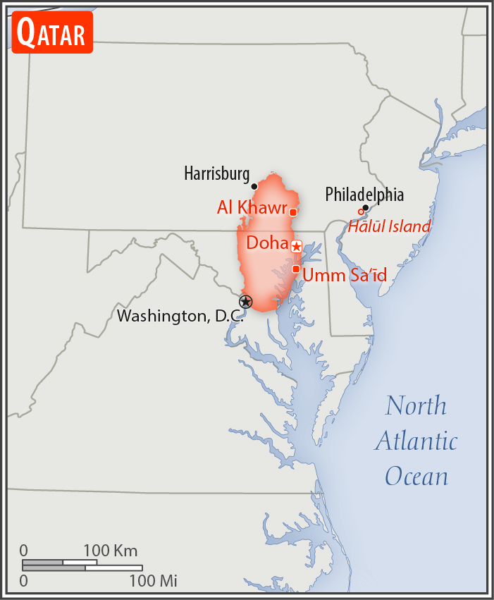
almost twice the size of Delaware; slightly smaller than Connecticut
Land boundaries:
total: 87 km
[see also: Land boundaries - total country ranks ]
border countries (1):
Saudi Arabia 87 km
Coastline:
563 km
[see also: Coastline country ranks ]
Maritime claims:
territorial sea: 12
nm
[see also: Maritime claims - territorial sea country ranks ]
exclusive economic zone:
as determined by bilateral agreements or the median line
[see also: Maritime claims - exclusive economic zone country ranks ]
contiguous zone: 24
nm
[see also: Maritime claims - contiguous zone country ranks ]
Climate:
arid; mild, pleasant winters; very hot, humid summers
More Climate Details
Terrain:
mostly flat and barren desert
Elevation:
mean elevation: 28 m
[see also: Elevation - mean elevation country ranks ]
lowest point:
Persian Gulf 0 m
highest point:
Tuwayyir al Hamir 103 m
Natural resources:
petroleum, fish, natural gas
Land use:
agricultural land: 5.6%
(2011 est.)
[see also: Land use - agricultural land country ranks ]
arable land: 1.1%
(2011 est.)
[see also: Land use - arable land country ranks ]
permanent crops: 0.2%
(2011 est.)
[see also: Land use - permanent crops country ranks ]
permanent pasture: 4.3%
(2011 est.)
[see also: Land use - permanent pasture country ranks ]
forest: 0%
(2011 est.)
[see also: Land use - forest country ranks ]
other: 94.4%
(2011 est.)
[see also: Land use country ranks ]
Irrigated land:
130 sq km
(2012)
[see also: Irrigated land country ranks ]
Population distribution:
most of the population is clustered in or around the capital of Doha on the eastern side of the peninsula
Natural hazards:
haze, dust storms, sandstorms common
Environment - current issues:
air, land, and water pollution are significant environmental issues; limited natural freshwater resources are increasing dependence on large-scale desalination facilities; other issues include conservation of oil supplies and preservation of the natural wildlife heritage
Environment - international agreements:
party to:
Biodiversity, Climate Change, Climate Change-Kyoto Protocol, Desertification, Endangered Species, Hazardous Wastes, Law of the Sea, Ozone Layer Protection, Ship Pollution
signed, but not ratified:
none of the selected agreements
Geography - note:
the peninsula occupies a strategic location in the central Persian Gulf near major petroleum deposits
NOTE: 1) The information regarding Qatar on this page is re-published from the 2020 World Fact Book of the United States Central Intelligence Agency and other sources. No claims are made regarding the accuracy of Qatar Geography 2020 information contained here. All suggestions for corrections of any errors about Qatar Geography 2020 should be addressed to the CIA or the source cited on each page.
2) The rank that you see is the CIA reported rank, which may have the following issues:
a) They assign increasing rank number, alphabetically for countries with the same value of the ranked item, whereas we assign them the same rank.
b) The CIA sometimes assigns counterintuitive ranks. For example, it assigns unemployment rates in increasing order, whereas we rank them in decreasing order.
- Main Index
- 2020 Index
- Country Ranks
- Definitions
- Qatar Index 2020
- Qatar Main Index
- Introduction
- History
- Geography
- Climate
- Maps
- People
- Religion
- Government
- Gov. Leaders
- Flags
- Economy
- Energy
- Communications
- Transportation
- Airport Codes
- Military
- Terrorism
- Transnational Issues
- Photos
- Advertise Here
- Feedback

This page was last modified 27-Jan-20