


Location:
Southeastern Europe, between Macedonia and Hungary
Geographic coordinates:
44 00 N, 21 00 E
Map references:
Europe
Area:
total: 77,474 sq km
[see also: Area - total country ranks ]
land: 77,474 sq km
[see also: Area - land country ranks ]
water: 0 sq km
[see also: Area - water country ranks ]
country comparison to the world (CIA rank, may be based on non-current data):
118
Area - comparative:
slightly smaller than South Carolina
Area comparison map:
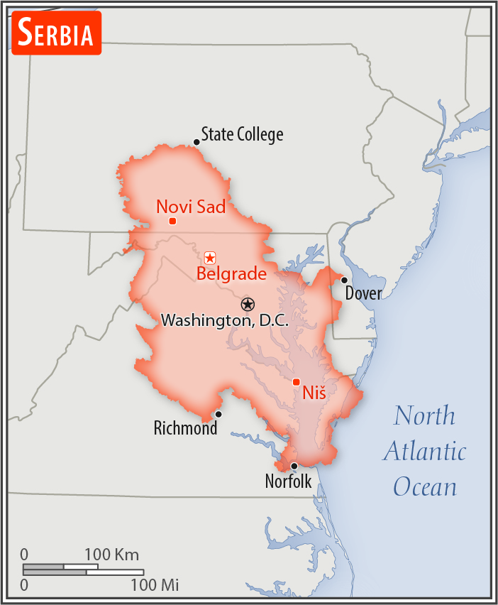
slightly smaller than South Carolina
Land boundaries:
total: 2,322 km
[see also: Land boundaries - total country ranks ]
border countries (8):
Bosnia and Herzegovina 345 km, Bulgaria 344 km, Croatia 314 km, Hungary 164 km, Kosovo 366 km, Macedonia 101 km, Montenegro 157 km, Romania 531 km
Coastline:
0 km
(landlocked)
[see also: Coastline country ranks ]
Maritime claims:
none (landlocked)
Climate:
in the north, continental climate (cold winters and hot, humid summers with well-distributed rainfall); in other parts, continental and Mediterranean climate (relatively cold winters with heavy snowfall and hot, dry summers and autumns)
More Climate Details
Terrain:
extremely varied; to the north, rich fertile plains; to the east, limestone ranges and basins; to the southeast, ancient mountains and hills
Elevation:
mean elevation: 442 m
[see also: Elevation - mean elevation country ranks ]
lowest point:
Danube and Timok Rivers 35 m
highest point:
Midzor 2,169 m
Natural resources:
oil, gas, coal, iron ore, copper, zinc, antimony, chromite, gold, silver, magnesium, pyrite, limestone, marble, salt, arable land
Land use:
agricultural land: 57.9%
(2011 est.)
[see also: Land use - agricultural land country ranks ]
arable land: 37.7%
(2011 est.)
[see also: Land use - arable land country ranks ]
permanent crops: 3.4%
(2011 est.)
[see also: Land use - permanent crops country ranks ]
permanent pasture: 16.8%
(2011 est.)
[see also: Land use - permanent pasture country ranks ]
forest: 31.6%
(2011 est.)
[see also: Land use - forest country ranks ]
other: 10.5%
(2011 est.)
[see also: Land use country ranks ]
Irrigated land:
950 sq km
(2012)
[see also: Irrigated land country ranks ]
Population distribution:
a fairly even distribution throughout most of the country, with urban areas attracting larger and denser populations
Natural hazards:
destructive earthquakes
Environment - current issues:
air pollution around Belgrade and other industrial cities; water pollution from industrial wastes dumped into the Sava which flows into the Danube; inadequate management of domestic, industrial, and hazardous waste
Environment - international agreements:
party to:
Air Pollution, Biodiversity, Climate Change, Climate Change-Kyoto Protocol, Desertification, Endangered Species, Hazardous Wastes, Law of the Sea, Marine Dumping, Marine Life Conservation, Ozone Layer Protection, Ship Pollution, Wetlands
signed, but not ratified:
none of the selected agreements
Geography - note:
landlocked; controls one of the major land routes from Western Europe to Turkey and the Near East
NOTE: 1) The information regarding Serbia on this page is re-published from the 2020 World Fact Book of the United States Central Intelligence Agency and other sources. No claims are made regarding the accuracy of Serbia Geography 2020 information contained here. All suggestions for corrections of any errors about Serbia Geography 2020 should be addressed to the CIA or the source cited on each page.
2) The rank that you see is the CIA reported rank, which may have the following issues:
a) They assign increasing rank number, alphabetically for countries with the same value of the ranked item, whereas we assign them the same rank.
b) The CIA sometimes assigns counterintuitive ranks. For example, it assigns unemployment rates in increasing order, whereas we rank them in decreasing order.
- Main Index
- 2020 Index
- Country Ranks
- Definitions
- Serbia Index 2020
- Serbia Main Index
- Introduction
- History
- Geography
- Climate
- Maps
- People
- Religion
- Government
- Gov. Leaders
- Flags
- Economy
- Energy
- Communications
- Transportation
- Airport Codes
- Military
- Transnational Issues
- Photos
- Advertise Here
- Feedback

This page was last modified 27-Jan-20