


Location:
Southeastern Asia, northwest of Australia in the Lesser Sunda Islands at the eastern end of the Indonesian archipelago; note - Timor-Leste includes the eastern half of the island of Timor, the Oecussi (Ambeno) region on the northwest portion of the island of Timor, and the islands of Pulau Atauro and Pulau Jaco
Geographic coordinates:
8 50 S, 125 55 E
Map references:
Southeast Asia
Area:
total: 14,874 sq km
[see also: Area - total country ranks ]
land: 14,874 sq km
[see also: Area - land country ranks ]
water: 0 sq km
[see also: Area - water country ranks ]
country comparison to the world (CIA rank, may be based on non-current data):
160
Area - comparative:
slightly larger than Connecticut; almost half the size of Maryland
Area comparison map:
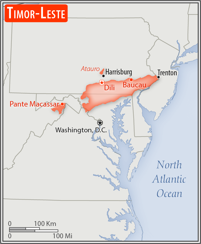
slightly larger than Connecticut; almost half the size of Maryland
Land boundaries:
total: 253 km
[see also: Land boundaries - total country ranks ]
border countries (1):
Indonesia 253 km
Coastline:
706 km
[see also: Coastline country ranks ]
Maritime claims:
territorial sea: 12
nm
[see also: Maritime claims - territorial sea country ranks ]
contiguous zone: 24
nm
[see also: Maritime claims - contiguous zone country ranks ]
exclusive fishing zone: 200
nm
[see also: Maritime claims - exclusive fishing zone country ranks ]
Climate:
tropical; hot, humid; distinct rainy and dry seasons
Terrain:
mountainous
Elevation:
lowest point:
Timor Sea, Savu Sea, and Banda Sea 0 m
highest point:
Foho Tatamailau 2,963 m
Natural resources:
gold, petroleum, natural gas, manganese, marble
Land use:
agricultural land: 25.1%
(2011 est.)
[see also: Land use - agricultural land country ranks ]
arable land: 10.1%
(2011 est.)
[see also: Land use - arable land country ranks ]
permanent crops: 4.9%
(2011 est.)
[see also: Land use - permanent crops country ranks ]
permanent pasture: 10.1%
(2011 est.)
[see also: Land use - permanent pasture country ranks ]
forest: 49.1%
(2011 est.)
[see also: Land use - forest country ranks ]
other: 25.8%
(2011 est.)
[see also: Land use country ranks ]
Irrigated land:
350 sq km
(2012)
[see also: Irrigated land country ranks ]
Population distribution:
most of the population concentrated in the western third of the country, particularly around Dili
Natural hazards:
floods and landslides are common; earthquakes; tsunamis; tropical cyclones
Environment - current issues:
air pollution and deterioration of air quality; greenhouse gas emissions; water quality, scarcity, and access; land and soil degradation; forest depletion; widespread use of slash and burn agriculture has led to deforestation and soil erosion; loss of biodiversity
Environment - international agreements:
party to:
Biodiversity, Climate Change, Climate Change-Kyoto Protocol, Desertification
signed, but not ratified:
none of the selected agreements
Geography - note:
Timor comes from the Malay word for "east"; the island of Timor is part of the Malay Archipelago and is the largest and easternmost of the Lesser Sunda Islands; the district of Oecussi is an exclave separated from Timor-Leste proper by Indonesia
NOTE: 1) The information regarding Timor-Leste on this page is re-published from the 2020 World Fact Book of the United States Central Intelligence Agency and other sources. No claims are made regarding the accuracy of Timor-Leste Geography 2020 information contained here. All suggestions for corrections of any errors about Timor-Leste Geography 2020 should be addressed to the CIA or the source cited on each page.
2) The rank that you see is the CIA reported rank, which may have the following issues:
a) They assign increasing rank number, alphabetically for countries with the same value of the ranked item, whereas we assign them the same rank.
b) The CIA sometimes assigns counterintuitive ranks. For example, it assigns unemployment rates in increasing order, whereas we rank them in decreasing order.
- Main Index
- 2020 Index
- Country Ranks
- Definitions
- Timor-Leste Index 2020
- Timor-Leste Main Index
- Introduction
- Geography
- Maps
- People
- Religion
- Government
- Gov. Leaders
- Flags
- Economy
- Energy
- Communications
- Transportation
- Airport Codes
- Military
- Transnational Issues
- Photos
- Advertise Here
- Feedback

This page was last modified 27-Jan-20