


Location:
Oceania, archipelago in the South Pacific Ocean, about two-thirds of the way from Hawaii to New Zealand
Geographic coordinates:
20 00 S, 175 00 W
Map references:
Oceania
Area:
total: 747 sq km
[see also: Area - total country ranks ]
land: 717 sq km
[see also: Area - land country ranks ]
water: 30 sq km
[see also: Area - water country ranks ]
country comparison to the world (CIA rank, may be based on non-current data):
190
Area - comparative:
four times the size of Washington, DC
Area comparison map:
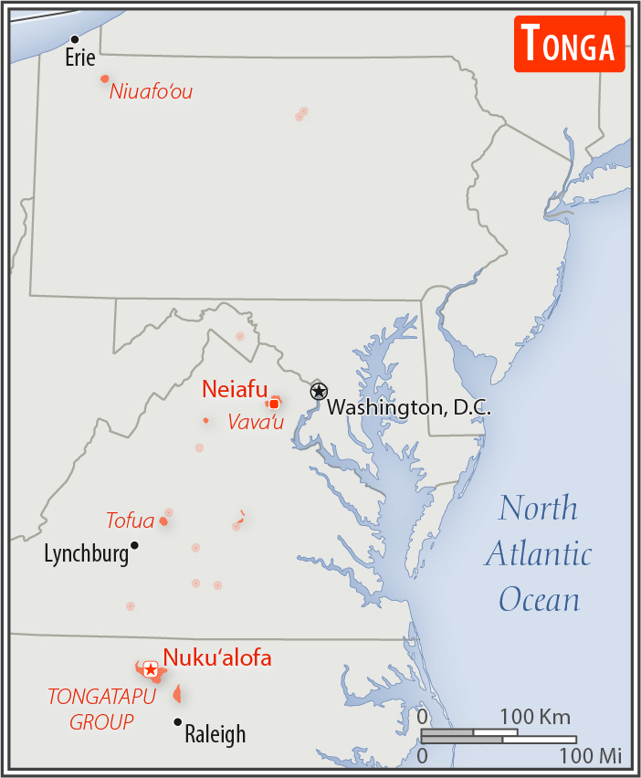
four times the size of Washington, DC
Land boundaries:
0 km
Coastline:
419 km
[see also: Coastline country ranks ]
Maritime claims:
territorial sea: 12
nm
[see also: Maritime claims - territorial sea country ranks ]
exclusive economic zone: 200
nm
[see also: Maritime claims - exclusive economic zone country ranks ]
continental shelf:
200-m depth or to the depth of exploitation
[see also: Maritime claims - continental shelf country ranks ]
Climate:
tropical; modified by trade winds; warm season (December to May), cool season (May to December)
Terrain:
mostly flat islands with limestone bedrock formed from uplifted coral formation; others have limestone overlying volcanic rock
Elevation:
lowest point:
Pacific Ocean 0 m
highest point:
Kao Volcano on Kao Island 1,046 m
Natural resources:
arable land, fish
Land use:
agricultural land: 43.1%
(2011 est.)
[see also: Land use - agricultural land country ranks ]
arable land: 22.2%
(2011 est.)
[see also: Land use - arable land country ranks ]
permanent crops: 15.3%
(2011 est.)
[see also: Land use - permanent crops country ranks ]
permanent pasture: 5.6%
(2011 est.)
[see also: Land use - permanent pasture country ranks ]
forest: 12.5%
(2011 est.)
[see also: Land use - forest country ranks ]
other: 44.4%
(2011 est.)
[see also: Land use country ranks ]
Irrigated land:
0 sq km
(2012)
[see also: Irrigated land country ranks ]
Population distribution:
over two-thirds of the population lives on the island of Tongatapu; only 45 of the nation's 171 islands are occupied
Natural hazards:
cyclones (October to April); earthquakes and volcanic activity on Fonuafo'ou
volcanism: moderate volcanic activity; Fonualei (180 m) has shown frequent activity in recent years, while Niuafo'ou (260 m), which last erupted in 1985, has forced evacuations; other historically active volcanoes include Late and Tofua
Environment - current issues:
deforestation from land being cleared for agriculture and settlement; soil exhaustion; water pollution due to salinization, sewage, and toxic chemicals from farming activities; coral reefs and marine populations threatened
Environment - international agreements:
party to:
Biodiversity, Climate Change, Climate Change-Kyoto Protocol, Desertification, Hazardous Wastes, Law of the Sea, Marine Dumping, Marine Life Conservation, Ozone Layer Protection, Ship Pollution
signed, but not ratified:
none of the selected agreements
Geography - note:
the western islands (making up the Tongan Volcanic Arch) are all of volcanic origin; the eastern islands are nonvolcanic and are composed of coral limestone and sand
NOTE: 1) The information regarding Tonga on this page is re-published from the 2020 World Fact Book of the United States Central Intelligence Agency and other sources. No claims are made regarding the accuracy of Tonga Geography 2020 information contained here. All suggestions for corrections of any errors about Tonga Geography 2020 should be addressed to the CIA or the source cited on each page.
2) The rank that you see is the CIA reported rank, which may have the following issues:
a) They assign increasing rank number, alphabetically for countries with the same value of the ranked item, whereas we assign them the same rank.
b) The CIA sometimes assigns counterintuitive ranks. For example, it assigns unemployment rates in increasing order, whereas we rank them in decreasing order.
- Main Index
- 2020 Index
- Country Ranks
- Definitions
- Tonga Index 2020
- Tonga Main Index
- Introduction
- History
- Geography
- Maps
- People
- Religion
- Government
- Gov. Leaders
- Flags
- Economy
- Energy
- Communications
- Transportation
- Airport Codes
- Military
- Transnational Issues
- Photos
- Advertise Here
- Feedback

This page was last modified 27-Jan-20