


Location:
Southeastern Europe and Southwestern Asia (that portion of Turkey west of the Bosporus is geographically part of Europe), bordering the Black Sea, between Bulgaria and Georgia, and bordering the Aegean Sea and the Mediterranean Sea, between Greece and Syria
Geographic coordinates:
39 00 N, 35 00 E
Map references:
Middle East
Area:
total: 783,562 sq km
[see also: Area - total country ranks ]
land: 769,632 sq km
[see also: Area - land country ranks ]
water: 13,930 sq km
[see also: Area - water country ranks ]
country comparison to the world (CIA rank, may be based on non-current data):
38
Area - comparative:
slightly larger than Texas
Area comparison map:
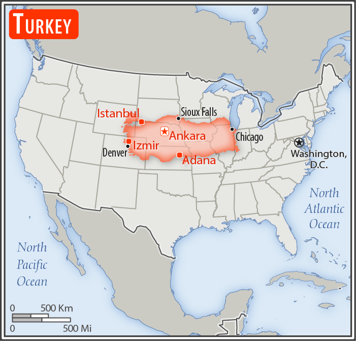
slightly larger than Texas
Land boundaries:
total: 2,816 km
[see also: Land boundaries - total country ranks ]
border countries (8):
Armenia 311 km, Azerbaijan 17 km, Bulgaria 223 km, Georgia 273 km, Greece 192 km, Iran 534 km, Iraq 367 km, Syria 899 km
Coastline:
7,200 km
[see also: Coastline country ranks ]
Maritime claims:
territorial sea: 6
nm in the Aegean Sea
[see also: Maritime claims - territorial sea country ranks ]
exclusive economic zone:
in Black Sea only: to the maritime boundary agreed upon with the former USSR
12 nm in Black Sea and in Mediterranean Sea
Climate:
temperate; hot, dry summers with mild, wet winters; harsher in interior
More Climate Details
Terrain:
high central plateau (Anatolia); narrow coastal plain; several mountain ranges
Elevation:
mean elevation: 1,132 m
[see also: Elevation - mean elevation country ranks ]
lowest point:
Mediterranean Sea 0 m
highest point:
Mount Ararat 5,137 m
Natural resources:
coal, iron ore, copper, chromium, antimony, mercury, gold, barite, borate, celestite (strontium), emery, feldspar, limestone, magnesite, marble, perlite, pumice, pyrites (sulfur), clay, arable land, hydropower
Land use:
agricultural land: 49.7%
(2011 est.)
[see also: Land use - agricultural land country ranks ]
arable land: 26.7%
(2011 est.)
[see also: Land use - arable land country ranks ]
permanent crops: 4%
(2011 est.)
[see also: Land use - permanent crops country ranks ]
permanent pasture: 19%
(2011 est.)
[see also: Land use - permanent pasture country ranks ]
forest: 14.9%
(2011 est.)
[see also: Land use - forest country ranks ]
other: 35.4%
(2011 est.)
[see also: Land use country ranks ]
Irrigated land:
52,150 sq km
(2012)
[see also: Irrigated land country ranks ]
Population distribution:
the most densely populated area is found around the Bosporus in the northwest where 20% of the population lives in Istanbul; with the exception of Ankara, urban centers remain small and scattered throughout the interior of Anatolia; an overall pattern of peripheral development exists, particularly along the Aegean Sea coast in the west, and the Tigris and Euphrates River systems in the southeast
Natural hazards:
severe earthquakes, especially in northern Turkey, along an arc extending from the Sea of Marmara to Lake Van; landslides; flooding
volcanism: limited volcanic activity; its three historically active volcanoes; Ararat, Nemrut Dagi, and Tendurek Dagi have not erupted since the 19th century or earlier
Environment - current issues:
water pollution from dumping of chemicals and detergents; air pollution, particularly in urban areas; deforestation; land degradation; concern for oil spills from increasing Bosporus ship traffic; conservation of biodiversity
Environment - international agreements:
party to:
Air Pollution, Antarctic Treaty, Biodiversity, Climate Change, Desertification, Endangered Species, Hazardous Wastes, Ozone Layer Protection, Ship Pollution, Wetlands
signed, but not ratified:
Environmental Modification
Geography - note:
strategic location controlling the Turkish Straits (Bosporus, Sea of Marmara, Dardanelles) that link the Black and Aegean Seas; the 3% of Turkish territory north of the Straits lies in Europe and goes by the names of European Turkey, Eastern Thrace, or Turkish Thrace; the 97% of the country in Asia is referred to as Anatolia; Istanbul, which straddles the Bosporus, is the only metropolis in the world located on two continents; Mount Ararat, the legendary landing place of Noah's ark, is in the far eastern portion of the country
NOTE: 1) The information regarding Turkey on this page is re-published from the 2020 World Fact Book of the United States Central Intelligence Agency and other sources. No claims are made regarding the accuracy of Turkey Geography 2020 information contained here. All suggestions for corrections of any errors about Turkey Geography 2020 should be addressed to the CIA or the source cited on each page.
2) The rank that you see is the CIA reported rank, which may have the following issues:
a) They assign increasing rank number, alphabetically for countries with the same value of the ranked item, whereas we assign them the same rank.
b) The CIA sometimes assigns counterintuitive ranks. For example, it assigns unemployment rates in increasing order, whereas we rank them in decreasing order.
- Main Index
- 2020 Index
- Country Ranks
- Definitions
- Turkey Index 2020
- Turkey Main Index
- Introduction
- History
- Geography
- Climate
- Maps
- People
- Religion
- Government
- Gov. Leaders
- Flags
- Economy
- Energy
- Communications
- Transportation
- Airport Codes
- Military
- Terrorism
- Transnational Issues
- Photos
- Advertise Here
- Feedback

This page was last modified 27-Jan-20