


Location:
Middle East, bordering the Arabian Sea, Gulf of Aden, and Red Sea, between Oman and Saudi Arabia
Geographic coordinates:
15 00 N, 48 00 E
Map references:
Middle East
Area:
total: 527,968 sq km
[see also: Area - total country ranks ]
land: 527,968 sq km
[see also: Area - land country ranks ]
water: 0 sq km
note: includes Perim, Socotra, the former Yemen Arab Republic (YAR or North Yemen), and the former People's Democratic Republic of Yemen (PDRY or South Yemen)
country comparison to the world (CIA rank, may be based on non-current data):
51
Area - comparative:
almost four times the size of Alabama; slightly larger than twice the size of Wyoming
Area comparison map:
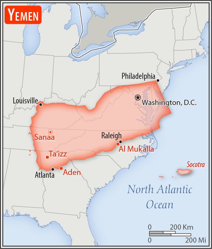
almost four times the size of Alabama; slightly larger than twice the size of Wyoming
Land boundaries:
total: 1,601 km
[see also: Land boundaries - total country ranks ]
border countries (2):
Oman 294 km, Saudi Arabia 1307 km
Coastline:
1,906 km
[see also: Coastline country ranks ]
Maritime claims:
territorial sea: 12
nm
[see also: Maritime claims - territorial sea country ranks ]
exclusive economic zone: 200
nm
[see also: Maritime claims - exclusive economic zone country ranks ]
contiguous zone: 24
nm
[see also: Maritime claims - contiguous zone country ranks ]
continental shelf: 200
nm or to the edge of the continental margin
[see also: Maritime claims - continental shelf country ranks ]
Climate:
mostly desert; hot and humid along west coast; temperate in western mountains affected by seasonal monsoon; extraordinarily hot, dry, harsh desert in east
Terrain:
narrow coastal plain backed by flat-topped hills and rugged mountains; dissected upland desert plains in center slope into the desert interior of the Arabian Peninsula
Elevation:
mean elevation: 999 m
[see also: Elevation - mean elevation country ranks ]
lowest point:
Arabian Sea 0 m
highest point:
Jabal an Nabi Shu'ayb 3,666 m
Natural resources:
petroleum, fish, rock salt, marble; small deposits of coal, gold, lead, nickel, and copper; fertile soil in west
Land use:
agricultural land: 44.5%
(2011 est.)
[see also: Land use - agricultural land country ranks ]
arable land: 2.2%
(2011 est.)
[see also: Land use - arable land country ranks ]
permanent crops: 0.6%
(2011 est.)
[see also: Land use - permanent crops country ranks ]
permanent pasture: 41.7%
(2011 est.)
[see also: Land use - permanent pasture country ranks ]
forest: 1%
(2011 est.)
[see also: Land use - forest country ranks ]
other: 54.5%
(2011 est.)
[see also: Land use country ranks ]
Irrigated land:
6,800 sq km
(2012)
[see also: Irrigated land country ranks ]
Population distribution:
the vast majority of the population is found in the Asir Mountains (part of the larger Sarawat Mountain system), located in the far western region of the country
Natural hazards:
sandstorms and dust storms in summer
volcanism: limited volcanic activity; Jebel at Tair (Jabal al-Tair, Jebel Teir, Jabal al-Tayr, Jazirat at-Tair) (244 m), which forms an island in the Red Sea, erupted in 2007 after awakening from dormancy; other historically active volcanoes include Harra of Arhab, Harras of Dhamar, Harra es-Sawad, and Jebel Zubair, although many of these have not erupted in over a century
Environment - current issues:
limited natural freshwater resources; inadequate supplies of potable water; overgrazing; soil erosion; desertification
Environment - international agreements:
party to:
Biodiversity, Climate Change, Climate Change-Kyoto Protocol, Desertification, Endangered Species, Environmental Modification, Hazardous Wastes, Law of the Sea, Ozone Layer Protection
signed, but not ratified:
none of the selected agreements
Geography - note:
strategic location on Bab el Mandeb, the strait linking the Red Sea and the Gulf of Aden, one of world's most active shipping lanes
NOTE: 1) The information regarding Yemen on this page is re-published from the 2020 World Fact Book of the United States Central Intelligence Agency and other sources. No claims are made regarding the accuracy of Yemen Geography 2020 information contained here. All suggestions for corrections of any errors about Yemen Geography 2020 should be addressed to the CIA or the source cited on each page.
2) The rank that you see is the CIA reported rank, which may have the following issues:
a) They assign increasing rank number, alphabetically for countries with the same value of the ranked item, whereas we assign them the same rank.
b) The CIA sometimes assigns counterintuitive ranks. For example, it assigns unemployment rates in increasing order, whereas we rank them in decreasing order.
- Main Index
- 2020 Index
- Country Ranks
- Definitions
- Yemen Index 2020
- Yemen Main Index
- Introduction
- History
- Geography
- Maps
- People
- Religion
- Government
- Gov. Leaders
- Flags
- Economy
- Energy
- Communications
- Transportation
- Airport Codes
- Military
- Terrorism
- Transnational Issues
- Photos
- Advertise Here
- Feedback

This page was last modified 27-Jan-20