heavy pollution in lagoon of south Tarawa atoll due to overcrowding mixed with traditional practices such as lagoon latrines and open-pit dumping; ground water at risk; potential for water shortages, disease; coastal erosion
party to: Biodiversity, Climate Change, Climate Change-Kyoto Protocol, Climate Change-Paris Agreement, Comprehensive Nuclear Test Ban, Desertification, Hazardous Wastes, Law of the Sea, Marine Dumping-London Convention, Ozone Layer Protection, Ship Pollution, Wetlands, Whaling
signed, but not ratified: none of the selected agreements
tropical; marine, hot and humid, moderated by trade winds
agricultural land: 42% (2018 est.)
arable land: 2.5% (2018 est.)
permanent crops: 39.5% (2018 est.)
permanent pasture: 0% (2018 est.)
forest: 15% (2018 est.)
other: 43% (2018 est.)
urban population: 57.8% of total population (2023)
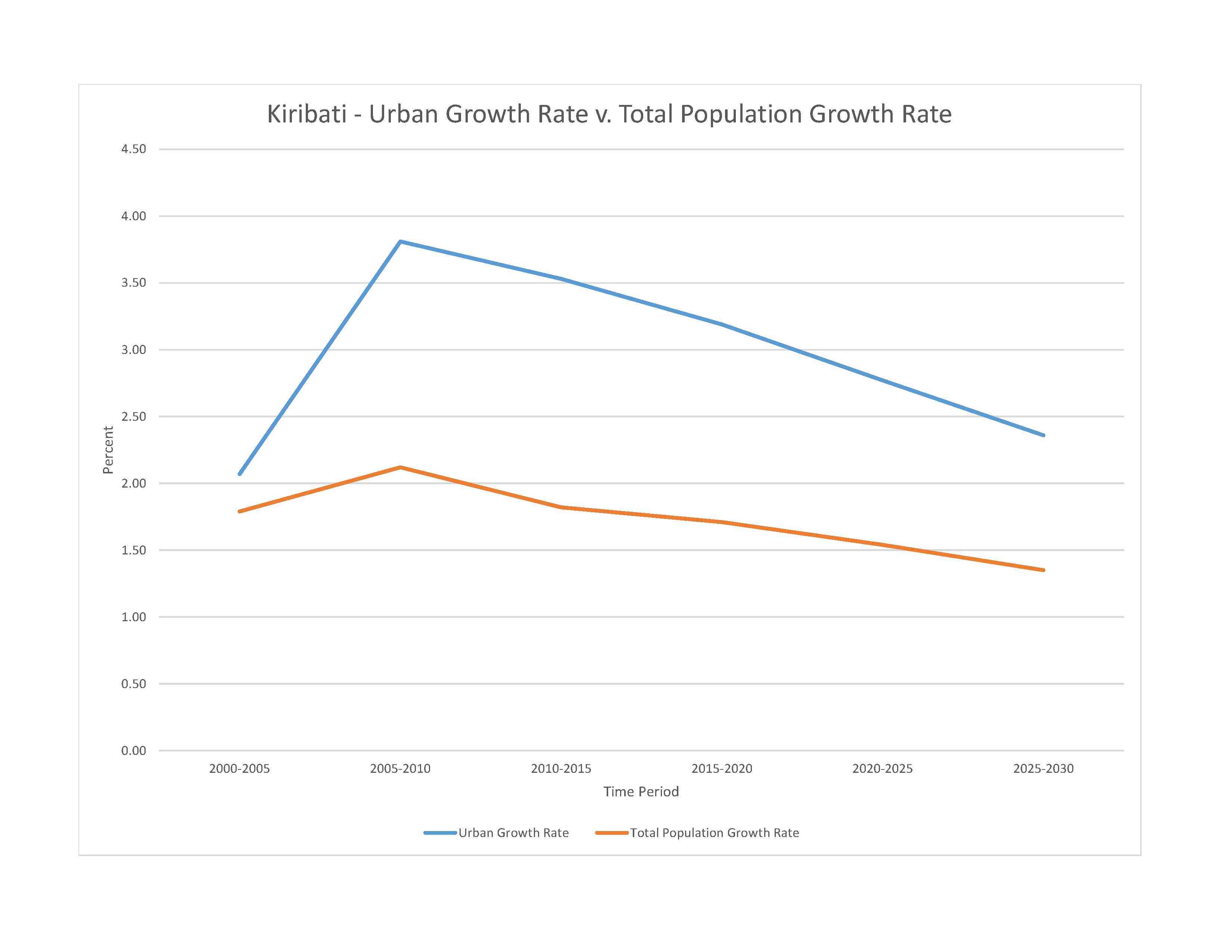
rate of urbanization: 2.77% annual rate of change (2020-25 est.)

0.04% of GDP (2018 est.)
0% of GDP (2018 est.)
particulate matter emissions: 7.62 micrograms per cubic meter (2019 est.)
carbon dioxide emissions: 0.07 megatons (2016 est.)
methane emissions: 0.02 megatons (2020 est.)
municipal solid waste generated annually: 35,724 tons (2016 est.)
0 cubic meters (2017 est.)
NOTE: The information regarding Kiribati on this page is re-published from the 2024 World Fact Book of the United States Central Intelligence Agency and other sources. No claims are made regarding the accuracy of Kiribati 2024 information contained here. All suggestions for corrections of any errors about Kiribati 2024 should be addressed to the CIA or the source cited on each page.
This page was last modified 04 May 24, Copyright © 2024 ITA all rights reserved.