Central Africa, islands in the Gulf of Guinea, just north of the Equator, west of Gabon
1 00 N, 7 00 E
Africa
total: 964 sq km
land: 964 sq km
water: 0 sq km
more than five times the size of Washington, DC
total: 0 km
209 km
territorial sea: 12 nm
exclusive economic zone: 200 nm
measured from claimed archipelagic baselines
tropical; hot, humid; one rainy season (October to May)
volcanic, mountainous
highest point: Pico de Sao Tome 2,024 m
lowest point: Atlantic Ocean 0 m
fish, hydropower
agricultural land: 50.7% (2018 est.)
arable land: 9.1% (2018 est.)
permanent crops: 40.6% (2018 est.)
permanent pasture: 1% (2018 est.)
forest: 28.1% (2018 est.)
other: 21.2% (2018 est.)
100 sq km (2012)
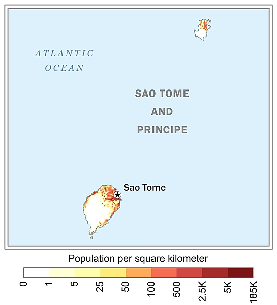
Sao Tome, the capital city, has roughly a quarter of the nation's population; Santo Antonio is the largest town on Principe; the northern areas of both islands have the highest population densities as shown in this 
flooding
the second-smallest African country (after the Seychelles); the two main islands form part of a chain of extinct volcanoes and both are mountainous
NOTE: The information regarding Sao Tome and Principe on this page is re-published from the 2024 World Fact Book of the United States Central Intelligence Agency and other sources. No claims are made regarding the accuracy of Sao Tome and Principe 2024 information contained here. All suggestions for corrections of any errors about Sao Tome and Principe 2024 should be addressed to the CIA or the source cited on each page.
This page was last modified 04 May 24, Copyright © 2024 ITA all rights reserved.