Central Africa, northeast of Angola
0 00 N, 25 00 E
Africa
total: 2,344,858 sq km
land: 2,267,048 sq km
water: 77,810 sq km
slightly less than one-fourth the size of the US
total: 11,027 km
border countries (9): Angola 2,646 km (of which 225 km is the boundary of Angola's discontiguous Cabinda Province); Burundi 236 km; Central African Republic 1,747 km; Republic of the Congo 1,775 km; Rwanda 221 km; South Sudan 714 km; Tanzania 479 km; Uganda 877 km; Zambia 2,332 km
37 km
territorial sea: 12 nm
exclusive economic zone: since 2011, the DRC has had a Common Interest Zone agreement with Angola for the mutual development of off-shore resources
tropical; hot and humid in equatorial river basin; cooler and drier in southern highlands; cooler and wetter in eastern highlands; north of Equator - wet season (April to October), dry season (December to February); south of Equator - wet season (November to March), dry season (April to October)
vast central basin is a low-lying plateau; mountains in east
highest point: Pic Marguerite on Mont Ngaliema (Mount Stanley) 5,110 m
lowest point: Atlantic Ocean 0 m
mean elevation: 726 m
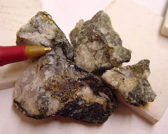
cobalt, copper, niobium, tantalum, petroleum, industrial and gem diamonds, gold, silver, zinc, manganese, tin, uranium, coal, hydropower, timber
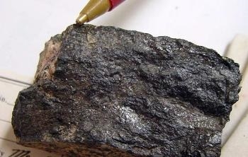
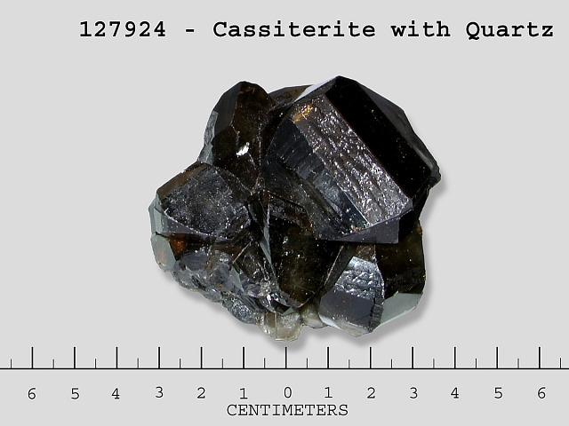
note 1: coltan, the industrial name for a columbite–tantalite mineral from which niobium and tantalum are extracted, is being linked to warfare in the Democratic Republic of the Congo; mining of coltan is mainly artisanal and small-scale and vulnerable to extortion and human trafficking; fighting over cassiterite deposits, a tin ore, is also a major cause of conflict in eastern parts of the Democratic Republic of the Congo; tantalum, tin, tungsten, and gold extracted from central Africa are considered "conflict minerals" and as such are subject to international monitoring
note 2: the DROC is the World's leading producer of cobalt, accounting for as much as 70% of the World's supply; between 20-30% of this cobalt is produced in artisanal and small-scale mining operations which are vulnerable to extortion, human trafficking, and exploitative working conditions including child labor
Columbite-Tantalite:  Cobaltite:
  Cassiterite:
agricultural land: 11.4% (2018 est.)
arable land: 3.1% (2018 est.)
permanent crops: 0.3% (2018 est.)
permanent pasture: 8% (2018 est.)
forest: 67.9% (2018 est.)
other: 20.7% (2018 est.)
110 sq km (2012)
fresh water lake(s): Lake Tanganyika (shared with Burundi, Tanzania, and Zambia) - 32,000 sq km; Lake Albert (shared with Uganda) - 5,590 sq km; Lake Mweru (shared with Zambia) - 4,350 sq km; Lac Mai-Ndombe - 2,300 sq km; Lake Kivu (shared with Rwanda) - 2,220 sq km; Lake Edward (shared with Uganda) - 2,150 sq km; Lac Tumba - 500 sq km; Lac Upemba - 530 sq km
Zaïre (Congo) river mouth (shared with Zambia [s], Angola, and Republic of Congo) - 4,700 km; Ubangi river mouth (shared with Central African Republic [s] and Republic of Congo) - 2,270 km note – [s] after country name indicates river source; [m] after country name indicates river mouth
Atlantic Ocean drainage: Congo (3,730,881 sq km), (Mediterranean Sea) Nile (3,254,853 sq km)
Indian Ocean drainage: Zambezi (1,332,412 sq km)
Congo Basin
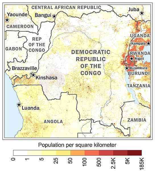
urban clusters are spread throughout the country, particularly in the northeast along the border with Uganda, Rwanda, and Burundi; the largest city is the capital, Kinshasha, located in the west along the Congo River; the south is least densely populated as shown in this 
periodic droughts in south; Congo River floods (seasonal); active volcanoes in the east along the Great Rift Valley
volcanism: Nyiragongo (3,470 m), which erupted in 2002 and is experiencing ongoing activity, poses a major threat to the city of Goma, home to a quarter million people; the volcano produces unusually fast-moving lava, known to travel up to 100 km /hr; Nyiragongo has been deemed a Decade Volcano by the International Association of Volcanology and Chemistry of the Earth's Interior, worthy of study due to its explosive history and close proximity to human populations; its neighbor, Nyamuragira, which erupted in 2010, is Africa's most active volcano; Visoke is the only other historically active volcano
note 1: second largest country in Africa (after Algeria) and largest country in Sub-Saharan Africa; straddles the equator; dense tropical rain forest in central river basin and eastern highlands; the narrow strip of land that controls the lower Congo River is the DRC's only outlet to the South Atlantic Ocean
note 2: because of its speed, cataracts, rapids, and turbulence the Congo River, most of which flows through the DRC, has never been accurately measured along much of its length; nonetheless, it is conceded to be the deepest river in the world; estimates of its greatest depth vary between 220 and 250 meters
NOTE: The information regarding Congo Democratic Republic of The on this page is re-published from the 2024 World Fact Book of the United States Central Intelligence Agency and other sources. No claims are made regarding the accuracy of Congo Democratic Republic of The 2024 information contained here. All suggestions for corrections of any errors about Congo Democratic Republic of The 2024 should be addressed to the CIA or the source cited on each page.
This page was last modified 04 May 24, Copyright © 2024 ITA all rights reserved.