


Location:
Southern Africa, bordering the South Atlantic Ocean, between Namibia and Democratic Republic of the Congo
Geographic coordinates:
12 30 S, 18 30 E
Map references:
Africa
Area:
total: 1,246,700 sq km
[see also: Area - total country ranks ]
land: 1,246,700 sq km
[see also: Area - land country ranks ]
water: 0 sq km
[see also: Area - water country ranks ]
country comparison to the world (CIA rank, may be based on non-current data):
24
Area - comparative:
about eight times the size of Georgia; slightly less than twice the size of Texas
Area comparison map:
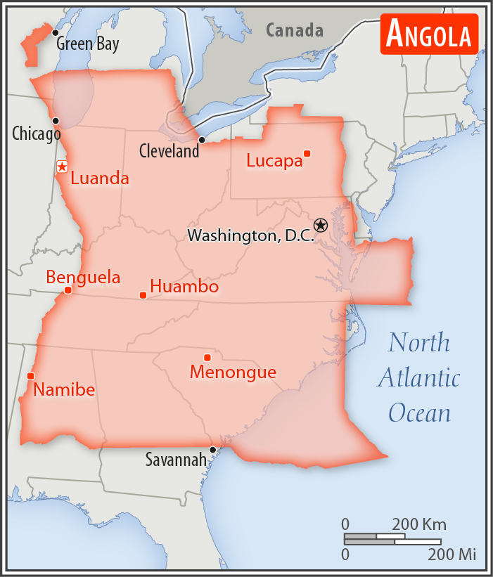
about eight times the size of Georgia; slightly less than twice the size of Texas
Land boundaries:
total: 5,369 km
[see also: Land boundaries - total country ranks ]
border countries (4):
Democratic Republic of the Congo 2646 km (of which 225 km is the boundary of discontiguous Cabinda Province), Republic of the Congo 231 km, Namibia 1427 km, Zambia 1065 km
Coastline:
1,600 km
[see also: Coastline country ranks ]
Maritime claims:
territorial sea: 12
nm
[see also: Maritime claims - territorial sea country ranks ]
exclusive economic zone: 200
nm
[see also: Maritime claims - exclusive economic zone country ranks ]
contiguous zone: 24
nm
[see also: Maritime claims - contiguous zone country ranks ]
Climate:
semiarid in south and along coast to Luanda; north has cool, dry season (May to October) and hot, rainy season (November to April)
More Climate Details
Terrain:
narrow coastal plain rises abruptly to vast interior plateau
Elevation:
mean elevation: 1,112 m
[see also: Elevation - mean elevation country ranks ]
lowest point:
Atlantic Ocean 0 m
highest point:
Moca 2,620 m
Natural resources:
petroleum, diamonds, iron ore, phosphates, copper, feldspar, gold, bauxite, uranium
Land use:
agricultural land: 47.5%
(2016 est.)
[see also: Land use - agricultural land country ranks ]
arable land: 3.9%
(2016 est.)
[see also: Land use - arable land country ranks ]
permanent crops: 0.3%
(2016 est.)
[see also: Land use - permanent crops country ranks ]
permanent pasture: 43.3%
(2016 est.)
[see also: Land use - permanent pasture country ranks ]
forest: 46.3%
(2016 est.)
[see also: Land use - forest country ranks ]
other: 6.2%
(2016 est.)
[see also: Land use country ranks ]
Irrigated land:
860 sq km
(2014)
[see also: Irrigated land country ranks ]
Population distribution:
most people live in the western half of the country; urban areas account for the highest concentrations of people, particularly the capital of Luanda
Natural hazards:
locally heavy rainfall causes periodic flooding on the plateau
Environment - current issues:
overuse of pastures and subsequent soil erosion attributable to population pressures; desertification; deforestation of tropical rain forest, in response to both international demand for tropical timber and to domestic use as fuel, resulting in loss of biodiversity; soil erosion contributing to water pollution and siltation of rivers and dams; inadequate supplies of potable water
Environment - international agreements:
party to:
Biodiversity, Climate Change, Climate Change-Kyoto Protocol, Desertification, Hazardous Wastes, Law of the Sea, Marine Dumping, Ozone Layer Protection, Ship Pollution
signed, but not ratified:
none of the selected agreements
Geography - note:
the province of Cabinda is an exclave, separated from the rest of the country by the Democratic Republic of the Congo
NOTE: 1) The information regarding Angola on this page is re-published from the 2020 World Fact Book of the United States Central Intelligence Agency and other sources. No claims are made regarding the accuracy of Angola Geography 2020 information contained here. All suggestions for corrections of any errors about Angola Geography 2020 should be addressed to the CIA or the source cited on each page.
2) The rank that you see is the CIA reported rank, which may have the following issues:
a) They assign increasing rank number, alphabetically for countries with the same value of the ranked item, whereas we assign them the same rank.
b) The CIA sometimes assigns counterintuitive ranks. For example, it assigns unemployment rates in increasing order, whereas we rank them in decreasing order.
- Main Index
- 2020 Index
- Country Ranks
- Definitions
- Angola Index 2020
- Angola Main Index
- Introduction
- History
- Geography
- Climate
- Maps
- People
- Religion
- Government
- Gov. Leaders
- Flags
- Economy
- Energy
- Communications
- Transportation
- Airport Codes
- Military
- Transnational Issues
- Photos
- Advertise Here
- Feedback

This page was last modified 27-Jan-20