


Location:
Southwestern Asia, bordering the Caspian Sea, between Iran and Russia, with a small European portion north of the Caucasus range
Geographic coordinates:
40 30 N, 47 30 E
Map references:
Asia
Area:
total: 86,600 sq km
[see also: Area - total country ranks ]
land: 82,629 sq km
[see also: Area - land country ranks ]
water: 3,971 sq km
note: includes the exclave of Naxcivan Autonomous Republic and the Nagorno-Karabakh region; the region's autonomy was abolished by Azerbaijani Supreme Soviet on 26 November 1991
country comparison to the world (CIA rank, may be based on non-current data):
114
Area - comparative:
about three-quarters the size of Pennsylvania; slightly smaller than Maine
Area comparison map:
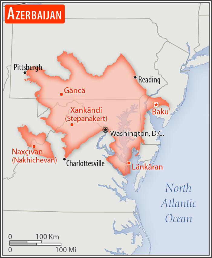
about three-quarters the size of Pennsylvania; slightly smaller than Maine
Land boundaries:
total: 2,468 km
[see also: Land boundaries - total country ranks ]
border countries (5):
Armenia 996 km, Georgia 428 km, Iran 689 km, Russia 338 km, Turkey 17 km
Coastline:
0 km
(landlocked); note - Azerbaijan borders the Caspian Sea (713 km)
[see also: Coastline country ranks ]
Maritime claims:
none (landlocked)
Climate:
dry, semiarid steppe
More Climate Details
Terrain:
large, flat Kur-Araz Ovaligi (Kura-Araks Lowland, much of it below sea level) with Great Caucasus Mountains to the north, Qarabag Yaylasi (Karabakh Upland) to the west; Baku lies on Abseron Yasaqligi (Apsheron Peninsula) that juts into Caspian Sea
Elevation:
mean elevation: 384 m
[see also: Elevation - mean elevation country ranks ]
lowest point:
Caspian Sea -28 m
highest point:
Bazarduzu Dagi 4,466 m
Natural resources:
petroleum, natural gas, iron ore, nonferrous metals, bauxite
Land use:
agricultural land: 57.6%
(2016 est.)
[see also: Land use - agricultural land country ranks ]
arable land: 22.8%
(2016 est.)
[see also: Land use - arable land country ranks ]
permanent crops: 2.7%
(2016 est.)
[see also: Land use - permanent crops country ranks ]
permanent pasture: 32.1%
(2016 est.)
[see also: Land use - permanent pasture country ranks ]
forest: 11.3%
(2016 est.)
[see also: Land use - forest country ranks ]
other: 31.1%
(2016 est.)
[see also: Land use country ranks ]
Irrigated land:
14,277 sq km
(2012)
[see also: Irrigated land country ranks ]
Population distribution:
highest population density is found in the far eastern area of the county, in and around Baku; apart from smaller urbanized areas, the rest of the country has a fairly light and evenly distributed population
Natural hazards:
droughts
Environment - current issues:
local scientists consider the Abseron Yasaqligi (Apsheron Peninsula) (including Baku and Sumqayit) and the Caspian Sea to be the ecologically most devastated area in the world because of severe air, soil, and water pollution; soil pollution results from oil spills, from the use of DDT pesticide, and from toxic defoliants used in the production of cotton; surface and underground water are polluted by untreated municipal and industrial wastewater and agricultural run-off
Environment - international agreements:
party to:
Air Pollution, Biodiversity, Climate Change, Climate Change-Kyoto Protocol, Desertification, Endangered Species, Hazardous Wastes, Marine Dumping, Ozone Layer Protection, Ship Pollution, Wetlands
signed, but not ratified:
none of the selected agreements
Geography - note:
both the main area of the country and the Naxcivan exclave are landlocked
NOTE: 1) The information regarding Azerbaijan on this page is re-published from the 2020 World Fact Book of the United States Central Intelligence Agency and other sources. No claims are made regarding the accuracy of Azerbaijan Geography 2020 information contained here. All suggestions for corrections of any errors about Azerbaijan Geography 2020 should be addressed to the CIA or the source cited on each page.
2) The rank that you see is the CIA reported rank, which may have the following issues:
a) They assign increasing rank number, alphabetically for countries with the same value of the ranked item, whereas we assign them the same rank.
b) The CIA sometimes assigns counterintuitive ranks. For example, it assigns unemployment rates in increasing order, whereas we rank them in decreasing order.
- Main Index
- 2020 Index
- Country Ranks
- Definitions
- Azerbaijan Index 2020
- Azerbaijan Main Index
- Introduction
- History
- Geography
- Climate
- Maps
- People
- Religion
- Government
- Gov. Leaders
- Flags
- Economy
- Energy
- Communications
- Transportation
- Airport Codes
- Military
- Transnational Issues
- Photos
- Advertise Here
- Feedback

This page was last modified 27-Jan-20