


Location:
Western Europe, bordering the North Sea, between France and the Netherlands
Geographic coordinates:
50 50 N, 4 00 E
Map references:
Europe
Area:
total: 30,528 sq km
[see also: Area - total country ranks ]
land: 30,278 sq km
[see also: Area - land country ranks ]
water: 250 sq km
[see also: Area - water country ranks ]
country comparison to the world (CIA rank, may be based on non-current data):
141
Area - comparative:
about the size of Maryland
Area comparison map:
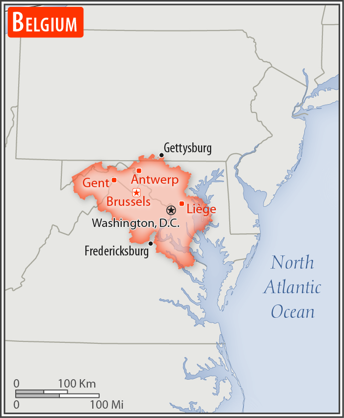
about the size of Maryland
Land boundaries:
total: 1,297 km
[see also: Land boundaries - total country ranks ]
border countries (4):
France 556 km, Germany 133 km, Luxembourg 130 km, Netherlands 478 km
Coastline:
66.5 km
[see also: Coastline country ranks ]
Maritime claims:
territorial sea: 12
nm
[see also: Maritime claims - territorial sea country ranks ]
exclusive economic zone:
geographic coordinates define outer limit
[see also: Maritime claims - exclusive economic zone country ranks ]
contiguous zone: 24
nm
[see also: Maritime claims - contiguous zone country ranks ]
continental shelf:
median line with neighbors
[see also: Maritime claims - continental shelf country ranks ]
Climate:
temperate; mild winters, cool summers; rainy, humid, cloudy
More Climate Details
Terrain:
flat coastal plains in northwest, central rolling hills, rugged mountains of Ardennes Forest in southeast
Elevation:
mean elevation: 181 m
[see also: Elevation - mean elevation country ranks ]
lowest point:
North Sea 0 m
highest point:
Botrange 694 m
Natural resources:
construction materials, silica sand, carbonates, arable land
Land use:
agricultural land: 44.1%
(2011 est.)
[see also: Land use - agricultural land country ranks ]
arable land: 27.2%
(2011 est.)
[see also: Land use - arable land country ranks ]
permanent crops: 0.8%
(2011 est.)
[see also: Land use - permanent crops country ranks ]
permanent pasture: 16.1%
(2011 est.)
[see also: Land use - permanent pasture country ranks ]
forest: 22.4%
(2011 est.)
[see also: Land use - forest country ranks ]
other: 33.5%
(2011 est.)
[see also: Land use country ranks ]
Irrigated land:
230 sq km
(2012)
[see also: Irrigated land country ranks ]
Population distribution:
most of the population concentrated in the northern two-thirds of the country; the southeast is more thinly populated; considered to have one of the highest population densities in the world; approximately 97% live in urban areas
Natural hazards:
flooding is a threat along rivers and in areas of reclaimed coastal land, protected from the sea by concrete dikes
Environment - current issues:
intense pressures from human activities: urbanization, dense transportation network, industry, extensive animal breeding and crop cultivation; air and water pollution also have repercussions for neighboring countries
Environment - international agreements:
party to:
Air Pollution, Air Pollution-Nitrogen Oxides, Air Pollution-Persistent Organic Pollutants, Air Pollution-Sulfur 85, Air Pollution-Sulfur 94, Air Pollution-Volatile Organic Compounds, Antarctic-Environmental Protocol, Antarctic-Marine Living Resources, Antarctic Seals, Antarctic Treaty, Biodiversity, Climate Change, Climate Change-Kyoto Protocol, Desertification, Endangered Species, Environmental Modification, Hazardous Wastes, Law of the Sea, Marine Dumping, Marine Life Conservation, Ozone Layer Protection, Ship Pollution, Tropical Timber 83, Tropical Timber 94, Wetlands, Whaling
signed, but not ratified:
none of the selected agreements
Geography - note:
crossroads of Western Europe; most West European capitals are within 1,000 km of Brussels, the seat of both the European Union and NATO
NOTE: 1) The information regarding Belgium on this page is re-published from the 2020 World Fact Book of the United States Central Intelligence Agency and other sources. No claims are made regarding the accuracy of Belgium Geography 2020 information contained here. All suggestions for corrections of any errors about Belgium Geography 2020 should be addressed to the CIA or the source cited on each page.
2) The rank that you see is the CIA reported rank, which may have the following issues:
a) They assign increasing rank number, alphabetically for countries with the same value of the ranked item, whereas we assign them the same rank.
b) The CIA sometimes assigns counterintuitive ranks. For example, it assigns unemployment rates in increasing order, whereas we rank them in decreasing order.
- Main Index
- 2020 Index
- Country Ranks
- Definitions
- Belgium Index 2020
- Belgium Main Index
- Introduction
- History
- Geography
- Climate
- Maps
- People
- Religion
- Government
- Gov. Leaders
- Flags
- Economy
- Energy
- Communications
- Transportation
- Airport Codes
- Military
- Transnational Issues
- Photos
- Advertise Here
- Feedback

This page was last modified 27-Jan-20