


Location:
Southern Africa, north of South Africa
Geographic coordinates:
22 00 S, 24 00 E
Map references:
Africa
Area:
total: 581,730 sq km
[see also: Area - total country ranks ]
land: 566,730 sq km
[see also: Area - land country ranks ]
water: 15,000 sq km
[see also: Area - water country ranks ]
country comparison to the world (CIA rank, may be based on non-current data):
49
Area - comparative:
slightly smaller than Texas; almost four times the size of Illinois
Area comparison map:
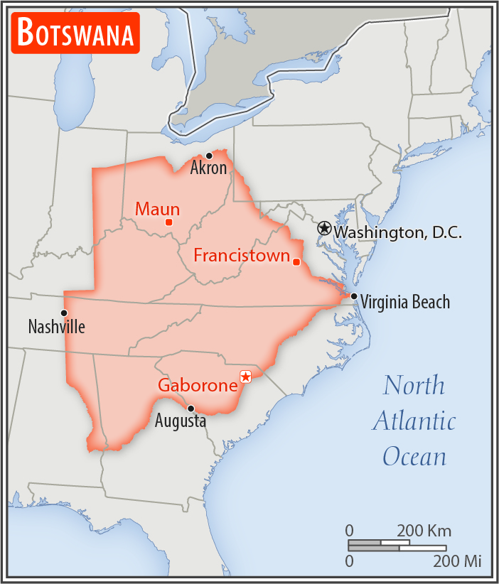
slightly smaller than Texas; almost four times the size of Illinois
Land boundaries:
total: 4,347.15 km
[see also: Land boundaries - total country ranks ]
border countries (4):
Namibia 1544 km, South Africa 1969 km, Zambia 0.15 km, Zimbabwe 834 km
Coastline:
0 km
(landlocked)
[see also: Coastline country ranks ]
Maritime claims:
none (landlocked)
Climate:
semiarid; warm winters and hot summers
More Climate Details
Terrain:
predominantly flat to gently rolling tableland; Kalahari Desert in southwest
Elevation:
mean elevation: 1,013 m
[see also: Elevation - mean elevation country ranks ]
lowest point:
junction of the Limpopo and Shashe Rivers 513 m
highest point:
Tsodilo Hills 1,489 m
Natural resources:
diamonds, copper, nickel, salt, soda ash, potash, coal, iron ore, silver
Land use:
agricultural land: 45.8%
(2011 est.)
[see also: Land use - agricultural land country ranks ]
arable land: 0.6%
(2011 est.)
[see also: Land use - arable land country ranks ]
permanent crops: 0%
(2011 est.)
[see also: Land use - permanent crops country ranks ]
permanent pasture: 45.2%
(2011 est.)
[see also: Land use - permanent pasture country ranks ]
forest: 19.8%
(2011 est.)
[see also: Land use - forest country ranks ]
other: 34.4%
(2011 est.)
[see also: Land use country ranks ]
Irrigated land:
20 sq km
(2012)
[see also: Irrigated land country ranks ]
Population distribution:
the population is primarily concentrated in the east with a focus in and around the captial of Gaborone, and the far central-eastern city of Francistown; population density remains low in other areas in the country, especially in the Kalahari to the west
Natural hazards:
periodic droughts; seasonal August winds blow from the west, carrying sand and dust across the country, which can obscure visibility
Environment - current issues:
overgrazing; desertification; limited freshwater resources; air pollution
Environment - international agreements:
party to:
Biodiversity, Climate Change, Climate Change-Kyoto Protocol, Desertification, Endangered Species, Hazardous Wastes, Law of the Sea, Ozone Layer Protection, Wetlands
signed, but not ratified:
none of the selected agreements
Geography - note:
landlocked; population concentrated in the southern and eastern parts of the country
NOTE: 1) The information regarding Botswana on this page is re-published from the 2020 World Fact Book of the United States Central Intelligence Agency and other sources. No claims are made regarding the accuracy of Botswana Geography 2020 information contained here. All suggestions for corrections of any errors about Botswana Geography 2020 should be addressed to the CIA or the source cited on each page.
2) The rank that you see is the CIA reported rank, which may have the following issues:
a) They assign increasing rank number, alphabetically for countries with the same value of the ranked item, whereas we assign them the same rank.
b) The CIA sometimes assigns counterintuitive ranks. For example, it assigns unemployment rates in increasing order, whereas we rank them in decreasing order.
- Main Index
- 2020 Index
- Country Ranks
- Definitions
- Botswana Index 2020
- Botswana Main Index
- Introduction
- History
- Geography
- Climate
- Maps
- People
- Religion
- Government
- Gov. Leaders
- Flags
- Economy
- Energy
- Communications
- Transportation
- Airport Codes
- Military
- Transnational Issues
- Photos
- Advertise Here
- Feedback

This page was last modified 27-Jan-20