


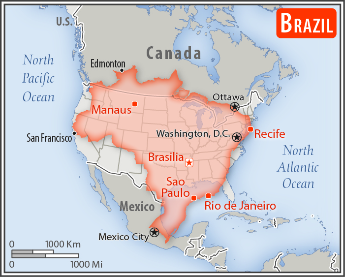
Location:
Eastern South America, bordering the Atlantic Ocean
Geographic coordinates:
10 00 S, 55 00 W
Map references:
South America
Area:
total: 8,515,770 sq km
[see also: Area - total country ranks ]
land: 8,358,140 sq km
[see also: Area - land country ranks ]
water: 157,630 sq km
note: includes Arquipelago de Fernando de Noronha, Atol das Rocas, Ilha da Trindade, Ilhas Martin Vaz, and Penedos de Sao Pedro e Sao Paulo
country comparison to the world (CIA rank, may be based on non-current data):
6
Area - comparative:
slightly smaller than the US
Area comparison map:
slightly smaller than the US
Land boundaries:
total: 16,145 km
[see also: Land boundaries - total country ranks ]
border countries (10):
Argentina 1263 km, Bolivia 3403 km, Colombia 1790 km, French Guiana 649 km, Guyana 1308 km, Paraguay 1371 km, Peru 2659 km, Suriname 515 km, Uruguay 1050 km, Venezuela 2137 km
Coastline:
7,491 km
[see also: Coastline country ranks ]
Maritime claims:
territorial sea: 12
nm
[see also: Maritime claims - territorial sea country ranks ]
exclusive economic zone: 200
nm
[see also: Maritime claims - exclusive economic zone country ranks ]
contiguous zone: 24
nm
[see also: Maritime claims - contiguous zone country ranks ]
continental shelf: 200
nm or to edge of the continental margin
[see also: Maritime claims - continental shelf country ranks ]
Climate:
mostly tropical, but temperate in south
More Climate Details
Terrain:
mostly flat to rolling lowlands in north; some plains, hills, mountains, and narrow coastal belt
Elevation:
mean elevation: 320 m
[see also: Elevation - mean elevation country ranks ]
lowest point:
Atlantic Ocean 0 m
highest point:
Pico da Neblina 2,994 m
Natural resources:
alumina, bauxite, beryllium, gold, iron ore, manganese, nickel, niobium, phosphates, platinum, tantalum, tin, rare earth elements, uranium, petroleum, hydropower, timber
Land use:
agricultural land: 32.9%
(2011 est.)
[see also: Land use - agricultural land country ranks ]
arable land: 8.6%
(2011 est.)
[see also: Land use - arable land country ranks ]
permanent crops: 0.8%
(2011 est.)
[see also: Land use - permanent crops country ranks ]
permanent pasture: 23.5%
(2011 est.)
[see also: Land use - permanent pasture country ranks ]
forest: 61.9%
(2011 est.)
[see also: Land use - forest country ranks ]
other: 5.2%
(2011 est.)
[see also: Land use country ranks ]
Irrigated land:
54,000 sq km
(2012)
[see also: Irrigated land country ranks ]
Population distribution:
the vast majority of people live along, or relatively near, the Atlantic coast in the east; the population core is in the southeast, anchored by the cities of Sao Paolo, Brasilia, and Rio de Janeiro
Natural hazards:
recurring droughts in northeast; floods and occasional frost in south
Environment - current issues:
deforestation in Amazon Basin destroys the habitat and endangers a multitude of plant and animal species indigenous to the area; illegal wildlife trade; illegal poaching; air and water pollution in Rio de Janeiro, Sao Paulo, and several other large cities; land degradation and water pollution caused by improper mining activities; wetland degradation; severe oil spills
Environment - international agreements:
party to:
Antarctic-Environmental Protocol, Antarctic-Marine Living Resources, Antarctic Seals, Antarctic Treaty, Biodiversity, Climate Change, Climate Change-Kyoto Protocol, Desertification, Endangered Species, Environmental Modification, Hazardous Wastes, Law of the Sea, Marine Dumping, Ozone Layer Protection, Ship Pollution, Tropical Timber 83, Tropical Timber 94, Wetlands, Whaling
signed, but not ratified:
none of the selected agreements
Geography - note:
largest country in South America and in the Southern Hemisphere; shares common boundaries with every South American country except Chile and Ecuador; most of the Pantanal, the world's largest tropical wetland, extends through the west central part of the country; shares Iguazu Falls, the world's largest waterfalls system, with Argentina
NOTE: 1) The information regarding Brazil on this page is re-published from the 2020 World Fact Book of the United States Central Intelligence Agency and other sources. No claims are made regarding the accuracy of Brazil Geography 2020 information contained here. All suggestions for corrections of any errors about Brazil Geography 2020 should be addressed to the CIA or the source cited on each page.
2) The rank that you see is the CIA reported rank, which may have the following issues:
a) They assign increasing rank number, alphabetically for countries with the same value of the ranked item, whereas we assign them the same rank.
b) The CIA sometimes assigns counterintuitive ranks. For example, it assigns unemployment rates in increasing order, whereas we rank them in decreasing order.
- Main Index
- 2020 Index
- Country Ranks
- Definitions
- Brazil Index 2020
- Brazil Main Index
- Introduction
- History
- Geography
- Climate
- Maps
- People
- Religion
- Government
- Gov. Leaders
- Flags
- Economy
- Energy
- Communications
- Transportation
- Airport Codes
- Military
- Transnational Issues
- Photos
- Advertise Here
- Feedback

This page was last modified 27-Jan-20