


Location:
Southeastern Asia, bordering the Andaman Sea and the Bay of Bengal, between Bangladesh and Thailand
Geographic coordinates:
22 00 N, 98 00 E
Map references:
Southeast Asia
Area:
total: 676,578 sq km
[see also: Area - total country ranks ]
land: 653,508 sq km
[see also: Area - land country ranks ]
water: 23,070 sq km
[see also: Area - water country ranks ]
country comparison to the world (CIA rank, may be based on non-current data):
41
Area - comparative:
slightly smaller than Texas
Area comparison map:
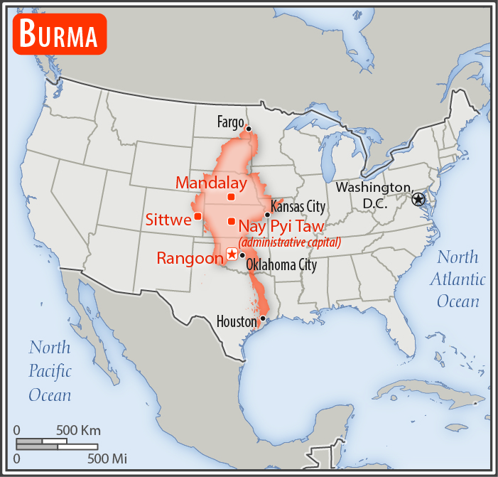
slightly smaller than Texas
Land boundaries:
total: 6,522 km
[see also: Land boundaries - total country ranks ]
border countries (5):
Bangladesh 271 km, China 2129 km, India 1468 km, Laos 238 km, Thailand 2416 km
Coastline:
1,930 km
[see also: Coastline country ranks ]
Maritime claims:
territorial sea: 12
nm
[see also: Maritime claims - territorial sea country ranks ]
exclusive economic zone: 200
nm
[see also: Maritime claims - exclusive economic zone country ranks ]
contiguous zone: 24
nm
[see also: Maritime claims - contiguous zone country ranks ]
continental shelf: 200
nm or to the edge of the continental margin
[see also: Maritime claims - continental shelf country ranks ]
Climate:
tropical monsoon; cloudy, rainy, hot, humid summers (southwest monsoon, June to September); less cloudy, scant rainfall, mild temperatures, lower humidity during winter (northeast monsoon, December to April)
More Climate Details
Terrain:
central lowlands ringed by steep, rugged highlands
Elevation:
mean elevation: 702 m
[see also: Elevation - mean elevation country ranks ]
lowest point:
Andaman Sea/Bay of Bengal 0 m
highest point:
Gamlang Razi 5,870 m
Natural resources:
petroleum, timber, tin, antimony, zinc, copper, tungsten, lead, coal, marble, limestone, precious stones, natural gas, hydropower, arable land
Land use:
agricultural land: 19.2%
(2011 est.)
[see also: Land use - agricultural land country ranks ]
arable land: 16.5%
(2011 est.)
[see also: Land use - arable land country ranks ]
permanent crops: 2.2%
(2011 est.)
[see also: Land use - permanent crops country ranks ]
permanent pasture: 0.5%
(2011 est.)
[see also: Land use - permanent pasture country ranks ]
forest: 48.2%
(2011 est.)
[see also: Land use - forest country ranks ]
other: 32.6%
(2011 est.)
[see also: Land use country ranks ]
Irrigated land:
22,950 sq km
(2012)
[see also: Irrigated land country ranks ]
Population distribution:
population concentrated along coastal areas and in general proximity to the shores of the Irrawaddy River; the extreme north is relatively underpopulated
Natural hazards:
destructive earthquakes and cyclones; flooding and landslides common during rainy season (June to September); periodic droughts
Environment - current issues:
deforestation; industrial pollution of air, soil, and water; inadequate sanitation and water treatment contribute to disease; rapid depletion of the country's natural resources
Environment - international agreements:
party to:
Biodiversity, Climate Change, Climate Change-Kyoto Protocol, Desertification, Endangered Species, Hazardous Wastes, Law of the Sea, Ozone Layer Protection, Ship Pollution, Tropical Timber 83, Tropical Timber 94
signed, but not ratified:
none of the selected agreements
Geography - note:
strategic location near major Indian Ocean shipping lanes; the north-south flowing Irrawaddy River is the country's largest and most important commercial waterway
NOTE: 1) The information regarding Burma on this page is re-published from the 2020 World Fact Book of the United States Central Intelligence Agency and other sources. No claims are made regarding the accuracy of Burma Geography 2020 information contained here. All suggestions for corrections of any errors about Burma Geography 2020 should be addressed to the CIA or the source cited on each page.
2) The rank that you see is the CIA reported rank, which may have the following issues:
a) They assign increasing rank number, alphabetically for countries with the same value of the ranked item, whereas we assign them the same rank.
b) The CIA sometimes assigns counterintuitive ranks. For example, it assigns unemployment rates in increasing order, whereas we rank them in decreasing order.
- Main Index
- 2020 Index
- Country Ranks
- Definitions
- Burma Index 2020
- Burma Main Index
- Introduction
- History
- Geography
- Climate
- Maps
- People
- Religion
- Government
- Gov. Leaders
- Flags
- Economy
- Energy
- Communications
- Transportation
- Airport Codes
- Military
- Transnational Issues
- Photos
- Advertise Here
- Feedback

This page was last modified 27-Jan-20