


Location:
Central Africa, north of Democratic Republic of the Congo
Geographic coordinates:
7 00 N, 21 00 E
Map references:
Africa
Area:
total: 622,984 sq km
[see also: Area - total country ranks ]
land: 622,984 sq km
[see also: Area - land country ranks ]
water: 0 sq km
[see also: Area - water country ranks ]
country comparison to the world (CIA rank, may be based on non-current data):
46
Area - comparative:
slightly smaller than Texas; about four times the size of Georgia
Area comparison map:
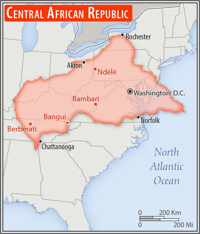
slightly smaller than Texas; about four times the size of Georgia
Land boundaries:
total: 5,920 km
[see also: Land boundaries - total country ranks ]
border countries (6):
Cameroon 901 km, Chad 1556 km, Democratic Republic of the Congo 1747 km, Republic of the Congo 487 km, South Sudan 1055 km, Sudan 174 km
Coastline:
0 km
(landlocked)
[see also: Coastline country ranks ]
Maritime claims:
none (landlocked)
Climate:
tropical; hot, dry winters; mild to hot, wet summers
Terrain:
vast, flat to rolling plateau; scattered hills in northeast and southwest
Elevation:
mean elevation: 635 m
[see also: Elevation - mean elevation country ranks ]
lowest point:
Oubangui River 335 m
highest point:
Mont Ngaoui 1,410 m
Natural resources:
diamonds, uranium, timber, gold, oil, hydropower
Land use:
agricultural land: 8.1%
(2011 est.)
[see also: Land use - agricultural land country ranks ]
arable land: 2.9%
(2011 est.)
[see also: Land use - arable land country ranks ]
permanent crops: 0.1%
(2011 est.)
[see also: Land use - permanent crops country ranks ]
permanent pasture: 5.1%
(2011 est.)
[see also: Land use - permanent pasture country ranks ]
forest: 36.2%
(2011 est.)
[see also: Land use - forest country ranks ]
other: 55.7%
(2011 est.)
[see also: Land use country ranks ]
Irrigated land:
10 sq km
(2012)
[see also: Irrigated land country ranks ]
Population distribution:
majority of residents live in the western and central areas of the country, especially in and around the capital of Bangui
Natural hazards:
hot, dry, dusty harmattan winds affect northern areas; floods are common
Environment - current issues:
water pollution; tap water is not potable; poaching and mismanagement have diminished the country's reputation as one of the last great wildlife refuges; desertification; deforestation; soil erosion
Environment - international agreements:
party to:
Biodiversity, Climate Change, Climate Change-Kyoto Protocol, Desertification, Endangered Species, Hazardous Wastes, Ozone Layer Protection, Tropical Timber 94, Wetlands
signed, but not ratified:
Law of the Sea
Geography - note:
landlocked; almost the precise center of Africa
NOTE: 1) The information regarding Central African Republic on this page is re-published from the 2020 World Fact Book of the United States Central Intelligence Agency and other sources. No claims are made regarding the accuracy of Central African Republic Geography 2020 information contained here. All suggestions for corrections of any errors about Central African Republic Geography 2020 should be addressed to the CIA or the source cited on each page.
2) The rank that you see is the CIA reported rank, which may have the following issues:
a) They assign increasing rank number, alphabetically for countries with the same value of the ranked item, whereas we assign them the same rank.
b) The CIA sometimes assigns counterintuitive ranks. For example, it assigns unemployment rates in increasing order, whereas we rank them in decreasing order.
- Main Index
- 2020 Index
- Country Ranks
- Definitions
- Central African Republic Index 2020
- Central African Republic Main Index
- Introduction
- Geography
- Maps
- People
- Religion
- Government
- Gov. Leaders
- Flags
- Economy
- Energy
- Communications
- Transportation
- Airport Codes
- Military
- Transnational Issues
- Photos
- Advertise Here
- Feedback

This page was last modified 27-Jan-20