


Location:
Central America, bordering the North Pacific Ocean, between Guatemala and Honduras
Geographic coordinates:
13 50 N, 88 55 W
Map references:
Central America and the Caribbean
Area:
total: 21,041 sq km
[see also: Area - total country ranks ]
land: 20,721 sq km
[see also: Area - land country ranks ]
water: 320 sq km
[see also: Area - water country ranks ]
country comparison to the world (CIA rank, may be based on non-current data):
154
Area - comparative:
about the same size as New Jersey
Area comparison map:
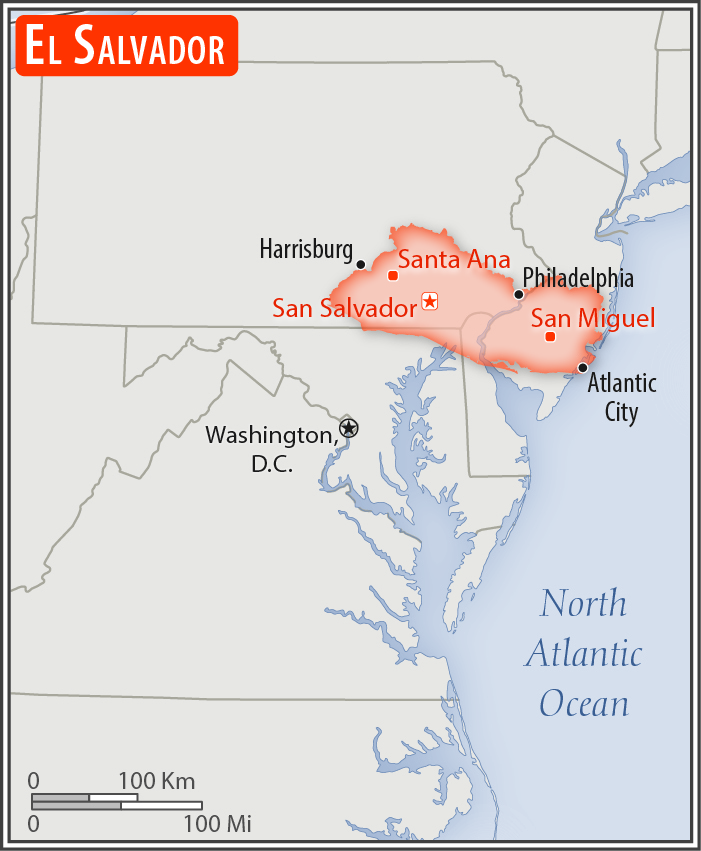
about the same size as New Jersey
Land boundaries:
total: 590 km
[see also: Land boundaries - total country ranks ]
border countries (2):
Guatemala 199 km, Honduras 391 km
Coastline:
307 km
[see also: Coastline country ranks ]
Maritime claims:
territorial sea: 12
nm
[see also: Maritime claims - territorial sea country ranks ]
exclusive economic zone: 200
nm
[see also: Maritime claims - exclusive economic zone country ranks ]
contiguous zone: 24
nm
[see also: Maritime claims - contiguous zone country ranks ]
Climate:
tropical; rainy season (May to October); dry season (November to April); tropical on coast; temperate in uplands
More Climate Details
Terrain:
mostly mountains with narrow coastal belt and central plateau
Elevation:
mean elevation: 442 m
[see also: Elevation - mean elevation country ranks ]
lowest point:
Pacific Ocean 0 m
highest point:
Cerro El Pital 2,730 m
Natural resources:
hydropower, geothermal power, petroleum, arable land
Land use:
agricultural land: 74.7%
(2011 est.)
[see also: Land use - agricultural land country ranks ]
arable land: 33.1%
(2011 est.)
[see also: Land use - arable land country ranks ]
permanent crops: 10.9%
(2011 est.)
[see also: Land use - permanent crops country ranks ]
permanent pasture: 30.7%
(2011 est.)
[see also: Land use - permanent pasture country ranks ]
forest: 13.6%
(2011 est.)
[see also: Land use - forest country ranks ]
other: 11.7%
(2011 est.)
[see also: Land use country ranks ]
Irrigated land:
452 sq km
(2012)
[see also: Irrigated land country ranks ]
Population distribution:
athough it is the smallest country in land area in Central America, El Salvador has a population that is 18 times larger than Belize; at least 20% of the population lives abroad; high population density country-wide, with particular concentration around the capital of San Salvador
Natural hazards:
known as the Land of Volcanoes; frequent and sometimes destructive earthquakes and volcanic activity; extremely susceptible to hurricanes
volcanism: significant volcanic activity; San Salvador (1,893 m), which last erupted in 1917, has the potential to cause major harm to the country's capital, which lies just below the volcano's slopes; San Miguel (2,130 m), which last erupted in 2002, is one of the most active volcanoes in the country; other historically active volcanoes include Conchaguita, Ilopango, Izalco, and Santa Ana
Environment - current issues:
deforestation; soil erosion; water pollution; contamination of soils from disposal of toxic wastes
Environment - international agreements:
party to:
Biodiversity, Climate Change, Climate Change-Kyoto Protocol, Desertification, Endangered Species, Hazardous Wastes, Ozone Layer Protection, Wetlands
signed, but not ratified:
Law of the Sea
Geography - note:
smallest Central American country and only one without a coastline on the Caribbean Sea
NOTE: 1) The information regarding El Salvador on this page is re-published from the 2020 World Fact Book of the United States Central Intelligence Agency and other sources. No claims are made regarding the accuracy of El Salvador Geography 2020 information contained here. All suggestions for corrections of any errors about El Salvador Geography 2020 should be addressed to the CIA or the source cited on each page.
2) The rank that you see is the CIA reported rank, which may have the following issues:
a) They assign increasing rank number, alphabetically for countries with the same value of the ranked item, whereas we assign them the same rank.
b) The CIA sometimes assigns counterintuitive ranks. For example, it assigns unemployment rates in increasing order, whereas we rank them in decreasing order.
- Main Index
- 2020 Index
- Country Ranks
- Definitions
- El Salvador Index 2020
- El Salvador Main Index
- Introduction
- History
- Geography
- Climate
- Maps
- People
- Religion
- Government
- Gov. Leaders
- Flags
- Economy
- Energy
- Communications
- Transportation
- Airport Codes
- Military
- Transnational Issues
- Photos
- Advertise Here
- Feedback

This page was last modified 27-Jan-20