


Location:
Eastern Africa, bordering the Red Sea, between Djibouti and Sudan
Geographic coordinates:
15 00 N, 39 00 E
Map references:
Africa
Area:
total: 117,600 sq km
[see also: Area - total country ranks ]
land: 101,000 sq km
[see also: Area - land country ranks ]
water: 16,600 sq km
[see also: Area - water country ranks ]
country comparison to the world (CIA rank, may be based on non-current data):
102
Area - comparative:
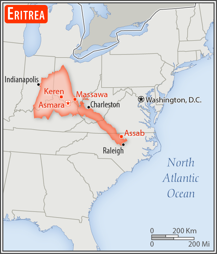
slightly smaller than Pennsylvania
Area comparison map:
slightly larger than Pennsylvania
Land boundaries:
total: 1,840 km
[see also: Land boundaries - total country ranks ]
border countries (3):
Djibouti 125 km, Ethiopia 1033 km, Sudan 682 km
Coastline:
2,234 km
(mainland on Red Sea 1,151 km, islands in Red Sea 1,083 km)
[see also: Coastline country ranks ]
Maritime claims:
territorial sea: 12
nm
[see also: Maritime claims - territorial sea country ranks ]
Climate:
hot, dry desert strip along Red Sea coast; cooler and wetter in the central highlands (up to 61 cm of rainfall annually, heaviest June to September); semiarid in western hills and lowlands
More Climate Details
Terrain:
dominated by extension of Ethiopian north-south trending highlands, descending on the east to a coastal desert plain, on the northwest to hilly terrain and on the southwest to flat-to-rolling plains
Elevation:
mean elevation: 853 m
[see also: Elevation - mean elevation country ranks ]
lowest point:
near Kulul within the Danakil Depression -75 m
highest point:
Soira 3,018 m
Natural resources:
gold, potash, zinc, copper, salt, possibly oil and natural gas, fish
Land use:
agricultural land: 75.1%
(2011 est.)
[see also: Land use - agricultural land country ranks ]
arable land: 6.8%
(2011 est.)
[see also: Land use - arable land country ranks ]
permanent crops: 0%
(2011 est.)
[see also: Land use - permanent crops country ranks ]
permanent pasture: 68.3%
(2011 est.)
[see also: Land use - permanent pasture country ranks ]
forest: 15.1%
(2011 est.)
[see also: Land use - forest country ranks ]
other: 9.8%
(2011 est.)
[see also: Land use country ranks ]
Irrigated land:
210 sq km
(2012)
[see also: Irrigated land country ranks ]
Population distribution:
density is highest in the center of the country in and around the cities of Asmara (capital) and Keren; smaller settlements exist in the north and south
Natural hazards:
frequent droughts, rare earthquakes and volcanoes; locust swarms
volcanism: Dubbi (1,625 m), which last erupted in 1861, was the country's only historically active volcano until Nabro (2,218 m) came to life on 12 June 2011
Environment - current issues:
deforestation; desertification; soil erosion; overgrazing
Environment - international agreements:
party to:
Biodiversity, Climate Change, Climate Change-Kyoto Protocol, Desertification, Endangered Species, Hazardous Wastes, Ozone Layer Protection
signed, but not ratified:
none of the selected agreements
Geography - note:
strategic geopolitical position along world's busiest shipping lanes; Eritrea retained the entire coastline of Ethiopia along the Red Sea upon de jure independence from Ethiopia on 24 May 1993
NOTE: 1) The information regarding Eritrea on this page is re-published from the 2020 World Fact Book of the United States Central Intelligence Agency and other sources. No claims are made regarding the accuracy of Eritrea Geography 2020 information contained here. All suggestions for corrections of any errors about Eritrea Geography 2020 should be addressed to the CIA or the source cited on each page.
2) The rank that you see is the CIA reported rank, which may have the following issues:
a) They assign increasing rank number, alphabetically for countries with the same value of the ranked item, whereas we assign them the same rank.
b) The CIA sometimes assigns counterintuitive ranks. For example, it assigns unemployment rates in increasing order, whereas we rank them in decreasing order.
- Main Index
- 2020 Index
- Country Ranks
- Definitions
- Eritrea Index 2020
- Eritrea Main Index
- Introduction
- History
- Geography
- Climate
- Maps
- People
- Religion
- Government
- Gov. Leaders
- Flags
- Economy
- Energy
- Communications
- Transportation
- Airport Codes
- Military
- Transnational Issues
- Photos
- Advertise Here
- Feedback

This page was last modified 27-Jan-20