


Location:
Southwestern Asia, bordering the Black Sea, between Turkey and Russia, with a sliver of land north of the Caucasus extending into Europe; note - Georgia views itself as part of Europe; geopolitically, it can be classified as falling within Europe, the Middle East, or both
Geographic coordinates:
42 00 N, 43 30 E
Map references:
Asia
Area:
total: 69,700 sq km
[see also: Area - total country ranks ]
land: 69,700 sq km
[see also: Area - land country ranks ]
water: 0 sq km
note: approximately 12,560 sq km, or about 18% of Georgia's area, is Russian occupied; the seized area includes all of Abkhazia and the breakaway region of South Ossetia, which consists of the northern part of Shida Kartli, eastern slivers of the Imereti region and Racha-Lechkhumi and Kvemo Svaneti, and part of western Mtskheta-Mtianeti
country comparison to the world (CIA rank, may be based on non-current data):
122
Area - comparative:
slightly smaller than South Carolina; slightly larger than West Virginia
Area comparison map:
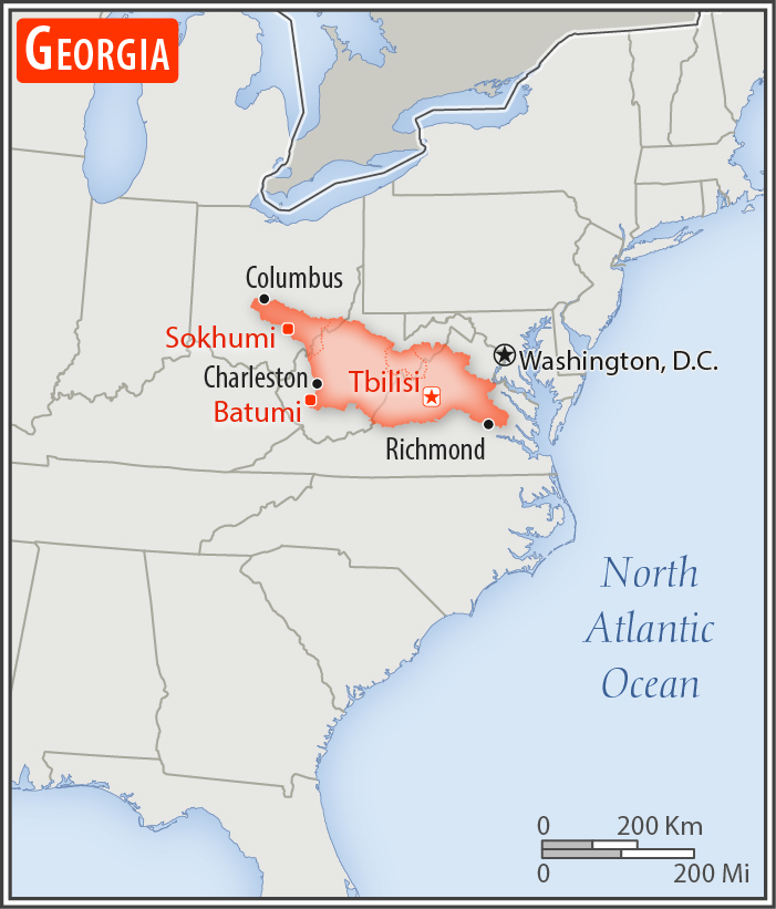
slightly smaller than South Carolina; slightly larger than West Virginia
Land boundaries:
total: 1,814 km
[see also: Land boundaries - total country ranks ]
border countries (4):
Armenia 219 km, Azerbaijan 428 km, Russia 894 km, Turkey 273 km
Coastline:
310 km
[see also: Coastline country ranks ]
Maritime claims:
territorial sea: 12
nm
[see also: Maritime claims - territorial sea country ranks ]
exclusive economic zone: 200
nm
[see also: Maritime claims - exclusive economic zone country ranks ]
Climate:
warm and pleasant; Mediterranean-like on Black Sea coast
More Climate Details
Terrain:
largely mountainous with Great Caucasus Mountains in the north and Lesser Caucasus Mountains in the south; Kolkhet'is Dablobi (Kolkhida Lowland) opens to the Black Sea in the west; Mtkvari River Basin in the east; fertile soils in river valley flood plains and foothills of Kolkhida Lowland
Elevation:
mean elevation: 1,432 m
[see also: Elevation - mean elevation country ranks ]
lowest point:
Black Sea 0 m
highest point:
Mt'a Shkhara 5,193 m
Natural resources:
timber, hydropower, manganese deposits, iron ore, copper, minor coal and oil deposits; coastal climate and soils allow for important tea and citrus growth
Land use:
agricultural land: 35.5%
(2011 est.)
[see also: Land use - agricultural land country ranks ]
arable land: 5.8%
(2011 est.)
[see also: Land use - arable land country ranks ]
permanent crops: 1.8%
(2011 est.)
[see also: Land use - permanent crops country ranks ]
permanent pasture: 27.9%
(2011 est.)
[see also: Land use - permanent pasture country ranks ]
forest: 39.4%
(2011 est.)
[see also: Land use - forest country ranks ]
other: 25.1%
(2011 est.)
[see also: Land use country ranks ]
Irrigated land:
4,330 sq km
(2012)
[see also: Irrigated land country ranks ]
Population distribution:
settlement concentrated in the central valley, particularly in the capital city of Tbilisi in the east; smaller urban agglomerations dot the Black Sea coast, with Bat'umi being the largest
Natural hazards:
earthquakes
Environment - current issues:
air pollution, particularly in Rust'avi; heavy water pollution of Mtkvari River and the Black Sea; inadequate supplies of potable water; soil pollution from toxic chemicals; land and forest degradation; biodiversity loss; waste management
Environment - international agreements:
party to:
Air Pollution, Biodiversity, Climate Change, Climate Change-Kyoto Protocol, Desertification, Endangered Species, Hazardous Wastes, Law of the Sea, Ozone Layer Protection, Ship Pollution, Wetlands
signed, but not ratified:
none of the selected agreements
Geography - note:
note 1: strategically located east of the Black Sea; Georgia controls much of the Caucasus Mountains and the routes through them
note 2: the world's four deepest caves are all in Georgia, including two that are the only known caves on earth deeper than 2,000 m: Krubera Cave at -2,197 m (-7,208 ft; reached in 2012) and Veryovkina Cave at -2,212 (-7,257 ft; reached in 2018)
NOTE: 1) The information regarding Georgia on this page is re-published from the 2020 World Fact Book of the United States Central Intelligence Agency and other sources. No claims are made regarding the accuracy of Georgia Geography 2020 information contained here. All suggestions for corrections of any errors about Georgia Geography 2020 should be addressed to the CIA or the source cited on each page.
2) The rank that you see is the CIA reported rank, which may have the following issues:
a) They assign increasing rank number, alphabetically for countries with the same value of the ranked item, whereas we assign them the same rank.
b) The CIA sometimes assigns counterintuitive ranks. For example, it assigns unemployment rates in increasing order, whereas we rank them in decreasing order.
- Main Index
- 2020 Index
- Country Ranks
- Definitions
- Georgia Index 2020
- Georgia Main Index
- Introduction
- History
- Geography
- Climate
- Maps
- People
- Religion
- Government
- Gov. Leaders
- Flags
- Economy
- Energy
- Communications
- Transportation
- Airport Codes
- Military
- Transnational Issues
- Photos
- Advertise Here
- Feedback

This page was last modified 27-Jan-20