


Location:
Central Europe, bordering the Baltic Sea and the North Sea, between the Netherlands and Poland, south of Denmark
Geographic coordinates:
51 00 N, 9 00 E
Map references:
Europe
Area:
total: 357,022 sq km
[see also: Area - total country ranks ]
land: 348,672 sq km
[see also: Area - land country ranks ]
water: 8,350 sq km
[see also: Area - water country ranks ]
country comparison to the world (CIA rank, may be based on non-current data):
64
Area - comparative:
three times the size of Pennsylvania; slightly smaller than Montana
Area comparison map:
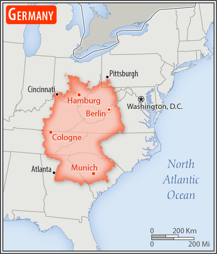
three times the size of Pennsylvania; slightly smaller than Montana
Land boundaries:
total: 3,714 km
[see also: Land boundaries - total country ranks ]
border countries (9):
Austria 801 km, Belgium 133 km, Czech Republic 704 km, Denmark 140 km, France 418 km, Luxembourg 128 km, Netherlands 575 km, Poland 467 km, Switzerland 348 km
Coastline:
2,389 km
[see also: Coastline country ranks ]
Maritime claims:
territorial sea: 12
nm
[see also: Maritime claims - territorial sea country ranks ]
exclusive economic zone: 200
nm
[see also: Maritime claims - exclusive economic zone country ranks ]
continental shelf:
200-m depth or to the depth of exploitation
[see also: Maritime claims - continental shelf country ranks ]
Climate:
temperate and marine; cool, cloudy, wet winters and summers; occasional warm mountain (foehn) wind
More Climate Details
Terrain:
lowlands in north, uplands in center, Bavarian Alps in south
Elevation:
mean elevation: 263 m
[see also: Elevation - mean elevation country ranks ]
lowest point:
Neuendorf bei Wilster -3.5 m
highest point:
Zugspitze 2,963 m
Natural resources:
coal, lignite, natural gas, iron ore, copper, nickel, uranium, potash, salt, construction materials, timber, arable land
Land use:
agricultural land: 48%
(2011 est.)
[see also: Land use - agricultural land country ranks ]
arable land: 34.1%
(2011 est.)
[see also: Land use - arable land country ranks ]
permanent crops: 0.6%
(2011 est.)
[see also: Land use - permanent crops country ranks ]
permanent pasture: 13.3%
(2011 est.)
[see also: Land use - permanent pasture country ranks ]
forest: 31.8%
(2011 est.)
[see also: Land use - forest country ranks ]
other: 20.2%
(2011 est.)
[see also: Land use country ranks ]
Irrigated land:
6,500 sq km
(2012)
[see also: Irrigated land country ranks ]
Population distribution:
most populous country in Europe; a fairly even distribution throughout most of the country, with urban areas attracting larger and denser populations, particularly in the far western part of the industrial state of North Rhine-Westphalia
Natural hazards:
flooding
Environment - current issues:
emissions from coal-burning utilities and industries contribute to air pollution; acid rain, resulting from sulfur dioxide emissions, is damaging forests; pollution in the Baltic Sea from raw sewage and industrial effluents from rivers in eastern Germany; hazardous waste disposal; government established a mechanism for ending the use of nuclear power by 2022; government working to meet EU commitment to identify nature preservation areas in line with the EU's Flora, Fauna, and Habitat directive
Environment - international agreements:
party to:
Air Pollution, Air Pollution-Nitrogen Oxides, Air Pollution-Persistent Organic Pollutants, Air Pollution-Sulfur 85, Air Pollution-Sulfur 94, Air Pollution-Volatile Organic Compounds, Antarctic-Environmental Protocol, Antarctic-Marine Living Resources, Antarctic Seals, Antarctic Treaty, Biodiversity, Climate Change, Climate Change-Kyoto Protocol, Desertification, Endangered Species, Environmental Modification, Hazardous Wastes, Law of the Sea, Marine Dumping, Ozone Layer Protection, Ship Pollution, Tropical Timber 83, Tropical Timber 94, Wetlands, Whaling
signed, but not ratified:
none of the selected agreements
Geography - note:
strategic location on North European Plain and along the entrance to the Baltic Sea; most major rivers in Germany - the Rhine, Weser, Oder, Elbe - flow northward; the Danube, which originates in the Black Forest, flows eastward
NOTE: 1) The information regarding Germany on this page is re-published from the 2020 World Fact Book of the United States Central Intelligence Agency and other sources. No claims are made regarding the accuracy of Germany Geography 2020 information contained here. All suggestions for corrections of any errors about Germany Geography 2020 should be addressed to the CIA or the source cited on each page.
2) The rank that you see is the CIA reported rank, which may have the following issues:
a) They assign increasing rank number, alphabetically for countries with the same value of the ranked item, whereas we assign them the same rank.
b) The CIA sometimes assigns counterintuitive ranks. For example, it assigns unemployment rates in increasing order, whereas we rank them in decreasing order.
- Main Index
- 2020 Index
- Country Ranks
- Definitions
- Germany Index 2020
- Germany Main Index
- Introduction
- History
- Geography
- Climate
- Maps
- People
- Religion
- Government
- Gov. Leaders
- Flags
- Economy
- Energy
- Communications
- Transportation
- Airport Codes
- Military
- Transnational Issues
- Photos
- Advertise Here
- Feedback

This page was last modified 27-Jan-20