


Location:
Middle East, bordering the Persian Gulf, between Iran and Kuwait
Geographic coordinates:
33 00 N, 44 00 E
Map references:
Middle East
Area:
total: 438,317 sq km
[see also: Area - total country ranks ]
land: 437,367 sq km
[see also: Area - land country ranks ]
water: 950 sq km
[see also: Area - water country ranks ]
country comparison to the world (CIA rank, may be based on non-current data):
60
Area - comparative:
slightly more than three times the size of New York state
Area comparison map:
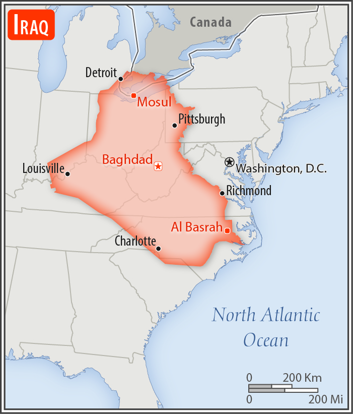
slightly more than three times the size of New York state
Land boundaries:
total: 3,809 km
[see also: Land boundaries - total country ranks ]
border countries (6):
Iran 1599 km, Jordan 179 km, Kuwait 254 km, Saudi Arabia 811 km, Syria 599 km, Turkey 367 km
Coastline:
58 km
[see also: Coastline country ranks ]
Maritime claims:
territorial sea: 12
nm
[see also: Maritime claims - territorial sea country ranks ]
continental shelf:
not specified
[see also: Maritime claims - continental shelf country ranks ]
Climate:
mostly desert; mild to cool winters with dry, hot, cloudless summers; northern mountainous regions along Iranian and Turkish borders experience cold winters with occasionally heavy snows that melt in early spring, sometimes causing extensive flooding in central and southern Iraq
More Climate Details
Terrain:
mostly broad plains; reedy marshes along Iranian border in south with large flooded areas; mountains along borders with Iran and Turkey
Elevation:
mean elevation: 312 m
[see also: Elevation - mean elevation country ranks ]
lowest point:
Persian Gulf 0 m
highest point:
Cheekha Dar (Kurdish for "Black Tent") 3,611 m
Natural resources:
petroleum, natural gas, phosphates, sulfur
Land use:
agricultural land: 18.1%
(2011 est.)
[see also: Land use - agricultural land country ranks ]
arable land: 8.4%
(2011 est.)
[see also: Land use - arable land country ranks ]
permanent crops: 0.5%
(2011 est.)
[see also: Land use - permanent crops country ranks ]
permanent pasture: 9.2%
(2011 est.)
[see also: Land use - permanent pasture country ranks ]
forest: 1.9%
(2011 est.)
[see also: Land use - forest country ranks ]
other: 80%
(2011 est.)
[see also: Land use country ranks ]
Irrigated land:
35,250 sq km
(2012)
[see also: Irrigated land country ranks ]
Population distribution:
population is concentrated in the north, center, and eastern parts of the country, with many of the larger urban agglomerations found along extensive parts of the Tigris and Euphrates Rivers; much of the western and southern areas are either lightly populated or uninhabited
Natural hazards:
dust storms; sandstorms; floods
Environment - current issues:
government water control projects drained most of the inhabited marsh areas east of An Nasiriyah by drying up or diverting the feeder streams and rivers; a once sizable population of Marsh Arabs, who inhabited these areas for thousands of years, has been displaced; furthermore, the destruction of the natural habitat poses serious threats to the area's wildlife populations; inadequate supplies of potable water; soil degradation (salination) and erosion; desertification; military and industrial infrastructure has released heavy metals and other hazardous substances into the air, soil, and groundwater; major sources of environmental damage are effluents from oil refineries, factory and sewage discharges into rivers, fertilizer and chemical contamination of the soil, and industrial air pollution in urban areas
Environment - international agreements:
party to:
Biodiversity, Hazardous Wastes, Law of the Sea, Ozone Layer Protection
signed, but not ratified:
Environmental Modification
Geography - note:
strategic location on Shatt al Arab waterway and at the head of the Persian Gulf
NOTE: 1) The information regarding Iraq on this page is re-published from the 2020 World Fact Book of the United States Central Intelligence Agency and other sources. No claims are made regarding the accuracy of Iraq Geography 2020 information contained here. All suggestions for corrections of any errors about Iraq Geography 2020 should be addressed to the CIA or the source cited on each page.
2) The rank that you see is the CIA reported rank, which may have the following issues:
a) They assign increasing rank number, alphabetically for countries with the same value of the ranked item, whereas we assign them the same rank.
b) The CIA sometimes assigns counterintuitive ranks. For example, it assigns unemployment rates in increasing order, whereas we rank them in decreasing order.
- Main Index
- 2020 Index
- Country Ranks
- Definitions
- Iraq Index 2020
- Iraq Main Index
- Introduction
- History
- Geography
- Climate
- Maps
- People
- Religion
- Government
- Gov. Leaders
- Flags
- Economy
- Energy
- Communications
- Transportation
- Airport Codes
- Military
- Terrorism
- Transnational Issues
- Photos
- Advertise Here
- Feedback

This page was last modified 27-Jan-20