


Location:
Middle East, bordering the Mediterranean Sea, between Israel and Syria
Geographic coordinates:
33 50 N, 35 50 E
Map references:
Middle East
Area:
total: 10,400 sq km
[see also: Area - total country ranks ]
land: 10,230 sq km
[see also: Area - land country ranks ]
water: 170 sq km
[see also: Area - water country ranks ]
country comparison to the world (CIA rank, may be based on non-current data):
169
Area - comparative:
about one-third the size of Maryland
Area comparison map:
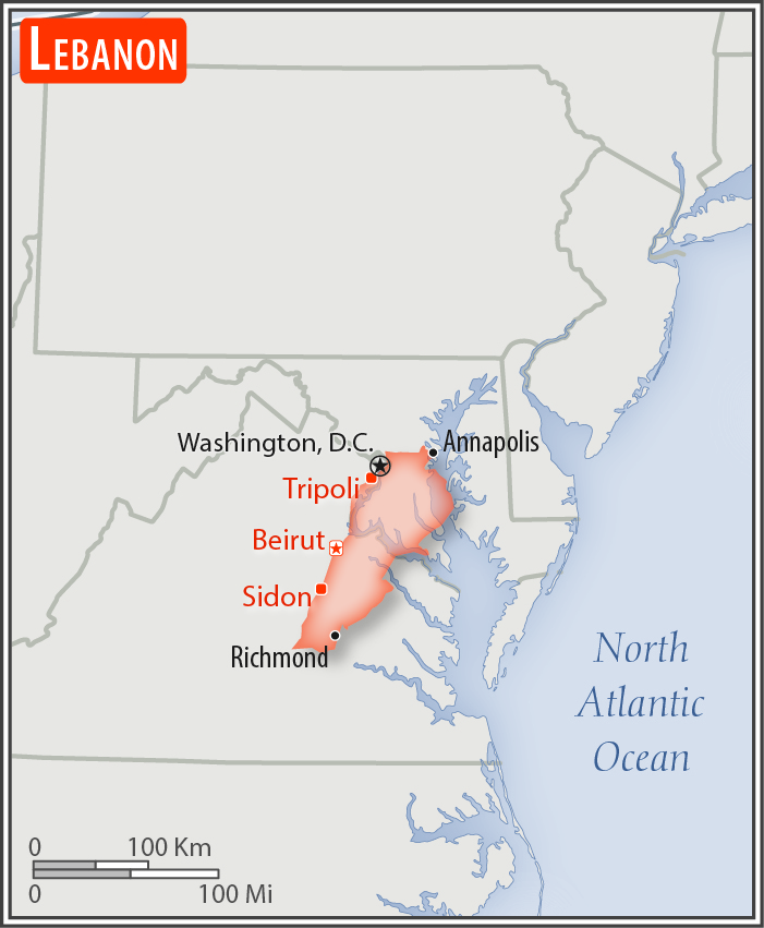
about one-third the size of Maryland
Land boundaries:
total: 484 km
[see also: Land boundaries - total country ranks ]
border countries (2):
Israel 81 km, Syria 403 km
Coastline:
225 km
[see also: Coastline country ranks ]
Maritime claims:
territorial sea: 12
nm
[see also: Maritime claims - territorial sea country ranks ]
Climate:
Mediterranean; mild to cool, wet winters with hot, dry summers; the Lebanon Mountains experience heavy winter snows
More Climate Details
Terrain:
narrow coastal plain; El Beqaa (Bekaa Valley) separates Lebanon and Anti-Lebanon Mountains
Elevation:
mean elevation: 1,250 m
[see also: Elevation - mean elevation country ranks ]
lowest point:
Mediterranean Sea 0 m
highest point:
Qornet es Saouda 3,088 m
Natural resources:
limestone, iron ore, salt, water-surplus state in a water-deficit region, arable land
Land use:
agricultural land: 63.3%
(2011 est.)
[see also: Land use - agricultural land country ranks ]
arable land: 11.9%
(2011 est.)
[see also: Land use - arable land country ranks ]
permanent crops: 12.3%
(2011 est.)
[see also: Land use - permanent crops country ranks ]
permanent pasture: 39.1%
(2011 est.)
[see also: Land use - permanent pasture country ranks ]
forest: 13.4%
(2011 est.)
[see also: Land use - forest country ranks ]
other: 23.3%
(2011 est.)
[see also: Land use country ranks ]
Irrigated land:
1,040 sq km
(2012)
[see also: Irrigated land country ranks ]
Population distribution:
the majority of the people live on or near the Mediterranean coast, and of these most live in and around the capital, Beirut; favorable growing conditions in the Bekaa Valley, on the southeastern side of the Lebanon Mountains, have attracted farmers and thus the area exhibits a smaller population density
Natural hazards:
earthquakes; dust storms, sandstorms
Environment - current issues:
deforestation; soil deterioration, erosion; desertification; species loss; air pollution in Beirut from vehicular traffic and the burning of industrial wastes; pollution of coastal waters from raw sewage and oil spills; waste-water management
Environment - international agreements:
party to:
Biodiversity, Climate Change, Climate Change-Kyoto Protocol, Desertification, Hazardous Wastes, Law of the Sea, Ozone Layer Protection, Ship Pollution, Wetlands
signed, but not ratified:
Environmental Modification, Marine Life Conservation
Geography - note:
smallest country in continental Asia; Nahr el Litani is the only major river in Near East not crossing an international boundary; rugged terrain historically helped isolate, protect, and develop numerous factional groups based on religion, clan, and ethnicity
NOTE: 1) The information regarding Lebanon on this page is re-published from the 2020 World Fact Book of the United States Central Intelligence Agency and other sources. No claims are made regarding the accuracy of Lebanon Geography 2020 information contained here. All suggestions for corrections of any errors about Lebanon Geography 2020 should be addressed to the CIA or the source cited on each page.
2) The rank that you see is the CIA reported rank, which may have the following issues:
a) They assign increasing rank number, alphabetically for countries with the same value of the ranked item, whereas we assign them the same rank.
b) The CIA sometimes assigns counterintuitive ranks. For example, it assigns unemployment rates in increasing order, whereas we rank them in decreasing order.
- Main Index
- 2020 Index
- Country Ranks
- Definitions
- Lebanon Index 2020
- Lebanon Main Index
- Introduction
- History
- Geography
- Climate
- Maps
- People
- Religion
- Government
- Gov. Leaders
- Flags
- Economy
- Energy
- Communications
- Transportation
- Airport Codes
- Military
- Terrorism
- Transnational Issues
- Photos
- Advertise Here
- Feedback

This page was last modified 27-Jan-20