


Location:
Southern Africa, island in the Indian Ocean, east of Mozambique
Geographic coordinates:
20 00 S, 47 00 E
Map references:
Africa
Area:
total: 587,041 sq km
[see also: Area - total country ranks ]
land: 581,540 sq km
[see also: Area - land country ranks ]
water: 5,501 sq km
[see also: Area - water country ranks ]
country comparison to the world (CIA rank, may be based on non-current data):
48
Area - comparative:
almost four times the size of Georgia; slightly less than twice the size of Arizona
Area comparison map:
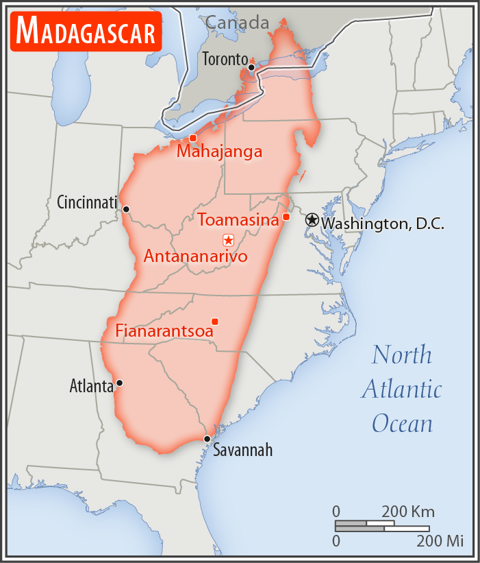
almost four times the size of Georgia; slightly less than twice the size of Arizona
Land boundaries:
0 km
Coastline:
4,828 km
[see also: Coastline country ranks ]
Maritime claims:
territorial sea: 12
nm
[see also: Maritime claims - territorial sea country ranks ]
exclusive economic zone: 200
nm
[see also: Maritime claims - exclusive economic zone country ranks ]
contiguous zone: 24
nm
[see also: Maritime claims - contiguous zone country ranks ]
continental shelf: 200
nm or 100 nm from the 2,500-m isobath
[see also: Maritime claims - continental shelf country ranks ]
Climate:
tropical along coast, temperate inland, arid in south
More Climate Details
Terrain:
narrow coastal plain, high plateau and mountains in center
Elevation:
mean elevation: 615 m
[see also: Elevation - mean elevation country ranks ]
lowest point:
Indian Ocean 0 m
highest point:
Maromokotro 2,876 m
Natural resources:
graphite, chromite, coal, bauxite, rare earth elements, salt, quartz, tar sands, semiprecious stones, mica, fish, hydropower
Land use:
agricultural land: 71.1%
(2011 est.)
[see also: Land use - agricultural land country ranks ]
arable land: 6%
(2011 est.)
[see also: Land use - arable land country ranks ]
permanent crops: 1%
(2011 est.)
[see also: Land use - permanent crops country ranks ]
permanent pasture: 64.1%
(2011 est.)
[see also: Land use - permanent pasture country ranks ]
forest: 21.5%
(2011 est.)
[see also: Land use - forest country ranks ]
other: 7.4%
(2011 est.)
[see also: Land use country ranks ]
Irrigated land:
10,860 sq km
(2012)
[see also: Irrigated land country ranks ]
Population distribution:
most of population lives on the eastern half of the island; significant clustering is found in the central highlands and eastern coastline
Natural hazards:
periodic cyclones; drought; and locust infestation
volcanism: Madagascar's volcanoes have not erupted in historical times
Environment - current issues:
erosion and soil degredation results from deforestation and overgrazing; desertification; agricultural fires; surface water contaminated with raw sewage and other organic wastes; wildlife preservation (endangered species of flora and fauna unique to the island)
Environment - international agreements:
party to:
Biodiversity, Climate Change, Climate Change-Kyoto Protocol, Desertification, Endangered Species, Hazardous Wastes, Law of the Sea, Marine Life Conservation, Ozone Layer Protection, Ship Pollution, Wetlands
signed, but not ratified:
none of the selected agreements
Geography - note:
world's fourth-largest island; strategic location along Mozambique Channel; despite Madagascar’s close proximity to the African continent, ocean currents isolate the island resulting in high rates of endemic plant and animal species; approximately 90% of the flora and fauna on the island are found nowhere else
NOTE: 1) The information regarding Madagascar on this page is re-published from the 2020 World Fact Book of the United States Central Intelligence Agency and other sources. No claims are made regarding the accuracy of Madagascar Geography 2020 information contained here. All suggestions for corrections of any errors about Madagascar Geography 2020 should be addressed to the CIA or the source cited on each page.
2) The rank that you see is the CIA reported rank, which may have the following issues:
a) They assign increasing rank number, alphabetically for countries with the same value of the ranked item, whereas we assign them the same rank.
b) The CIA sometimes assigns counterintuitive ranks. For example, it assigns unemployment rates in increasing order, whereas we rank them in decreasing order.
- Main Index
- 2020 Index
- Country Ranks
- Definitions
- Madagascar Index 2020
- Madagascar Main Index
- Introduction
- History
- Geography
- Climate
- Maps
- People
- Religion
- Government
- Gov. Leaders
- Flags
- Economy
- Energy
- Communications
- Transportation
- Airport Codes
- Military
- Transnational Issues
- Photos
- Advertise Here
- Feedback

This page was last modified 27-Jan-20