


Location:
Southern Africa, east of Zambia, west and north of Mozambique
Geographic coordinates:
13 30 S, 34 00 E
Map references:
Africa
Area:
total: 118,484 sq km
[see also: Area - total country ranks ]
land: 94,080 sq km
[see also: Area - land country ranks ]
water: 24,404 sq km
[see also: Area - water country ranks ]
country comparison to the world (CIA rank, may be based on non-current data):
101
Area - comparative:
slightly smaller than Pennsylvania
Area comparison map:
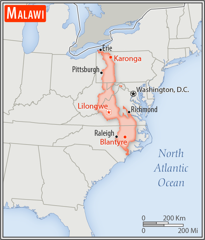
slightly smaller than Pennsylvania
Land boundaries:
total: 2,857 km
[see also: Land boundaries - total country ranks ]
border countries (3):
Mozambique 1498 km, Tanzania 512 km, Zambia 847 km
Coastline:
0 km
(landlocked)
[see also: Coastline country ranks ]
Maritime claims:
none (landlocked)
Climate:
sub-tropical; rainy season (November to May); dry season (May to November)
More Climate Details
Terrain:
narrow elongated plateau with rolling plains, rounded hills, some mountains
Elevation:
mean elevation: 779 m
[see also: Elevation - mean elevation country ranks ]
lowest point:
junction of the Shire River and international boundary with Mozambique 37 m
highest point:
Sapitwa (Mount Mlanje) 3,002 m
Natural resources:
limestone, arable land, hydropower, unexploited deposits of uranium, coal, and bauxite
Land use:
agricultural land: 59.2%
(2011 est.)
[see also: Land use - agricultural land country ranks ]
arable land: 38.2%
(2011 est.)
[see also: Land use - arable land country ranks ]
permanent crops: 1.4%
(2011 est.)
[see also: Land use - permanent crops country ranks ]
permanent pasture: 19.6%
(2011 est.)
[see also: Land use - permanent pasture country ranks ]
forest: 34%
(2011 est.)
[see also: Land use - forest country ranks ]
other: 6.8%
(2011 est.)
[see also: Land use country ranks ]
Irrigated land:
740 sq km
(2012)
[see also: Irrigated land country ranks ]
Population distribution:
population density is highest south of Lake Nyasa
Natural hazards:
flooding; droughts; earthquakes
Environment - current issues:
deforestation; land degradation; water pollution from agricultural runoff, sewage, industrial wastes; siltation of spawning grounds endangers fish populations; negative effects of climate change (extreme high temperatures, changing precipatation pattens)
Environment - international agreements:
party to:
Biodiversity, Climate Change, Climate Change-Kyoto Protocol, Desertification, Endangered Species, Environmental Modification, Hazardous Wastes, Marine Life Conservation, Ozone Layer Protection, Ship Pollution, Wetlands
signed, but not ratified:
Law of the Sea
Geography - note:
landlocked; Lake Nyasa, some 580 km long, is the country's most prominent physical feature; it contains more fish species than any other lake on earth
NOTE: 1) The information regarding Malawi on this page is re-published from the 2020 World Fact Book of the United States Central Intelligence Agency and other sources. No claims are made regarding the accuracy of Malawi Geography 2020 information contained here. All suggestions for corrections of any errors about Malawi Geography 2020 should be addressed to the CIA or the source cited on each page.
2) The rank that you see is the CIA reported rank, which may have the following issues:
a) They assign increasing rank number, alphabetically for countries with the same value of the ranked item, whereas we assign them the same rank.
b) The CIA sometimes assigns counterintuitive ranks. For example, it assigns unemployment rates in increasing order, whereas we rank them in decreasing order.
- Main Index
- 2020 Index
- Country Ranks
- Definitions
- Malawi Index 2020
- Malawi Main Index
- Introduction
- History
- Geography
- Climate
- Maps
- People
- Religion
- Government
- Gov. Leaders
- Flags
- Economy
- Energy
- Communications
- Transportation
- Airport Codes
- Military
- Transnational Issues
- Photos
- Advertise Here
- Feedback

This page was last modified 27-Jan-20