


Location:
Western Africa, bordering the North Atlantic Ocean, between Senegal and Western Sahara
Geographic coordinates:
20 00 N, 12 00 W
Map references:
Africa
Area:
total: 1,030,700 sq km
[see also: Area - total country ranks ]
land: 1,030,700 sq km
[see also: Area - land country ranks ]
water: 0 sq km
[see also: Area - water country ranks ]
country comparison to the world (CIA rank, may be based on non-current data):
30
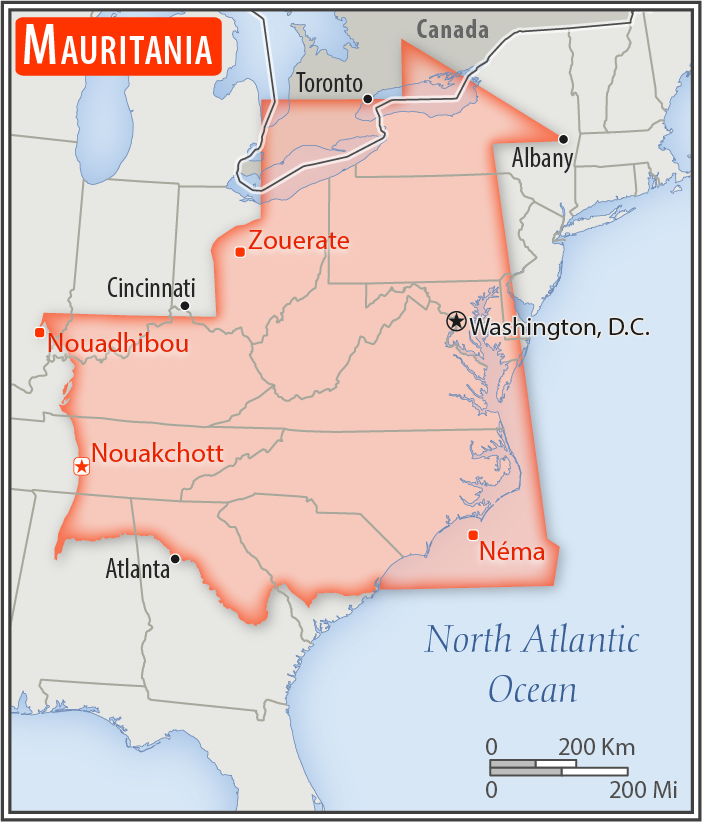
Area - comparative:
slightly larger than three times the size of New Mexico; about six times the size of Florida
Area comparison map:
slightly larger than three times the size of New Mexico; about six times the size of Florida
Land boundaries:
total: 5,002 km
[see also: Land boundaries - total country ranks ]
border countries (4):
Algeria 460 km, Mali 2236 km, Senegal 742 km, Western Sahara 1564 km
Coastline:
754 km
[see also: Coastline country ranks ]
Maritime claims:
territorial sea: 12
nm
[see also: Maritime claims - territorial sea country ranks ]
exclusive economic zone: 200
nm
[see also: Maritime claims - exclusive economic zone country ranks ]
contiguous zone: 24
nm
[see also: Maritime claims - contiguous zone country ranks ]
continental shelf: 200
nm or to the edge of the continental margin
[see also: Maritime claims - continental shelf country ranks ]
Climate:
desert; constantly hot, dry, dusty
More Climate Details
Terrain:
mostly barren, flat plains of the Sahara; some central hills
Elevation:
mean elevation: 276 m
[see also: Elevation - mean elevation country ranks ]
lowest point:
Sebkhet Te-n-Dghamcha -5 m
highest point:
Kediet Ijill 915 m
Natural resources:
iron ore, gypsum, copper, phosphate, diamonds, gold, oil, fish
Land use:
agricultural land: 38.5%
(2011 est.)
[see also: Land use - agricultural land country ranks ]
arable land: 0.4%
(2011 est.)
[see also: Land use - arable land country ranks ]
permanent crops: 0%
(2011 est.)
[see also: Land use - permanent crops country ranks ]
permanent pasture: 38.1%
(2011 est.)
[see also: Land use - permanent pasture country ranks ]
forest: 0.2%
(2011 est.)
[see also: Land use - forest country ranks ]
other: 61.3%
(2011 est.)
[see also: Land use country ranks ]
Irrigated land:
450 sq km
(2012)
[see also: Irrigated land country ranks ]
Population distribution:
with most of the country being a desert, vast areas of the country, particularly in the central, northern, and eastern areas, are without sizeable population clusters; half the population lives in or around the coastal capital of Nouakchott; smaller clusters are found near the southern border with Mali and Senegal
Natural hazards:
hot, dry, dust/sand-laden sirocco wind primarily in March and April; periodic droughts
Environment - current issues:
overgrazing, deforestation, and soil erosion aggravated by drought are contributing to desertification; limited natural freshwater resources away from the Senegal, which is the only perennial river; locust infestation
Environment - international agreements:
party to:
Biodiversity, Climate Change, Climate Change-Kyoto Protocol, Desertification, Endangered Species, Hazardous Wastes, Law of the Sea, Ozone Layer Protection, Ship Pollution, Wetlands, Whaling
signed, but not ratified:
none of the selected agreements
Geography - note:
Mauritania is considered both a part of North Africa's Maghreb region and West Africa's Sahel region; most of the population is concentrated in the cities of Nouakchott and Nouadhibou and along the Senegal River in the southern part of the country
NOTE: 1) The information regarding Mauritania on this page is re-published from the 2020 World Fact Book of the United States Central Intelligence Agency and other sources. No claims are made regarding the accuracy of Mauritania Geography 2020 information contained here. All suggestions for corrections of any errors about Mauritania Geography 2020 should be addressed to the CIA or the source cited on each page.
2) The rank that you see is the CIA reported rank, which may have the following issues:
a) They assign increasing rank number, alphabetically for countries with the same value of the ranked item, whereas we assign them the same rank.
b) The CIA sometimes assigns counterintuitive ranks. For example, it assigns unemployment rates in increasing order, whereas we rank them in decreasing order.
- Main Index
- 2020 Index
- Country Ranks
- Definitions
- Mauritania Index 2020
- Mauritania Main Index
- Introduction
- History
- Geography
- Climate
- Maps
- People
- Religion
- Government
- Gov. Leaders
- Flags
- Economy
- Energy
- Communications
- Transportation
- Airport Codes
- Military
- Transnational Issues
- Photos
- Advertise Here
- Feedback

This page was last modified 27-Jan-20