


Location:
Central America, bordering both the Caribbean Sea and the North Pacific Ocean, between Costa Rica and Honduras
Geographic coordinates:
13 00 N, 85 00 W
Map references:
Central America and the Caribbean
Area:
total: 130,370 sq km
[see also: Area - total country ranks ]
land: 119,990 sq km
[see also: Area - land country ranks ]
water: 10,380 sq km
[see also: Area - water country ranks ]
country comparison to the world (CIA rank, may be based on non-current data):
99
Area - comparative:
slightly larger than Pennsylvania; slightly smaller than New York state
Area comparison map:
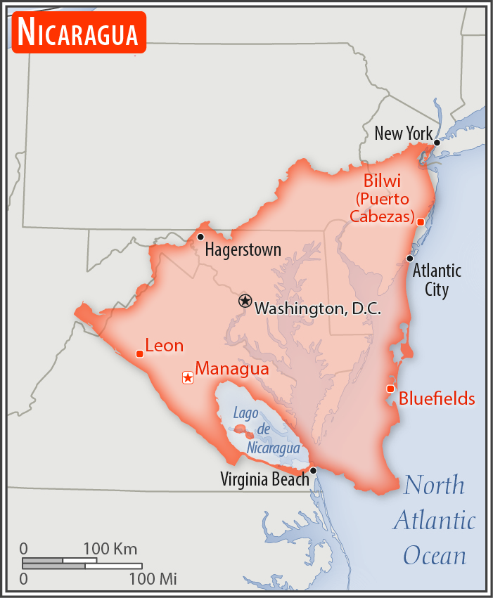
slightly larger than Pennsylvania; slightly smaller than New York state
Land boundaries:
total: 1,253 km
[see also: Land boundaries - total country ranks ]
border countries (2):
Costa Rica 313 km, Honduras 940 km
Coastline:
910 km
[see also: Coastline country ranks ]
Maritime claims:
territorial sea: 12
nm
[see also: Maritime claims - territorial sea country ranks ]
contiguous zone: 24
nm
[see also: Maritime claims - contiguous zone country ranks ]
continental shelf:
natural prolongation
[see also: Maritime claims - continental shelf country ranks ]
Climate:
tropical in lowlands, cooler in highlands
More Climate Details
Terrain:
extensive Atlantic coastal plains rising to central interior mountains; narrow Pacific coastal plain interrupted by volcanoes
Elevation:
mean elevation: 298 m
[see also: Elevation - mean elevation country ranks ]
lowest point:
Pacific Ocean 0 m
highest point:
Mogoton 2,085 m
Natural resources:
gold, silver, copper, tungsten, lead, zinc, timber, fish
Land use:
agricultural land: 42.2%
(2011 est.)
[see also: Land use - agricultural land country ranks ]
arable land: 12.5%
(2011 est.)
[see also: Land use - arable land country ranks ]
permanent crops: 2.5%
(2011 est.)
[see also: Land use - permanent crops country ranks ]
permanent pasture: 27.2%
(2011 est.)
[see also: Land use - permanent pasture country ranks ]
forest: 25.3%
(2011 est.)
[see also: Land use - forest country ranks ]
other: 32.5%
(2011 est.)
[see also: Land use country ranks ]
Irrigated land:
1,990 sq km
(2012)
[see also: Irrigated land country ranks ]
Population distribution:
the overwhelming majority of the population resides in the western half of the country, with much of the urban growth centered in the capital city of Managua; coastal areas also show large population clusters
Natural hazards:
destructive earthquakes; volcanoes; landslides; extremely susceptible to hurricanes
volcanism: significant volcanic activity; Cerro Negro (728 m), which last erupted in 1999, is one of Nicaragua's most active volcanoes; its lava flows and ash have been known to cause significant damage to farmland and buildings; other historically active volcanoes include Concepcion, Cosiguina, Las Pilas, Masaya, Momotombo, San Cristobal, and Telica
Environment - current issues:
deforestation; soil erosion; water pollution; drought
Environment - international agreements:
party to:
Biodiversity, Climate Change, Climate Change-Kyoto Protocol, Desertification, Endangered Species, Environmental Modification, Hazardous Wastes, Law of the Sea, Ozone Layer Protection, Ship Pollution, Wetlands, Whaling
signed, but not ratified:
none of the selected agreements
Geography - note:
largest country in Central America; contains the largest freshwater body in Central America, Lago de Nicaragua
NOTE: 1) The information regarding Nicaragua on this page is re-published from the 2020 World Fact Book of the United States Central Intelligence Agency and other sources. No claims are made regarding the accuracy of Nicaragua Geography 2020 information contained here. All suggestions for corrections of any errors about Nicaragua Geography 2020 should be addressed to the CIA or the source cited on each page.
2) The rank that you see is the CIA reported rank, which may have the following issues:
a) They assign increasing rank number, alphabetically for countries with the same value of the ranked item, whereas we assign them the same rank.
b) The CIA sometimes assigns counterintuitive ranks. For example, it assigns unemployment rates in increasing order, whereas we rank them in decreasing order.
- Main Index
- 2020 Index
- Country Ranks
- Definitions
- Nicaragua Index 2020
- Nicaragua Main Index
- Introduction
- History
- Geography
- Climate
- Maps
- People
- Religion
- Government
- Gov. Leaders
- Flags
- Economy
- Energy
- Communications
- Transportation
- Airport Codes
- Military
- Transnational Issues
- Photos
- Advertise Here
- Feedback

This page was last modified 27-Jan-20