


Location:
Western Africa, southeast of Algeria
Geographic coordinates:
16 00 N, 8 00 E
Map references:
Africa
Area:
total: 1.267 million sq km
[see also: Area - total country ranks ]
land: 1,266,700 sq km
[see also: Area - land country ranks ]
water: 300 sq km
[see also: Area - water country ranks ]
country comparison to the world (CIA rank, may be based on non-current data):
23
Area - comparative:
slightly less than twice the size of Texas
Area comparison map:
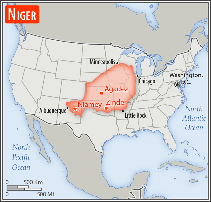
slightly less than twice the size of Texas
Land boundaries:
total: 5,834 km
[see also: Land boundaries - total country ranks ]
border countries (7):
Algeria 951 km, Benin 277 km, Burkina Faso 622 km, Chad 1196 km, Libya 342 km, Mali 838 km, Nigeria 1608 km
Coastline:
0 km
(landlocked)
[see also: Coastline country ranks ]
Maritime claims:
none (landlocked)
Climate:
desert; mostly hot, dry, dusty; tropical in extreme south
More Climate Details
Terrain:
predominately desert plains and sand dunes; flat to rolling plains in south; hills in north
Elevation:
mean elevation: 474 m
[see also: Elevation - mean elevation country ranks ]
lowest point:
Niger River 200 m
highest point:
Idoukal-n-Taghes 2,022 m
Natural resources:
uranium, coal, iron ore, tin, phosphates, gold, molybdenum, gypsum, salt, petroleum
Land use:
agricultural land: 35.1%
(2011 est.)
[see also: Land use - agricultural land country ranks ]
arable land: 12.3%
(2011 est.)
[see also: Land use - arable land country ranks ]
permanent crops: 0.1%
(2011 est.)
[see also: Land use - permanent crops country ranks ]
permanent pasture: 22.7%
(2011 est.)
[see also: Land use - permanent pasture country ranks ]
forest: 1%
(2011 est.)
[see also: Land use - forest country ranks ]
other: 63.9%
(2011 est.)
[see also: Land use country ranks ]
Irrigated land:
1,000 sq km
(2012)
[see also: Irrigated land country ranks ]
Population distribution:
majority of the populace is located in the southernmost extreme of the country along the border with Nigeria and Benin
Natural hazards:
recurring droughts
Environment - current issues:
overgrazing; soil erosion; deforestation; desertification; contaminated water; inadequate potable water; wildlife populations (such as elephant, hippopotamus, giraffe, and lion) threatened because of poaching and habitat destruction
Environment - international agreements:
party to:
Biodiversity, Climate Change, Climate Change-Kyoto Protocol, Desertification, Endangered Species, Environmental Modification, Hazardous Wastes, Ozone Layer Protection, Wetlands
signed, but not ratified:
Law of the Sea
Geography - note:
landlocked; one of the hottest countries in the world; northern four-fifths is desert, southern one-fifth is savanna, suitable for livestock and limited agriculture
NOTE: 1) The information regarding Niger on this page is re-published from the 2020 World Fact Book of the United States Central Intelligence Agency and other sources. No claims are made regarding the accuracy of Niger Geography 2020 information contained here. All suggestions for corrections of any errors about Niger Geography 2020 should be addressed to the CIA or the source cited on each page.
2) The rank that you see is the CIA reported rank, which may have the following issues:
a) They assign increasing rank number, alphabetically for countries with the same value of the ranked item, whereas we assign them the same rank.
b) The CIA sometimes assigns counterintuitive ranks. For example, it assigns unemployment rates in increasing order, whereas we rank them in decreasing order.
- Main Index
- 2020 Index
- Country Ranks
- Definitions
- Niger Index 2020
- Niger Main Index
- Introduction
- History
- Geography
- Climate
- Maps
- People
- Religion
- Government
- Gov. Leaders
- Flags
- Economy
- Energy
- Communications
- Transportation
- Airport Codes
- Military
- Terrorism
- Transnational Issues
- Photos
- Advertise Here
- Feedback

This page was last modified 27-Jan-20