


Location:
Oceania, group of islands including the eastern half of the island of New Guinea between the Coral Sea and the South Pacific Ocean, east of Indonesia
Geographic coordinates:
6 00 S, 147 00 E
Map references:
Oceania
Area:
total: 462,840 sq km
[see also: Area - total country ranks ]
land: 452,860 sq km
[see also: Area - land country ranks ]
water: 9,980 sq km
[see also: Area - water country ranks ]
country comparison to the world (CIA rank, may be based on non-current data):
56
Area - comparative:
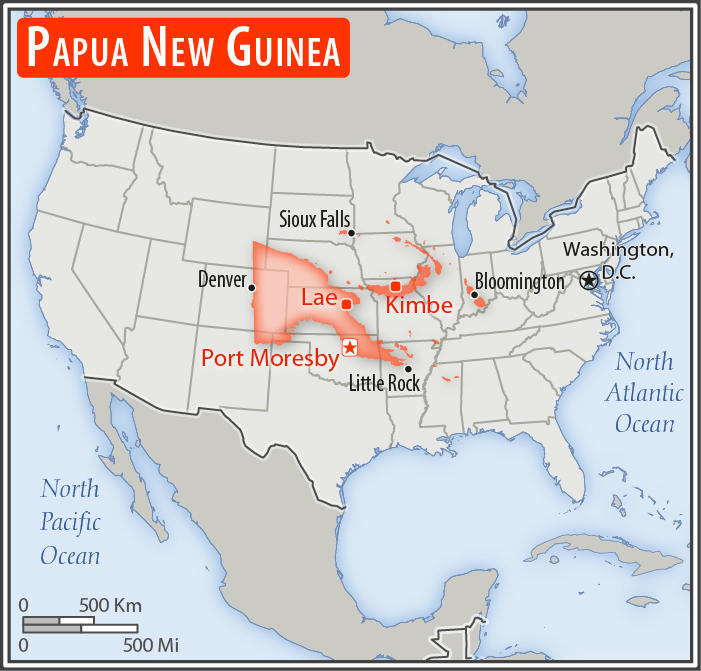
slightly larger than California
Area comparison map:
slightly larger than California
Land boundaries:
total: 824 km
[see also: Land boundaries - total country ranks ]
border countries (1):
Indonesia 824 km
Coastline:
5,152 km
[see also: Coastline country ranks ]
Maritime claims:
territorial sea: 12
nm
[see also: Maritime claims - territorial sea country ranks ]
continental shelf:
200-m depth or to the depth of exploitation
[see also: Maritime claims - continental shelf country ranks ]
exclusive fishing zone: 200
nm
measured from claimed archipelagic baselines
Climate:
tropical; northwest monsoon (December to March), southeast monsoon (May to October); slight seasonal temperature variation
More Climate Details
Terrain:
mostly mountains with coastal lowlands and rolling foothills
Elevation:
mean elevation: 667 m
[see also: Elevation - mean elevation country ranks ]
lowest point:
Pacific Ocean 0 m
highest point:
Mount Wilhelm 4,509 m
Natural resources:
gold, copper, silver, natural gas, timber, oil, fisheries
Land use:
agricultural land: 2.6%
(2011 est.)
[see also: Land use - agricultural land country ranks ]
arable land: 0.7%
(2011 est.)
[see also: Land use - arable land country ranks ]
permanent crops: 1.5%
(2011 est.)
[see also: Land use - permanent crops country ranks ]
permanent pasture: 0.4%
(2011 est.)
[see also: Land use - permanent pasture country ranks ]
forest: 63.1%
(2011 est.)
[see also: Land use - forest country ranks ]
other: 34.3%
(2011 est.)
[see also: Land use country ranks ]
Irrigated land:
0 sq km
(2012)
[see also: Irrigated land country ranks ]
Population distribution:
population concentrated in the highlands and eastern coastal areas on the island of New Guinea; predominantly a rural distribution with only about one-fifth of the population residing in urban areas
Natural hazards:
active volcanism; the country is subject to frequent and sometimes severe earthquakes; mud slides; tsunamis
volcanism: severe volcanic activity; Ulawun (2,334 m), one of Papua New Guinea's potentially most dangerous volcanoes, has been deemed a Decade Volcano by the International Association of Volcanology and Chemistry of the Earth's Interior, worthy of study due to its explosive history and close proximity to human populations; Rabaul (688 m) destroyed the city of Rabaul in 1937 and 1994; Lamington erupted in 1951 killing 3,000 people; Manam's 2004 eruption forced the island's abandonment; other historically active volcanoes include Bam, Bagana, Garbuna, Karkar, Langila, Lolobau, Long Island, Pago, St. Andrew Strait, Victory, and Waiowa; see note 2 under "Geography - note"
Environment - current issues:
rain forest loss as a result of growing commercial demand for tropical timber; unsustainable logging practices result in soil erosion, water quality degredation, and loss of habitat and biodiversity; large-scale mining projects cause adverse impacts on forests and water quality (discharge of heavy metals, cyanide, and acids into rivers); severe drought; inappropriate farming practices accelerate land degradion (soil erosion, siltation, loss of soil fertility); destructive fishing practices and coastal pollution due to run-off from land-based activities and oil spills
Environment - international agreements:
party to:
Antarctic Treaty, Biodiversity, Climate Change, Climate Change-Kyoto Protocol, Desertification, Endangered Species, Environmental Modification, Hazardous Wastes, Law of the Sea, Marine Dumping, Ozone Layer Protection, Ship Pollution, Tropical Timber 83, Tropical Timber 94, Wetlands
signed, but not ratified:
none of the selected agreements
note 1: shares island of New Guinea with Indonesia; generally east-west trending highlands break up New Guinea into diverse ecoregions; one of world's largest swamps along southwest coast
note 2: Papua New Guinea is one of the countries along the Ring of Fire, a belt of active volcanoes and earthquake epicenters bordering the Pacific Ocean; up to 90% of the world's earthquakes and some 75% of the world's volcanoes occur within the Ring of Fire
NOTE: 1) The information regarding Papua New Guinea on this page is re-published from the 2020 World Fact Book of the United States Central Intelligence Agency and other sources. No claims are made regarding the accuracy of Papua New Guinea Geography 2020 information contained here. All suggestions for corrections of any errors about Papua New Guinea Geography 2020 should be addressed to the CIA or the source cited on each page.
2) The rank that you see is the CIA reported rank, which may have the following issues:
a) They assign increasing rank number, alphabetically for countries with the same value of the ranked item, whereas we assign them the same rank.
b) The CIA sometimes assigns counterintuitive ranks. For example, it assigns unemployment rates in increasing order, whereas we rank them in decreasing order.
- Main Index
- 2020 Index
- Country Ranks
- Definitions
- Papua New Guinea Index 2020
- Papua New Guinea Main Index
- Introduction
- History
- Geography
- Climate
- Maps
- People
- Religion
- Government
- Gov. Leaders
- Flags
- Economy
- Energy
- Communications
- Transportation
- Airport Codes
- Military
- Transnational Issues
- Photos
- Advertise Here
- Feedback

This page was last modified 27-Jan-20