


Location:
Southwestern Europe, bordering the North Atlantic Ocean, west of Spain
Geographic coordinates:
39 30 N, 8 00 W
Map references:
Europe
Area:
total: 92,090 sq km
[see also: Area - total country ranks ]
land: 91,470 sq km
[see also: Area - land country ranks ]
water: 620 sq km
note: includes Azores and Madeira Islands
country comparison to the world (CIA rank, may be based on non-current data):
112
Area - comparative:
slightly smaller than Virginia
Area comparison map:
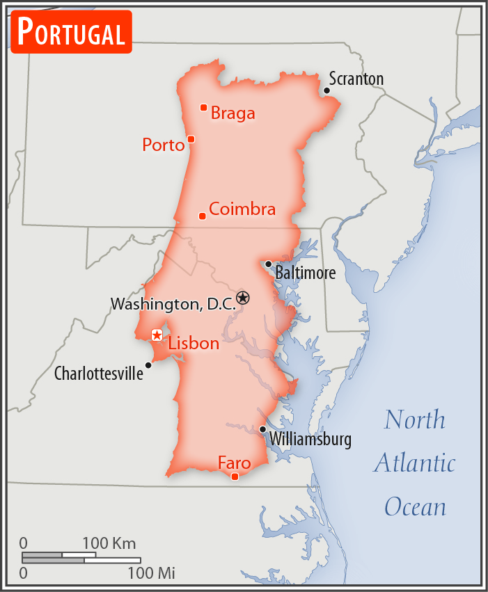
slightly smaller than Virginia
Land boundaries:
total: 1,224 km
[see also: Land boundaries - total country ranks ]
border countries (1):
Spain 1224 km
Coastline:
1,793 km
[see also: Coastline country ranks ]
Maritime claims:
territorial sea: 12
nm
[see also: Maritime claims - territorial sea country ranks ]
exclusive economic zone: 200
nm
[see also: Maritime claims - exclusive economic zone country ranks ]
contiguous zone: 24
nm
[see also: Maritime claims - contiguous zone country ranks ]
continental shelf:
200-m depth or to the depth of exploitation
[see also: Maritime claims - continental shelf country ranks ]
Climate:
maritime temperate; cool and rainy in north, warmer and drier in south
More Climate Details
Terrain:
the west-flowing Tagus River divides the country: the north is mountainous toward the interior, while the south is characterized by rolling plains
Elevation:
mean elevation: 372 m
[see also: Elevation - mean elevation country ranks ]
lowest point:
Atlantic Ocean 0 m
highest point:
Ponta do Pico (Pico or Pico Alto) on Ilha do Pico in the Azores 2,351 m
Natural resources:
fish, forests (cork), iron ore, copper, zinc, tin, tungsten, silver, gold, uranium, marble, clay, gypsum, salt, arable land, hydropower
Land use:
agricultural land: 39.7%
(2011 est.)
[see also: Land use - agricultural land country ranks ]
arable land: 11.9%
(2011 est.)
[see also: Land use - arable land country ranks ]
permanent crops: 7.8%
(2011 est.)
[see also: Land use - permanent crops country ranks ]
permanent pasture: 20%
(2011 est.)
[see also: Land use - permanent pasture country ranks ]
forest: 37.8%
(2011 est.)
[see also: Land use - forest country ranks ]
other: 22.5%
(2011 est.)
[see also: Land use country ranks ]
Irrigated land:
5,400 sq km
(2012)
[see also: Irrigated land country ranks ]
Population distribution:
concentrations are primarily along or near the Atlantic coast; both Lisbon and the second largest city, Porto, are coastal cities
Natural hazards:
Azores subject to severe earthquakes
volcanism: limited volcanic activity in the Azores Islands; Fayal or Faial (1,043 m) last erupted in 1958; most volcanoes have not erupted in centuries; historically active volcanoes include Agua de Pau, Furnas, Pico, Picos Volcanic System, San Jorge, Sete Cidades, and Terceira
Environment - current issues:
soil erosion; air pollution caused by industrial and vehicle emissions; water pollution, especially in urban centers and coastal areas
Environment - international agreements:
party to:
Air Pollution, Biodiversity, Climate Change, Climate Change-Kyoto Protocol, Desertification, Endangered Species, Hazardous Wastes, Law of the Sea, Marine Dumping, Marine Life Conservation, Ozone Layer Protection, Ship Pollution, Tropical Timber 83, Tropical Timber 94, Wetlands, Whaling
signed, but not ratified:
Air Pollution-Persistent Organic Pollutants, Air Pollution-Volatile Organic Compounds, Environmental Modification
Geography - note:
Azores and Madeira Islands occupy strategic locations along western sea approaches to Strait of Gibraltar
NOTE: 1) The information regarding Portugal on this page is re-published from the 2020 World Fact Book of the United States Central Intelligence Agency and other sources. No claims are made regarding the accuracy of Portugal Geography 2020 information contained here. All suggestions for corrections of any errors about Portugal Geography 2020 should be addressed to the CIA or the source cited on each page.
2) The rank that you see is the CIA reported rank, which may have the following issues:
a) They assign increasing rank number, alphabetically for countries with the same value of the ranked item, whereas we assign them the same rank.
b) The CIA sometimes assigns counterintuitive ranks. For example, it assigns unemployment rates in increasing order, whereas we rank them in decreasing order.
- Main Index
- 2020 Index
- Country Ranks
- Definitions
- Portugal Index 2020
- Portugal Main Index
- Introduction
- History
- Geography
- Climate
- Maps
- People
- Religion
- Government
- Gov. Leaders
- Flags
- Economy
- Energy
- Communications
- Transportation
- Airport Codes
- Military
- Transnational Issues
- Photos
- Advertise Here
- Feedback

This page was last modified 27-Jan-20