


Location:
Central Africa, east of the Democratic Republic of the Congo, north of Burundi
Geographic coordinates:
2 00 S, 30 00 E
Map references:
Africa
Area:
total: 26,338 sq km
[see also: Area - total country ranks ]
land: 24,668 sq km
[see also: Area - land country ranks ]
water: 1,670 sq km
[see also: Area - water country ranks ]
country comparison to the world (CIA rank, may be based on non-current data):
149
Area - comparative:
slightly smaller than Maryland
Area comparison map:
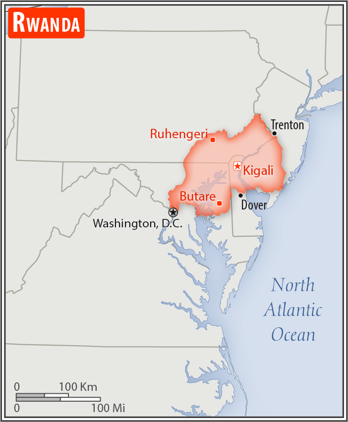
slightly smaller than Maryland
Land boundaries:
total: 930 km
[see also: Land boundaries - total country ranks ]
border countries (4):
Burundi 315 km, Democratic Republic of the Congo 221 km, Tanzania 222 km, Uganda 172 km
Coastline:
0 km
(landlocked)
[see also: Coastline country ranks ]
Maritime claims:
none (landlocked)
Climate:
temperate; two rainy seasons (February to April, November to January); mild in mountains with frost and snow possible
Terrain:
mostly grassy uplands and hills; relief is mountainous with altitude declining from west to east
Elevation:
mean elevation: 1,598 m
[see also: Elevation - mean elevation country ranks ]
lowest point:
Rusizi River 950 m
highest point:
Volcan Karisimbi 4,519 m
Natural resources:
gold, cassiterite (tin ore), wolframite (tungsten ore), methane, hydropower, arable land
Land use:
agricultural land: 74.5%
(2011 est.)
[see also: Land use - agricultural land country ranks ]
arable land: 47%
(2011 est.)
[see also: Land use - arable land country ranks ]
permanent crops: 10.1%
(2011 est.)
[see also: Land use - permanent crops country ranks ]
permanent pasture: 17.4%
(2011 est.)
[see also: Land use - permanent pasture country ranks ]
forest: 18%
(2011 est.)
[see also: Land use - forest country ranks ]
other: 7.5%
(2011 est.)
[see also: Land use country ranks ]
Irrigated land:
96 sq km
(2012)
[see also: Irrigated land country ranks ]
Population distribution:
one of Africa's most densely populated countries; large concentrations tend to be in the central regions and along the shore of Lake Kivu in the west
Natural hazards:
periodic droughts; the volcanic Virunga Mountains are in the northwest along the border with Democratic Republic of the Congo
volcanism: Visoke (3,711 m), located on the border with the Democratic Republic of the Congo, is the country's only historically active volcano
Environment - current issues:
deforestation results from uncontrolled cutting of trees for fuel; overgrazing; land degradation; soil erosion; a decline in soil fertility (soil exhaustion); wetland degradation and loss of biodiversity; widespread poaching
Environment - international agreements:
party to:
Biodiversity, Climate Change, Climate Change-Kyoto Protocol, Desertification, Endangered Species, Hazardous Wastes, Ozone Layer Protection, Wetlands
signed, but not ratified:
Law of the Sea
Geography - note:
landlocked; most of the country is intensively cultivated and rugged with the population predominantly rural
NOTE: 1) The information regarding Rwanda on this page is re-published from the 2020 World Fact Book of the United States Central Intelligence Agency and other sources. No claims are made regarding the accuracy of Rwanda Geography 2020 information contained here. All suggestions for corrections of any errors about Rwanda Geography 2020 should be addressed to the CIA or the source cited on each page.
2) The rank that you see is the CIA reported rank, which may have the following issues:
a) They assign increasing rank number, alphabetically for countries with the same value of the ranked item, whereas we assign them the same rank.
b) The CIA sometimes assigns counterintuitive ranks. For example, it assigns unemployment rates in increasing order, whereas we rank them in decreasing order.
- Main Index
- 2020 Index
- Country Ranks
- Definitions
- Rwanda Index 2020
- Rwanda Main Index
- Introduction
- History
- Geography
- Maps
- People
- Religion
- Government
- Gov. Leaders
- Flags
- Economy
- Energy
- Communications
- Transportation
- Airport Codes
- Military
- Transnational Issues
- Photos
- Advertise Here
- Feedback

This page was last modified 27-Jan-20