


Location:
south Central Europe, Julian Alps between Austria and Croatia
Geographic coordinates:
46 07 N, 14 49 E
Map references:
Europe
Area:
total: 20,273 sq km
[see also: Area - total country ranks ]
land: 20,151 sq km
[see also: Area - land country ranks ]
water: 122 sq km
[see also: Area - water country ranks ]
country comparison to the world (CIA rank, may be based on non-current data):
155
Area - comparative:
slightly smaller than New Jersey
Area comparison map:
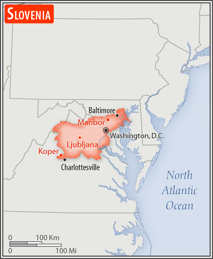
slightly smaller than New Jersey
Land boundaries:
total: 1,211 km
[see also: Land boundaries - total country ranks ]
border countries (4):
Austria 299 km, Croatia 600 km, Hungary 94 km, Italy 218 km
Coastline:
46.6 km
[see also: Coastline country ranks ]
Maritime claims:
territorial sea: 12
nm
[see also: Maritime claims - territorial sea country ranks ]
Climate:
Mediterranean climate on the coast, continental climate with mild to hot summers and cold winters in the plateaus and valleys to the east
More Climate Details
Terrain:
a short southwestern coastal strip of Karst topography on the Adriatic; an alpine mountain region lies adjacent to Italy and Austria in the north; mixed mountains and valleys with numerous rivers to the east
Elevation:
mean elevation: 492 m
[see also: Elevation - mean elevation country ranks ]
lowest point:
Adriatic Sea 0 m
highest point:
Triglav 2,864 m
Natural resources:
lignite, lead, zinc, building stone, hydropower, forests
Land use:
agricultural land: 22.8%
(2011 est.)
[see also: Land use - agricultural land country ranks ]
arable land: 8.4%
(2011 est.)
[see also: Land use - arable land country ranks ]
permanent crops: 1.3%
(2011 est.)
[see also: Land use - permanent crops country ranks ]
permanent pasture: 13.1%
(2011 est.)
[see also: Land use - permanent pasture country ranks ]
forest: 62.3%
(2011 est.)
[see also: Land use - forest country ranks ]
other: 14.9%
(2011 est.)
[see also: Land use country ranks ]
Irrigated land:
60 sq km
(2012)
[see also: Irrigated land country ranks ]
Population distribution:
a fairly even distribution throughout most of the country, with urban areas attracting larger and denser populations; pockets in the mountainous northwest exhibit less density than elsewhere
Natural hazards:
flooding; earthquakes
Environment - current issues:
air pollution from road traffic, domestic heating (wood buring), power generation, and industry; water pollution; biodiversity protection
Environment - international agreements:
party to:
Air Pollution, Air Pollution-Nitrogen Oxides, Air Pollution-Persistent Organic Pollutants, Air Pollution-Sulfur 94, Biodiversity, Climate Change, Climate Change-Kyoto Protocol, Desertification, Endangered Species, Environmental Modification, Hazardous Wastes, Law of the Sea, Marine Dumping, Ozone Layer Protection, Ship Pollution, Wetlands, Whaling
signed, but not ratified:
none of the selected agreements
Geography - note:
despite its small size, this eastern Alpine country controls some of Europe's major transit routes
NOTE: 1) The information regarding Slovenia on this page is re-published from the 2020 World Fact Book of the United States Central Intelligence Agency and other sources. No claims are made regarding the accuracy of Slovenia Geography 2020 information contained here. All suggestions for corrections of any errors about Slovenia Geography 2020 should be addressed to the CIA or the source cited on each page.
2) The rank that you see is the CIA reported rank, which may have the following issues:
a) They assign increasing rank number, alphabetically for countries with the same value of the ranked item, whereas we assign them the same rank.
b) The CIA sometimes assigns counterintuitive ranks. For example, it assigns unemployment rates in increasing order, whereas we rank them in decreasing order.
- Main Index
- 2020 Index
- Country Ranks
- Definitions
- Slovenia Index 2020
- Slovenia Main Index
- Introduction
- History
- Geography
- Climate
- Maps
- People
- Religion
- Government
- Gov. Leaders
- Flags
- Economy
- Energy
- Communications
- Transportation
- Airport Codes
- Military
- Transnational Issues
- Photos
- Advertise Here
- Feedback

This page was last modified 27-Jan-20