


Location:
Eastern Africa, bordering the Gulf of Aden and the Indian Ocean, east of Ethiopia
Geographic coordinates:
10 00 N, 49 00 E
Map references:
Africa
Area:
total: 637,657 sq km
[see also: Area - total country ranks ]
land: 627,337 sq km
[see also: Area - land country ranks ]
water: 10,320 sq km
[see also: Area - water country ranks ]
country comparison to the world (CIA rank, may be based on non-current data):
45
Area - comparative:
almost five times the size of Alabama; slightly smaller than Texas
Area comparison map:
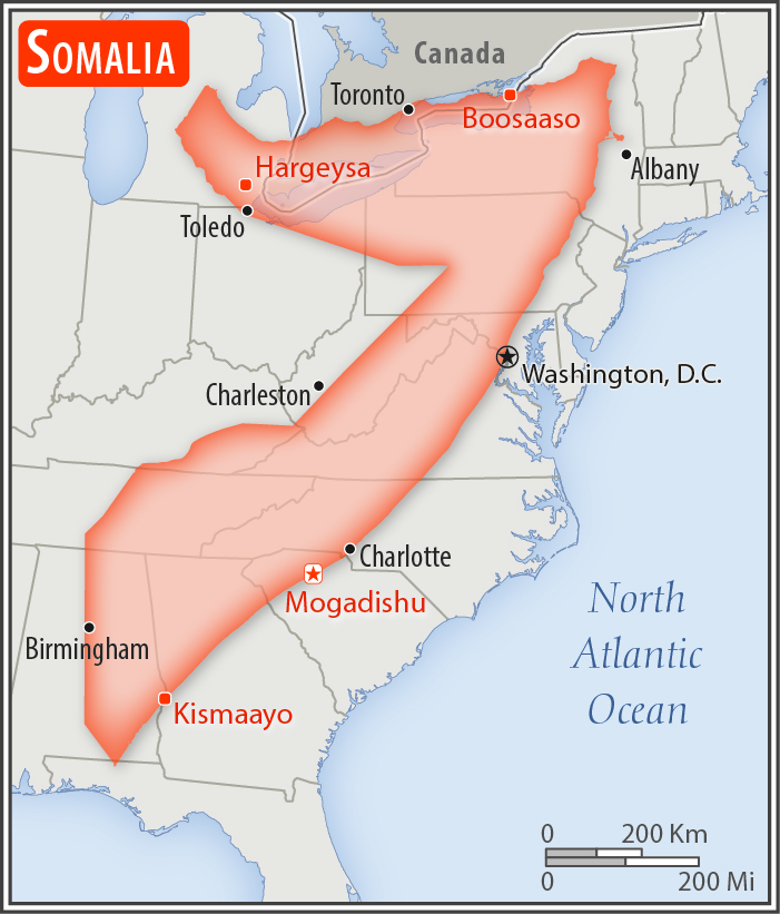
almost five times the size of Alabama; slightly smaller than Texas
Land boundaries:
total: 2,385 km
[see also: Land boundaries - total country ranks ]
border countries (3):
Djibouti 61 km, Ethiopia 1640 km, Kenya 684 km
Coastline:
3,025 km
[see also: Coastline country ranks ]
Maritime claims:
territorial sea: 200
nm
[see also: Maritime claims - territorial sea country ranks ]
Climate:
principally desert; northeast monsoon (December to February), moderate temperatures in north and hot in south; southwest monsoon (May to October), torrid in the north and hot in the south, irregular rainfall, hot and humid periods (tangambili) between monsoons
More Climate Details
Terrain:
mostly flat to undulating plateau rising to hills in north
Elevation:
mean elevation: 410 m
[see also: Elevation - mean elevation country ranks ]
lowest point:
Indian Ocean 0 m
highest point:
Shimbiris 2,416 m
Natural resources:
uranium and largely unexploited reserves of iron ore, tin, gypsum, bauxite, copper, salt, natural gas, likely oil reserves
Land use:
agricultural land: 70.3%
(2011 est.)
[see also: Land use - agricultural land country ranks ]
arable land: 1.8%
(2011 est.)
[see also: Land use - arable land country ranks ]
permanent crops: 0%
(2011 est.)
[see also: Land use - permanent crops country ranks ]
permanent pasture: 68.5%
(2011 est.)
[see also: Land use - permanent pasture country ranks ]
forest: 10.6%
(2011 est.)
[see also: Land use - forest country ranks ]
other: 19.1%
(2011 est.)
[see also: Land use country ranks ]
Irrigated land:
2,000 sq km
(2012)
[see also: Irrigated land country ranks ]
Population distribution:
distribution varies greatly throughout the country; least densely populated areas are in the northeast and central regions, as well as areas along the Kenyan border; most populated areas are in and around the cities of Mogadishu, Marka, Boorama, Hargeysa, and Baidoa
Natural hazards:
recurring droughts; frequent dust storms over eastern plains in summer; floods during rainy season
Environment - current issues:
water scarcity; contaminated water contributes to human health problems; improper waste disposal; deforestation; land degradation; overgrazing; soil erosion; desertification
Environment - international agreements:
party to:
Biodiversity, Desertification, Endangered Species, Hazardous Wastes, Law of the Sea, Ozone Layer Protection
signed, but not ratified:
none of the selected agreements
Geography - note:
strategic location on Horn of Africa along southern approaches to Bab el Mandeb and route through Red Sea and Suez Canal
NOTE: 1) The information regarding Somalia on this page is re-published from the 2020 World Fact Book of the United States Central Intelligence Agency and other sources. No claims are made regarding the accuracy of Somalia Geography 2020 information contained here. All suggestions for corrections of any errors about Somalia Geography 2020 should be addressed to the CIA or the source cited on each page.
2) The rank that you see is the CIA reported rank, which may have the following issues:
a) They assign increasing rank number, alphabetically for countries with the same value of the ranked item, whereas we assign them the same rank.
b) The CIA sometimes assigns counterintuitive ranks. For example, it assigns unemployment rates in increasing order, whereas we rank them in decreasing order.
- Main Index
- 2020 Index
- Country Ranks
- Definitions
- Somalia Index 2020
- Somalia Main Index
- Introduction
- History
- Geography
- Climate
- Maps
- People
- Religion
- Government
- Gov. Leaders
- Flags
- Economy
- Energy
- Communications
- Transportation
- Airport Codes
- Military
- Terrorism
- Transnational Issues
- Photos
- Advertise Here
- Feedback

This page was last modified 27-Jan-20