


Location:
Southern Asia, island in the Indian Ocean, south of India
Geographic coordinates:
7 00 N, 81 00 E
Map references:
Asia
Area:
total: 65,610 sq km
[see also: Area - total country ranks ]
land: 64,630 sq km
[see also: Area - land country ranks ]
water: 980 sq km
[see also: Area - water country ranks ]
country comparison to the world (CIA rank, may be based on non-current data):
123
Area - comparative:
slightly larger than West Virginia
Area comparison map:
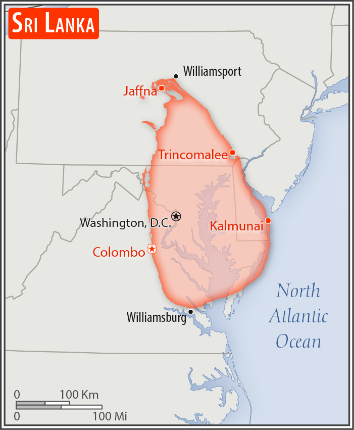
slightly larger than West Virginia
Land boundaries:
0 km
Coastline:
1,340 km
[see also: Coastline country ranks ]
Maritime claims:
territorial sea: 12
nm
[see also: Maritime claims - territorial sea country ranks ]
exclusive economic zone: 200
nm
[see also: Maritime claims - exclusive economic zone country ranks ]
contiguous zone: 24
nm
[see also: Maritime claims - contiguous zone country ranks ]
continental shelf: 200
nm or to the edge of the continental margin
[see also: Maritime claims - continental shelf country ranks ]
Climate:
tropical monsoon; northeast monsoon (December to March); southwest monsoon (June to October)
More Climate Details
Terrain:
mostly low, flat to rolling plain; mountains in south-central interior
Elevation:
mean elevation: 228 m
[see also: Elevation - mean elevation country ranks ]
lowest point:
Indian Ocean 0 m
highest point:
Pidurutalagala 2,524 m
Natural resources:
limestone, graphite, mineral sands, gems, phosphates, clay, hydropower, arable land
Land use:
agricultural land: 43.5%
(2011 est.)
[see also: Land use - agricultural land country ranks ]
arable land: 20.7%
(2011 est.)
[see also: Land use - arable land country ranks ]
permanent crops: 15.8%
(2011 est.)
[see also: Land use - permanent crops country ranks ]
permanent pasture: 7%
(2011 est.)
[see also: Land use - permanent pasture country ranks ]
forest: 29.4%
(2011 est.)
[see also: Land use - forest country ranks ]
other: 27.1%
(2011 est.)
[see also: Land use country ranks ]
Irrigated land:
5,700 sq km
(2012)
[see also: Irrigated land country ranks ]
Population distribution:
the population is primarily concentrated within a broad wet zone in the southwest, urban centers along the eastern coast, and on the Jaffna Peninsula in the north
Natural hazards:
occasional cyclones and tornadoes
Environment - current issues:
deforestation; soil erosion; wildlife populations threatened by poaching and urbanization; coastal degradation from mining activities and increased pollution; coral reef destruction; freshwater resources being polluted by industrial wastes and sewage runoff; waste disposal; air pollution in Colombo
Environment - international agreements:
party to:
Biodiversity, Climate Change, Climate Change-Kyoto Protocol, Desertification, Endangered Species, Environmental Modification, Hazardous Wastes, Law of the Sea, Ozone Layer Protection, Ship Pollution, Wetlands
signed, but not ratified:
Marine Life Conservation
Geography - note:
strategic location near major Indian Ocean sea lanes; Adam's Bridge is a chain of limestone shoals between the southeastern coast of India and the northwestern coast of Sri Lanka; geological evidence suggests that this 50-km long Bridge once connected India and Sri Lanka; ancient records seem to indicate that a foot passage was possible between the two land masses until the 15th century when the land bridge broke up in a cyclone
NOTE: 1) The information regarding Sri Lanka on this page is re-published from the 2020 World Fact Book of the United States Central Intelligence Agency and other sources. No claims are made regarding the accuracy of Sri Lanka Geography 2020 information contained here. All suggestions for corrections of any errors about Sri Lanka Geography 2020 should be addressed to the CIA or the source cited on each page.
2) The rank that you see is the CIA reported rank, which may have the following issues:
a) They assign increasing rank number, alphabetically for countries with the same value of the ranked item, whereas we assign them the same rank.
b) The CIA sometimes assigns counterintuitive ranks. For example, it assigns unemployment rates in increasing order, whereas we rank them in decreasing order.
- Main Index
- 2020 Index
- Country Ranks
- Definitions
- Sri Lanka Index 2020
- Sri Lanka Main Index
- Introduction
- History
- Geography
- Climate
- Maps
- People
- Religion
- Government
- Gov. Leaders
- Flags
- Economy
- Energy
- Communications
- Transportation
- Airport Codes
- Military
- Terrorism
- Transnational Issues
- Photos
- Advertise Here
- Feedback

This page was last modified 27-Jan-20