


Location:
north-eastern Africa, bordering the Red Sea, between Egypt and Eritrea
Geographic coordinates:
15 00 N, 30 00 E
Map references:
Africa
Area:
total: 1,861,484 sq km
[see also: Area - total country ranks ]
land: 1,731,671 sq km
[see also: Area - land country ranks ]
water: 129,813 sq km
[see also: Area - water country ranks ]
country comparison to the world (CIA rank, may be based on non-current data):
17
Area - comparative:
slightly less than one-fifth the size of the US
Area comparison map:
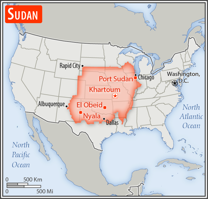
slightly less than one-fifth the size of the US
Land boundaries:
total: 6,819 km
[see also: Land boundaries - total country ranks ]
border countries (7):
Central African Republic 174 km, Chad 1403 km, Egypt 1276 km, Eritrea 682 km, Ethiopia 744 km, Libya 382 km, South Sudan 2158 km
note: Sudan-South Sudan boundary represents 1 January 1956 alignment; final alignment pending negotiations and demarcation; final sovereignty status of Abyei region pending negotiations between Sudan and South Sudan
Coastline:
853 km
[see also: Coastline country ranks ]
Maritime claims:
territorial sea: 12
nm
[see also: Maritime claims - territorial sea country ranks ]
contiguous zone: 18
nm
[see also: Maritime claims - contiguous zone country ranks ]
continental shelf:
200-m depth or to the depth of exploitation
[see also: Maritime claims - continental shelf country ranks ]
Climate:
hot and dry; arid desert; rainy season varies by region (April to November)
More Climate Details
Terrain:
generally flat, featureless plain; desert dominates the north
Elevation:
mean elevation: 568 m
[see also: Elevation - mean elevation country ranks ]
lowest point:
Red Sea 0 m
highest point:
Jabal Marrah 3,042 m
Natural resources:
petroleum; small reserves of iron ore, copper, chromium ore, zinc, tungsten, mica, silver, gold; hydropower
Land use:
agricultural land: 100%
(2011 est.)
[see also: Land use - agricultural land country ranks ]
arable land: 15.7%
(2011 est.)
[see also: Land use - arable land country ranks ]
permanent crops: 0.2%
(2011 est.)
[see also: Land use - permanent crops country ranks ]
permanent pasture: 84.2%
(2011 est.)
[see also: Land use - permanent pasture country ranks ]
forest: 0%
(2011 est.)
[see also: Land use - forest country ranks ]
other: 0%
(2011 est.)
[see also: Land use country ranks ]
Irrigated land:
18,900 sq km
(2012)
[see also: Irrigated land country ranks ]
Population distribution:
with the exception of a ribbon of settlement that corresponds to the banks of the Nile, northern Sudan, which extends into the dry Sahara, is sparsely populated; more abundant vegetation and broader access to water increases population distribution in the south extending habitable range along nearly the entire border with South Sudan; sizeable areas of population are found around Khartoum, southeast between the Blue and White Nile Rivers, and througout South Darfur
Natural hazards:
dust storms and periodic persistent droughts
Environment - current issues:
water pollution; inadequate supplies of potable water; water scarcity and periodic drought; wildlife populations threatened by excessive hunting; soil erosion; desertification; deforestation; loss of biodiversity
Environment - international agreements:
party to:
Biodiversity, Climate Change, Climate Change-Kyoto Protocol, Desertification, Endangered Species, Hazardous Wastes, Law of the Sea, Ozone Layer Protection, Wetlands
signed, but not ratified:
none of the selected agreements
Geography - note:
the Nile is Sudan's primary water source; its major tributaries, the White Nile and the Blue Nile, meet at Khartoum to form the River Nile which flows northward through Egypt to the Mediterranean Sea
NOTE: 1) The information regarding Sudan on this page is re-published from the 2020 World Fact Book of the United States Central Intelligence Agency and other sources. No claims are made regarding the accuracy of Sudan Geography 2020 information contained here. All suggestions for corrections of any errors about Sudan Geography 2020 should be addressed to the CIA or the source cited on each page.
2) The rank that you see is the CIA reported rank, which may have the following issues:
a) They assign increasing rank number, alphabetically for countries with the same value of the ranked item, whereas we assign them the same rank.
b) The CIA sometimes assigns counterintuitive ranks. For example, it assigns unemployment rates in increasing order, whereas we rank them in decreasing order.
- Main Index
- 2020 Index
- Country Ranks
- Definitions
- Sudan Index 2020
- Sudan Main Index
- Introduction
- History
- Geography
- Climate
- Maps
- People
- Religion
- Government
- Gov. Leaders
- Flags
- Economy
- Energy
- Communications
- Transportation
- Airport Codes
- Military
- Transnational Issues
- Photos
- Advertise Here
- Feedback

This page was last modified 27-Jan-20