


Location:
Middle East, bordering the Mediterranean Sea, between Lebanon and Turkey
Geographic coordinates:
35 00 N, 38 00 E
Map references:
Middle East
Area:
total: 187,437 sq km
[see also: Area - total country ranks ]
land: 185,887 sq km
[see also: Area - land country ranks ]
water: 1,550 sq km
note: includes 1,295 sq km of Israeli-occupied territory
country comparison to the world (CIA rank, may be based on non-current data):
90
Area - comparative:
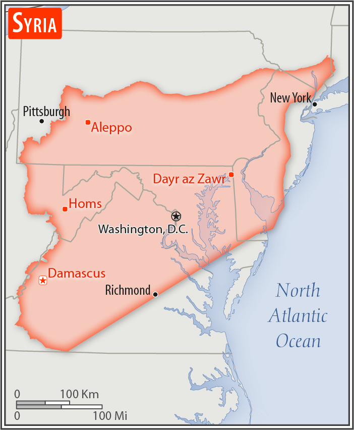
slightly more than 1.5 times the size of Pennsylvania
Area comparison map:
Land boundaries:
total: 2,343 km
[see also: Land boundaries - total country ranks ]
border countries (5):
Iraq 599 km, Israel 79 km, Jordan 362 km, Lebanon 394 km, Turkey 909 km
Coastline:
193 km
[see also: Coastline country ranks ]
Maritime claims:
territorial sea: 12
nm
[see also: Maritime claims - territorial sea country ranks ]
contiguous zone: 24
nm
[see also: Maritime claims - contiguous zone country ranks ]
Climate:
mostly desert; hot, dry, sunny summers (June to August) and mild, rainy winters (December to February) along coast; cold weather with snow or sleet periodically in Damascus
More Climate Details
Terrain:
primarily semiarid and desert plateau; narrow coastal plain; mountains in west
Elevation:
mean elevation: 514 m
[see also: Elevation - mean elevation country ranks ]
lowest point:
unnamed location near Lake Tiberias -208 m
highest point:
Mount Hermon (Jabal a-Shayk) 2,814 m
Natural resources:
petroleum, phosphates, chrome and manganese ores, asphalt, iron ore, rock salt, marble, gypsum, hydropower
Land use:
agricultural land: 75.8%
(2011 est.)
[see also: Land use - agricultural land country ranks ]
arable land: 25.4%
(2011 est.)
[see also: Land use - arable land country ranks ]
permanent crops: 5.8%
(2011 est.)
[see also: Land use - permanent crops country ranks ]
permanent pasture: 44.6%
(2011 est.)
[see also: Land use - permanent pasture country ranks ]
forest: 2.7%
(2011 est.)
[see also: Land use - forest country ranks ]
other: 21.5%
(2011 est.)
[see also: Land use country ranks ]
Irrigated land:
14,280 sq km
(2012)
[see also: Irrigated land country ranks ]
Population distribution:
significant population density along the Mediterranean coast; larger concentrations found in the major cities of Damascus, Aleppo (the country's largest city), and Hims (Homs); more than half of the population lives in the coastal plain, the province of Halab, and the Euphrates River valley
note: the ongoing civil war has altered the population distribution
Natural hazards:
dust storms, sandstorms
volcanism: Syria's two historically active volcanoes, Es Safa and an unnamed volcano near the Turkish border have not erupted in centuries
Environment - current issues:
deforestation; overgrazing; soil erosion; desertification; depletion of water resources; water pollution from raw sewage and petroleum refining wastes; inadequate potable water
Environment - international agreements:
party to:
Biodiversity, Climate Change, Climate Change-Kyoto Protocol, Desertification, Endangered Species, Hazardous Wastes, Ozone Layer Protection, Ship Pollution, Wetlands
signed, but not ratified:
Environmental Modification
Geography - note:
the capital of Damascus - located at an oasis fed by the Barada River - is thought to be one of the world's oldest continuously inhabited cities; there are 42 Israeli settlements and civilian land use sites in the Israeli-controlled Golan Heights
(2017)
NOTE: 1) The information regarding Syria on this page is re-published from the 2020 World Fact Book of the United States Central Intelligence Agency and other sources. No claims are made regarding the accuracy of Syria Geography 2020 information contained here. All suggestions for corrections of any errors about Syria Geography 2020 should be addressed to the CIA or the source cited on each page.
2) The rank that you see is the CIA reported rank, which may have the following issues:
a) They assign increasing rank number, alphabetically for countries with the same value of the ranked item, whereas we assign them the same rank.
b) The CIA sometimes assigns counterintuitive ranks. For example, it assigns unemployment rates in increasing order, whereas we rank them in decreasing order.
- Main Index
- 2020 Index
- Country Ranks
- Definitions
- Syria Index 2020
- Syria Main Index
- Introduction
- History
- Geography
- Climate
- Maps
- People
- Religion
- Government
- Gov. Leaders
- Flags
- Economy
- Energy
- Communications
- Transportation
- Airport Codes
- Military
- Terrorism
- Transnational Issues
- Photos
- Advertise Here
- Feedback

This page was last modified 27-Jan-20