


Location:
Southern South America, bordering the South Atlantic Ocean, between Argentina and Brazil
Geographic coordinates:
33 00 S, 56 00 W
Map references:
South America
Area:
total: 176,215 sq km
[see also: Area - total country ranks ]
land: 175,015 sq km
[see also: Area - land country ranks ]
water: 1,200 sq km
[see also: Area - water country ranks ]
country comparison to the world (CIA rank, may be based on non-current data):
92
Area - comparative:
about the size of Virginia and West Virginia combined; slightly smaller than the state of Washington
Area comparison map:
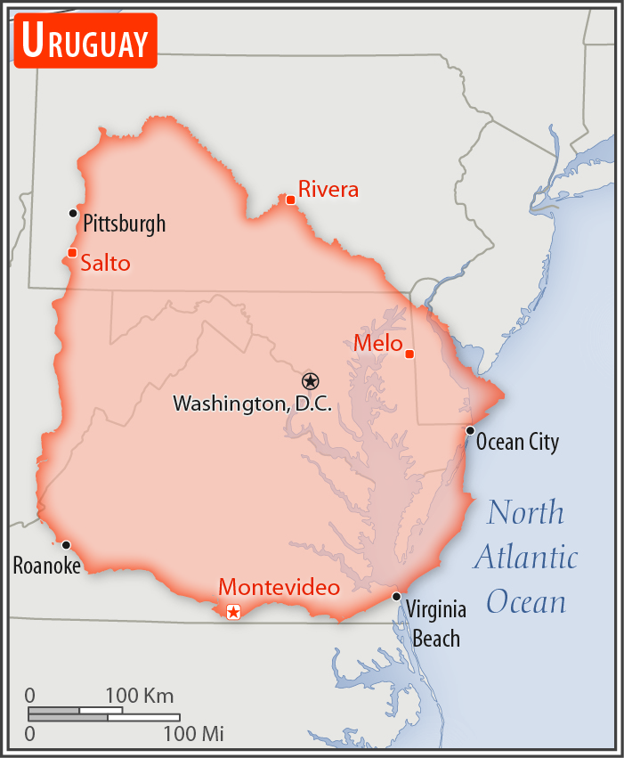
about the size of Virginia and West Virginia combined; slightly smaller than the state of Washington
Land boundaries:
total: 1,591 km
[see also: Land boundaries - total country ranks ]
border countries (2):
Argentina 541 km, Brazil 1050 km
Coastline:
660 km
[see also: Coastline country ranks ]
Maritime claims:
territorial sea: 12
nm
[see also: Maritime claims - territorial sea country ranks ]
exclusive economic zone: 200
nm
[see also: Maritime claims - exclusive economic zone country ranks ]
contiguous zone: 24
nm
[see also: Maritime claims - contiguous zone country ranks ]
continental shelf:
200 nm or the edge of continental margin
[see also: Maritime claims - continental shelf country ranks ]
Climate:
warm temperate; freezing temperatures almost unknown
More Climate Details
Terrain:
mostly rolling plains and low hills; fertile coastal lowland
Elevation:
mean elevation: 109 m
[see also: Elevation - mean elevation country ranks ]
lowest point:
Atlantic Ocean 0 m
highest point:
Cerro Catedral 514 m
Natural resources:
arable land, hydropower, minor minerals, fish
Land use:
agricultural land: 87.2%
(2011 est.)
[see also: Land use - agricultural land country ranks ]
arable land: 10.1%
(2011 est.)
[see also: Land use - arable land country ranks ]
permanent crops: 0.2%
(2011 est.)
[see also: Land use - permanent crops country ranks ]
permanent pasture: 76.9%
(2011 est.)
[see also: Land use - permanent pasture country ranks ]
forest: 10.2%
(2011 est.)
[see also: Land use - forest country ranks ]
other: 2.6%
(2011 est.)
[see also: Land use country ranks ]
Irrigated land:
2,380 sq km
(2012)
[see also: Irrigated land country ranks ]
Population distribution:
most of the country's population resides in the southern half of the country; approximately 80% of the populace is urban, living in towns or cities; nearly half of the population lives in and around the capital of Montevideo
Natural hazards:
seasonally high winds (the pampero is a chilly and occasional violent wind that blows north from the Argentine pampas), droughts, floods; because of the absence of mountains, which act as weather barriers, all locations are particularly vulnerable to rapid changes from weather fronts
Environment - current issues:
water pollution from meat packing/tannery industry; heavy metal pollution; inadequate solid/hazardous waste disposal; deforestation
Environment - international agreements:
party to:
Antarctic-Environmental Protocol, Antarctic-Marine Living Resources, Antarctic Treaty, Biodiversity, Climate Change, Climate Change-Kyoto Protocol, Desertification, Endangered Species, Environmental Modification, Hazardous Wastes, Law of the Sea, Ozone Layer Protection, Ship Pollution, Wetlands
signed, but not ratified:
Marine Dumping, Marine Life Conservation
Geography - note:
second-smallest South American country (after Suriname); most of the low-lying landscape (three-quarters of the country) is grassland, ideal for cattle and sheep raising
NOTE: 1) The information regarding Uruguay on this page is re-published from the 2020 World Fact Book of the United States Central Intelligence Agency and other sources. No claims are made regarding the accuracy of Uruguay Geography 2020 information contained here. All suggestions for corrections of any errors about Uruguay Geography 2020 should be addressed to the CIA or the source cited on each page.
2) The rank that you see is the CIA reported rank, which may have the following issues:
a) They assign increasing rank number, alphabetically for countries with the same value of the ranked item, whereas we assign them the same rank.
b) The CIA sometimes assigns counterintuitive ranks. For example, it assigns unemployment rates in increasing order, whereas we rank them in decreasing order.
- Main Index
- 2020 Index
- Country Ranks
- Definitions
- Uruguay Index 2020
- Uruguay Main Index
- Introduction
- History
- Geography
- Climate
- Maps
- People
- Religion
- Government
- Gov. Leaders
- Flags
- Economy
- Energy
- Communications
- Transportation
- Airport Codes
- Military
- Transnational Issues
- Photos
- Advertise Here
- Feedback

This page was last modified 27-Jan-20