


Location:
Central Africa, east of the Democratic Republic of the Congo, west of Tanzania
Geographic coordinates:
3 30 S, 30 00 E
Map references:
Africa
Area:
total: 27,830 sq km
[see also: Area - total country ranks ]
land: 25,680 sq km
[see also: Area - land country ranks ]
water: 2,150 sq km
[see also: Area - water country ranks ]
country comparison to the world (CIA rank, may be based on non-current data):
147
Area - comparative:
slightly smaller than Maryland
Area comparison map:
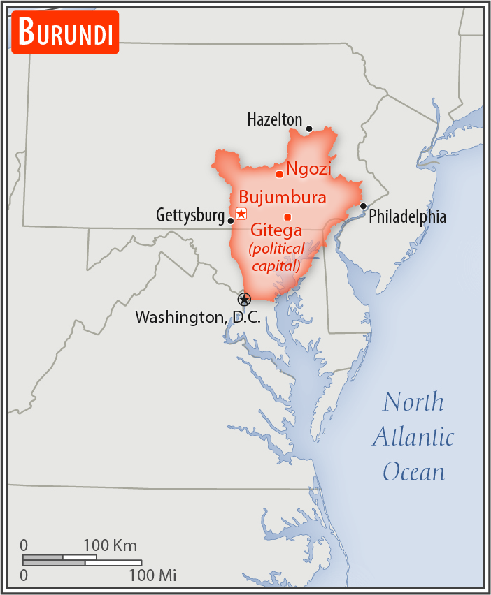
slightly smaller than Maryland
Land boundaries:
total: 1,140 km
[see also: Land boundaries - total country ranks ]
border countries (3):
Democratic Republic of the Congo 236 km, Rwanda 315 km, Tanzania 589 km
Coastline:
0 km
(landlocked)
[see also: Coastline country ranks ]
Maritime claims:
none (landlocked)
Climate:
equatorial; high plateau with considerable altitude variation (772 m to 2,670 m above sea level); average annual temperature varies with altitude from 23 to 17 degrees Celsius but is generally moderate as the average altitude is about 1,700 m; average annual rainfall is about 150 cm; two wet seasons (February to May and September to November), and two dry seasons (June to August and December to January)
Terrain:
hilly and mountainous, dropping to a plateau in east, some plains
Elevation:
mean elevation: 1,504 m
[see also: Elevation - mean elevation country ranks ]
lowest point:
Lake Tanganyika 772 m
highest point:
Heha 2,670 m
Natural resources:
nickel, uranium, rare earth oxides, peat, cobalt, copper, platinum, vanadium, arable land, hydropower, niobium, tantalum, gold, tin, tungsten, kaolin, limestone
Land use:
agricultural land: 73.3%
(2011 est.)
[see also: Land use - agricultural land country ranks ]
arable land: 38.9%
(2011 est.)
[see also: Land use - arable land country ranks ]
permanent crops: 15.6%
(2011 est.)
[see also: Land use - permanent crops country ranks ]
permanent pasture: 18.8%
(2011 est.)
[see also: Land use - permanent pasture country ranks ]
forest: 6.6%
(2011 est.)
[see also: Land use - forest country ranks ]
other: 20.1%
(2011 est.)
[see also: Land use country ranks ]
Irrigated land:
230 sq km
(2012)
[see also: Irrigated land country ranks ]
Population distribution:
one of Africa's most densely populated countries; concentrations tend to be in the north and along the northern shore of Lake Tanganyika in the west; most people live on farms near areas of fertile volcanic soil
Natural hazards:
flooding; landslides; drought
Environment - current issues:
soil erosion as a result of overgrazing and the expansion of agriculture into marginal lands; deforestation (little forested land remains because of uncontrolled cutting of trees for fuel); habitat loss threatens wildlife populations
Environment - international agreements:
party to:
Biodiversity, Climate Change, Climate Change-Kyoto Protocol, Desertification, Endangered Species, Hazardous Wastes, Ozone Layer Protection, Wetlands
signed, but not ratified:
Law of the Sea
Geography - note:
landlocked; straddles crest of the Nile-Congo watershed; the Kagera, which drains into Lake Victoria, is the most remote headstream of the White Nile
NOTE: 1) The information regarding Burundi on this page is re-published from the 2020 World Fact Book of the United States Central Intelligence Agency and other sources. No claims are made regarding the accuracy of Burundi Geography 2020 information contained here. All suggestions for corrections of any errors about Burundi Geography 2020 should be addressed to the CIA or the source cited on each page.
2) The rank that you see is the CIA reported rank, which may have the following issues:
a) They assign increasing rank number, alphabetically for countries with the same value of the ranked item, whereas we assign them the same rank.
b) The CIA sometimes assigns counterintuitive ranks. For example, it assigns unemployment rates in increasing order, whereas we rank them in decreasing order.
- Main Index
- 2020 Index
- Country Ranks
- Definitions
- Burundi Index 2020
- Burundi Main Index
- Introduction
- History
- Geography
- Maps
- People
- Religion
- Government
- Gov. Leaders
- Flags
- Economy
- Energy
- Communications
- Transportation
- Airport Codes
- Military
- Transnational Issues
- Photos
- Advertise Here
- Feedback

This page was last modified 27-Jan-20