


Location:
Central America, bordering both the Caribbean Sea and the North Pacific Ocean, between Nicaragua and Panama
Geographic coordinates:
10 00 N, 84 00 W
Map references:
Central America and the Caribbean
Area:
total: 51,100 sq km
[see also: Area - total country ranks ]
land: 51,060 sq km
[see also: Area - land country ranks ]
water: 40 sq km
note: includes Isla del Coco
country comparison to the world (CIA rank, may be based on non-current data):
130
Area - comparative:
slightly smaller than West Virginia
Area comparison map:
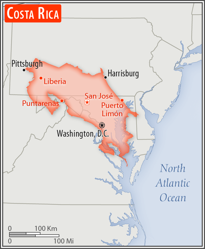
slightly smaller than West Virginia
Land boundaries:
total: 661 km
[see also: Land boundaries - total country ranks ]
border countries (2):
Nicaragua 313 km, Panama 348 km
Coastline:
1,290 km
[see also: Coastline country ranks ]
Maritime claims:
territorial sea: 12
nm
[see also: Maritime claims - territorial sea country ranks ]
exclusive economic zone: 200
nm
[see also: Maritime claims - exclusive economic zone country ranks ]
continental shelf: 200
nm
[see also: Maritime claims - continental shelf country ranks ]
Climate:
tropical and subtropical; dry season (December to April); rainy season (May to November); cooler in highlands
More Climate Details
Terrain:
coastal plains separated by rugged mountains including over 100 volcanic cones, of which several are major active volcanoes
Elevation:
mean elevation: 746 m
[see also: Elevation - mean elevation country ranks ]
lowest point:
Pacific Ocean 0 m
highest point:
Cerro Chirripo 3,819 m
Natural resources:
hydropower
Land use:
agricultural land: 37.1%
(2011 est.)
[see also: Land use - agricultural land country ranks ]
arable land: 4.9%
(2011 est.)
[see also: Land use - arable land country ranks ]
permanent crops: 6.7%
(2011 est.)
[see also: Land use - permanent crops country ranks ]
permanent pasture: 25.5%
(2011 est.)
[see also: Land use - permanent pasture country ranks ]
forest: 51.5%
(2011 est.)
[see also: Land use - forest country ranks ]
other: 11.4%
(2011 est.)
[see also: Land use country ranks ]
Irrigated land:
1,015 sq km
(2012)
[see also: Irrigated land country ranks ]
Population distribution:
roughly half of the nation's population resides in urban areas; the capital of San Jose is the largest city and home to approximately one-fifth of the population
Natural hazards:
occasional earthquakes, hurricanes along Atlantic coast; frequent flooding of lowlands at onset of rainy season and landslides; active volcanoes
volcanism: Arenal (1,670 m), which erupted in 2010, is the most active volcano in Costa Rica; a 1968 eruption destroyed the town of Tabacon; Irazu (3,432 m), situated just east of San Jose, has the potential to spew ash over the capital city as it did between 1963 and 1965; other historically active volcanoes include Miravalles, Poas, Rincon de la Vieja, and Turrialba
Environment - current issues:
deforestation and land use change, largely a result of the clearing of land for cattle ranching and agriculture; soil erosion; coastal marine pollution; fisheries protection; solid waste management; air pollution
Environment - international agreements:
party to:
Biodiversity, Climate Change, Climate Change-Kyoto Protocol, Desertification, Endangered Species, Environmental Modification, Hazardous Wastes, Law of the Sea, Marine Dumping, Ozone Layer Protection, Wetlands, Whaling
signed, but not ratified:
Marine Life Conservation
Geography - note:
four volcanoes, two of them active, rise near the capital of San Jose in the center of the country; one of the volcanoes, Irazu, erupted destructively in 1963-65
NOTE: 1) The information regarding Costa Rica on this page is re-published from the 2020 World Fact Book of the United States Central Intelligence Agency and other sources. No claims are made regarding the accuracy of Costa Rica Geography 2020 information contained here. All suggestions for corrections of any errors about Costa Rica Geography 2020 should be addressed to the CIA or the source cited on each page.
2) The rank that you see is the CIA reported rank, which may have the following issues:
a) They assign increasing rank number, alphabetically for countries with the same value of the ranked item, whereas we assign them the same rank.
b) The CIA sometimes assigns counterintuitive ranks. For example, it assigns unemployment rates in increasing order, whereas we rank them in decreasing order.
- Main Index
- 2020 Index
- Country Ranks
- Definitions
- Costa Rica Index 2020
- Costa Rica Main Index
- Introduction
- History
- Geography
- Climate
- Maps
- People
- Religion
- Government
- Gov. Leaders
- Flags
- Economy
- Energy
- Communications
- Transportation
- Airport Codes
- Military
- Transnational Issues
- Photos
- Advertise Here
- Feedback

This page was last modified 27-Jan-20