


Location:
Eastern Africa, bordering the Indian Ocean, between Somalia and Tanzania
Geographic coordinates:
1 00 N, 38 00 E
Map references:
Africa
Area:
total: 580,367 sq km
[see also: Area - total country ranks ]
land: 569,140 sq km
[see also: Area - land country ranks ]
water: 11,227 sq km
[see also: Area - water country ranks ]
country comparison to the world (CIA rank, may be based on non-current data):
50
Area - comparative:
five times the size of Ohio; slightly more than twice the size of Nevada
Area comparison map:
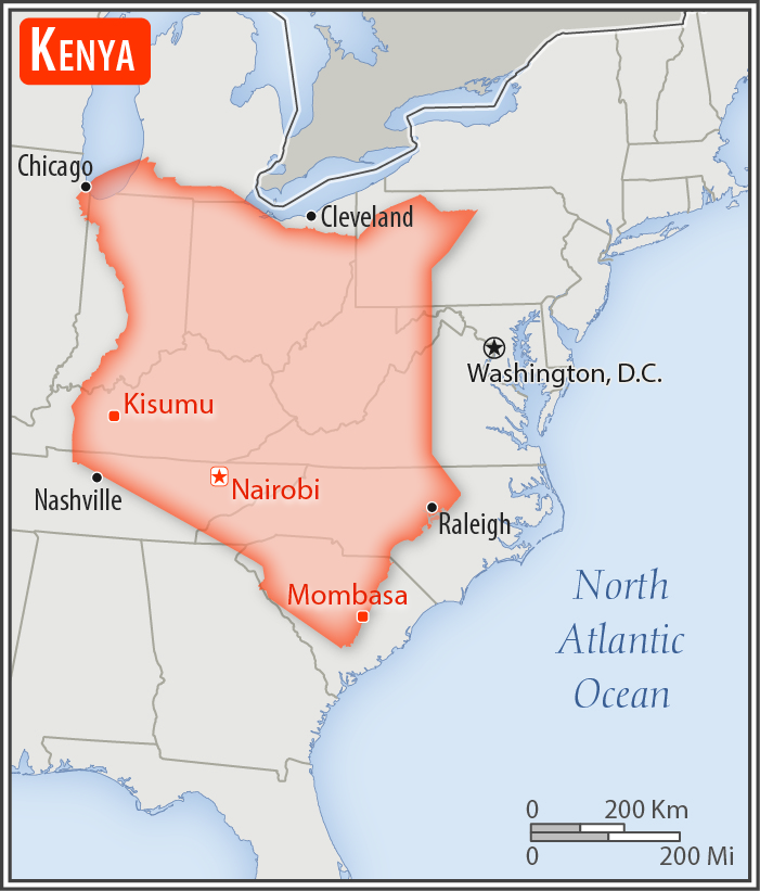
five times the size of Ohio; slightly more than twice the size of Nevada
Land boundaries:
total: 3,457 km
[see also: Land boundaries - total country ranks ]
border countries (5):
Ethiopia 867 km, Somalia 684 km, South Sudan 317 km, Tanzania 775 km, Uganda 814 km
Coastline:
536 km
[see also: Coastline country ranks ]
Maritime claims:
territorial sea: 12
nm
[see also: Maritime claims - territorial sea country ranks ]
exclusive economic zone: 200
nm
[see also: Maritime claims - exclusive economic zone country ranks ]
continental shelf:
200-m depth or to the depth of exploitation
[see also: Maritime claims - continental shelf country ranks ]
Climate:
varies from tropical along coast to arid in interior
More Climate Details
Terrain:
low plains rise to central highlands bisected by Great Rift Valley; fertile plateau in west
Elevation:
mean elevation: 762 m
[see also: Elevation - mean elevation country ranks ]
lowest point:
Indian Ocean 0 m
highest point:
Mount Kenya 5,199 m
Natural resources:
limestone, soda ash, salt, gemstones, fluorspar, zinc, diatomite, gypsum, wildlife, hydropower
Land use:
agricultural land: 48.1%
(2011 est.)
[see also: Land use - agricultural land country ranks ]
arable land: 9.8%
(2011 est.)
[see also: Land use - arable land country ranks ]
permanent crops: 0.9%
(2011 est.)
[see also: Land use - permanent crops country ranks ]
permanent pasture: 37.4%
(2011 est.)
[see also: Land use - permanent pasture country ranks ]
forest: 6.1%
(2011 est.)
[see also: Land use - forest country ranks ]
other: 45.8%
(2011 est.)
[see also: Land use country ranks ]
Irrigated land:
1,030 sq km
(2012)
[see also: Irrigated land country ranks ]
Population distribution:
population heavily concentrated in the west along the shore of Lake Victoria; other areas of high density include the capital of Nairobi, and in the southeast along the Indian Ocean coast
Natural hazards:
recurring drought; flooding during rainy seasons
volcanism: limited volcanic activity; the Barrier (1,032 m) last erupted in 1921; South Island is the only other historically active volcano
Environment - current issues:
water pollution from urban and industrial wastes; water shortage and degraded water quality from increased use of pesticides and fertilizers; flooding; water hyacinth infestation in Lake Victoria; deforestation; soil erosion; desertification; poaching
Environment - international agreements:
party to:
Biodiversity, Climate Change, Climate Change-Kyoto Protocol, Desertification, Endangered Species, Hazardous Wastes, Law of the Sea, Marine Dumping, Marine Life Conservation, Ozone Layer Protection, Ship Pollution, Wetlands, Whaling
signed, but not ratified:
none of the selected agreements
Geography - note:
the Kenyan Highlands comprise one of the most successful agricultural production regions in Africa; glaciers are found on Mount Kenya, Africa's second highest peak; unique physiography supports abundant and varied wildlife of scientific and economic value; Lake Victoria, the world's largest tropical lake and the second largest fresh water lake, is shared among three countries: Kenya, Tanzania, and Uganda
NOTE: 1) The information regarding Kenya on this page is re-published from the 2020 World Fact Book of the United States Central Intelligence Agency and other sources. No claims are made regarding the accuracy of Kenya Geography 2020 information contained here. All suggestions for corrections of any errors about Kenya Geography 2020 should be addressed to the CIA or the source cited on each page.
2) The rank that you see is the CIA reported rank, which may have the following issues:
a) They assign increasing rank number, alphabetically for countries with the same value of the ranked item, whereas we assign them the same rank.
b) The CIA sometimes assigns counterintuitive ranks. For example, it assigns unemployment rates in increasing order, whereas we rank them in decreasing order.
- Main Index
- 2020 Index
- Country Ranks
- Definitions
- Kenya Index 2020
- Kenya Main Index
- Introduction
- History
- Geography
- Climate
- Maps
- People
- Religion
- Government
- Gov. Leaders
- Flags
- Economy
- Energy
- Communications
- Transportation
- Airport Codes
- Military
- Terrorism
- Transnational Issues
- Photos
- Advertise Here
- Feedback

This page was last modified 27-Jan-20