


Location:
Western Africa, bordering the North Atlantic Ocean, between Cote d'Ivoire and Sierra Leone
Geographic coordinates:
6 30 N, 9 30 W
Map references:
Africa
Area:
total: 111,369 sq km
[see also: Area - total country ranks ]
land: 96,320 sq km
[see also: Area - land country ranks ]
water: 15,049 sq km
[see also: Area - water country ranks ]
country comparison to the world (CIA rank, may be based on non-current data):
105
Area - comparative:
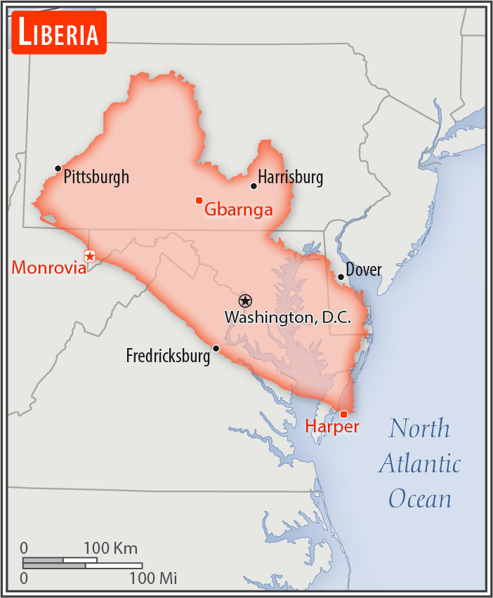
slightly larger than Virginia
Area comparison map:
slightly larger than Virginia
Land boundaries:
total: 1,667 km
[see also: Land boundaries - total country ranks ]
border countries (3):
Guinea 590 km, Cote d'Ivoire 778 km, Sierra Leone 299 km
Coastline:
579 km
[see also: Coastline country ranks ]
Maritime claims:
territorial sea: 200
nm
[see also: Maritime claims - territorial sea country ranks ]
Climate:
tropical; hot, humid; dry winters with hot days and cool to cold nights; wet, cloudy summers with frequent heavy showers
Terrain:
mostly flat to rolling coastal plains rising to rolling plateau and low mountains in northeast
Elevation:
mean elevation: 243 m
[see also: Elevation - mean elevation country ranks ]
lowest point:
Atlantic Ocean 0 m
highest point:
Mount Wuteve 1,447 m
Natural resources:
iron ore, timber, diamonds, gold, hydropower
Land use:
agricultural land: 28.1%
(2011 est.)
[see also: Land use - agricultural land country ranks ]
arable land: 5.2%
(2011 est.)
[see also: Land use - arable land country ranks ]
permanent crops: 2.1%
(2011 est.)
[see also: Land use - permanent crops country ranks ]
permanent pasture: 20.8%
(2011 est.)
[see also: Land use - permanent pasture country ranks ]
forest: 44.6%
(2011 est.)
[see also: Land use - forest country ranks ]
other: 27.3%
(2011 est.)
[see also: Land use country ranks ]
Irrigated land:
30 sq km
(2012)
[see also: Irrigated land country ranks ]
Population distribution:
more than half of the population lives in urban areas, with approximately one-third living within an 80-km radius of Monrovia
Natural hazards:
dust-laden harmattan winds blow from the Sahara (December to March)
Environment - current issues:
tropical rain forest deforestation; soil erosion; loss of biodiversity; hunting of endangered species for bushmeat; pollution of coastal waters from oil residue and raw sewage; pollution of rivers from industrial run-off; burning and dumping of household waste
Environment - international agreements:
party to:
Biodiversity, Climate Change, Climate Change-Kyoto Protocol, Desertification, Endangered Species, Hazardous Wastes, Law of the Sea, Ozone Layer Protection, Ship Pollution, Tropical Timber 83, Tropical Timber 94, Wetlands
signed, but not ratified:
Environmental Modification, Marine Life Conservation
Geography - note:
facing the Atlantic Ocean, the coastline is characterized by lagoons, mangrove swamps, and river-deposited sandbars; the inland grassy plateau supports limited agriculture
NOTE: 1) The information regarding Liberia on this page is re-published from the 2020 World Fact Book of the United States Central Intelligence Agency and other sources. No claims are made regarding the accuracy of Liberia Geography 2020 information contained here. All suggestions for corrections of any errors about Liberia Geography 2020 should be addressed to the CIA or the source cited on each page.
2) The rank that you see is the CIA reported rank, which may have the following issues:
a) They assign increasing rank number, alphabetically for countries with the same value of the ranked item, whereas we assign them the same rank.
b) The CIA sometimes assigns counterintuitive ranks. For example, it assigns unemployment rates in increasing order, whereas we rank them in decreasing order.
- Main Index
- 2020 Index
- Country Ranks
- Definitions
- Liberia Index 2020
- Liberia Main Index
- Introduction
- History
- Geography
- Maps
- People
- Religion
- Government
- Gov. Leaders
- Flags
- Economy
- Energy
- Communications
- Transportation
- Airport Codes
- Military
- Transnational Issues
- Photos
- Advertise Here
- Feedback

This page was last modified 27-Jan-20